

We’re beginning to transition back into a potentially active period of weather in Texas, so we’ll resume our daily weather blogs at this juncture. The first portion of this forecast will concentrate on the weather for the eclipse later today. I should point out that this will not be a totality eclipse for Texas, but the farther north you are in the state, the higher percentage of the sun will be blocked out between 1230 and 2 PM. The path of totality will be passing several hundred miles north and east of Texas. We’ll get our own total eclipse on April 8, 2024.
Cloud cover will be highest late this morning into the early afternoon hours across the Texas Panhandle where a few breaks will be possible. Cloud coverage will be lower as you get further south out of the Panhandle into West Texas and the Trans-Pecos. We’ll see partly cloudy conditions across the Rio Grande Valley north through the Middle Coast, Coastal Bend, and into Southeast Texas and the Brazos Valley. Elsewhere in Texas cloud cover should remain below 25 percent – thus giving a good chance of seeing the partial eclipse. Remember, do not look at the eclipse without eye protection. Sunglasses will not be enough to protect you from potential eye damage.


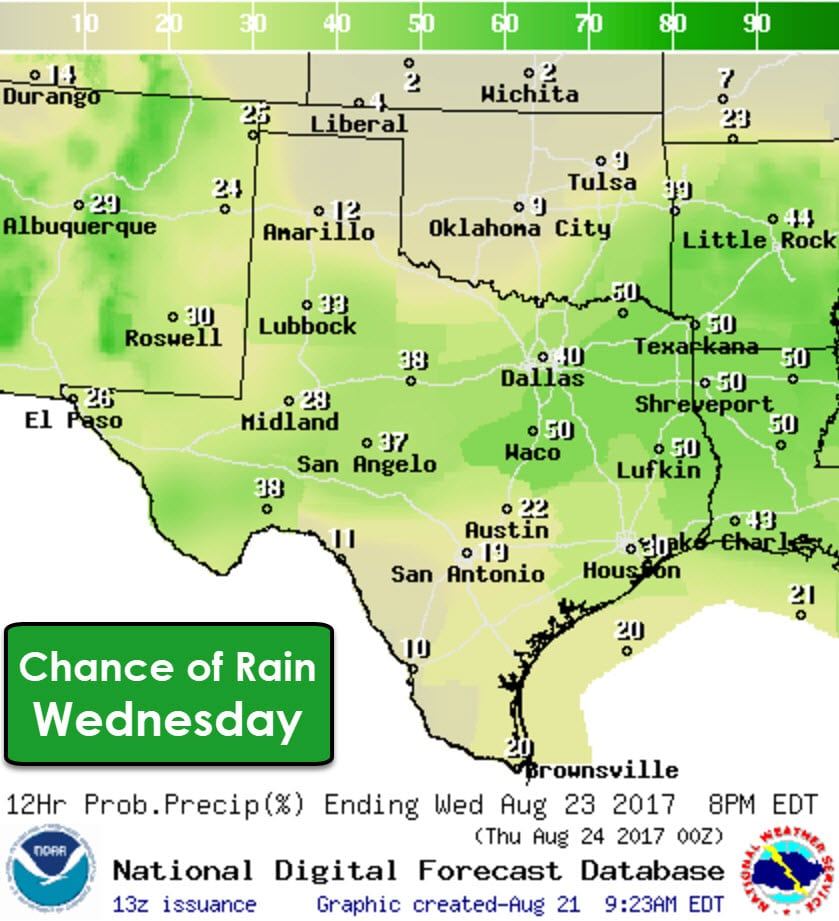

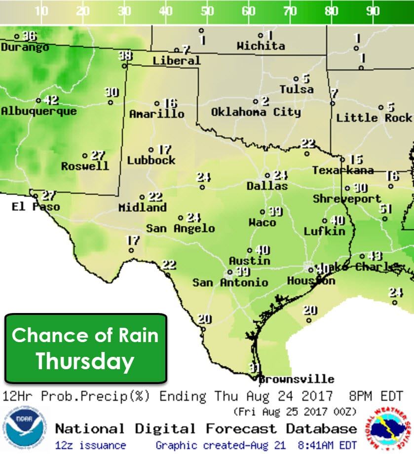
Now onto the second part of the forecast for this week. A weak frontal boundary will make slow southward progression on Thursday through the end of the work week. This boundary won’t really bring any significant air-mass changes, but it will be a focal point for shower and thunderstorm development. A few storms may be strong with a threat of localized damaging wind gusts, small hail, and enough lightning to make the animals go hide under the bed. Lots of moisture – both from the monsoon out west and from the Gulf of Mexico – will allow for high rainfall rates. We’ll have to watch for a localized, but enhanced flash flooding risk in areas that have received lots of rain over the last two weeks. Widespread flooding is not expected through mid-week.
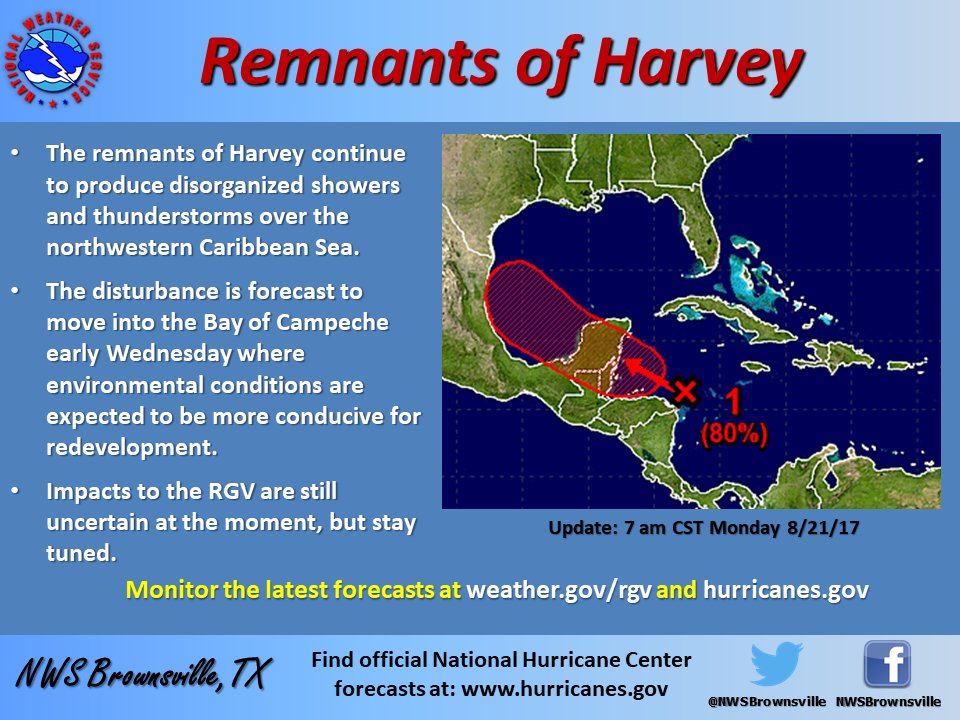
Our late week forecast is looking much more interesting as a potential tropical cyclone may impact parts of the Texas coastline. This morning we’re monitoring a disorganized area of thunderstorm activity a few hundred miles east of the Yucatan Pensenlya. This area of tropical mischief is actually the remnants of Harvey which degenerated earlier this week after encountering strong wind shear. That wind shear has weakened. I don’t think it is likely this will become more than a tropical depression before making landfall on the Yucatan Pensenlya late tonight. What we’ll need to watch closely is when former Harvey makes it into the Bay of Campeche and the southwest Gulf of Mexico on Wednesday. It does appear conditions will be favorable for Harvey to regenerate into a tropical storm. Models are starting to hint that Harvey may make a northwestward turn in the Bay of Campeche and could become a threat to the Rio Grande Valley by Friday. All of this is speculation, but there is enough confidence in potential mischief that we are going to have to watch it closely. Those in the Rio Grande Valley, South Texas, and Middle Coast should keep apprised of the latest forecast updates this week regarding Harvey. If Harvey – or moisture from Harvey – make it further north the potential for heavy rainfall and flooding will increase across the eastern half of Texas this upcoming weekend.


0 Comments