
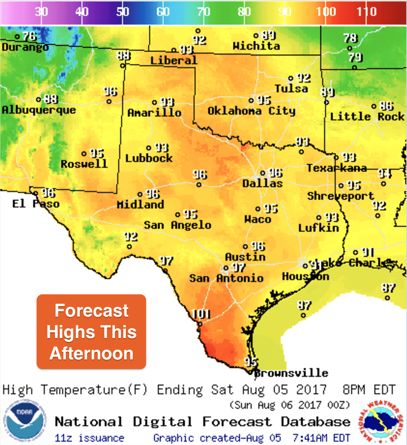
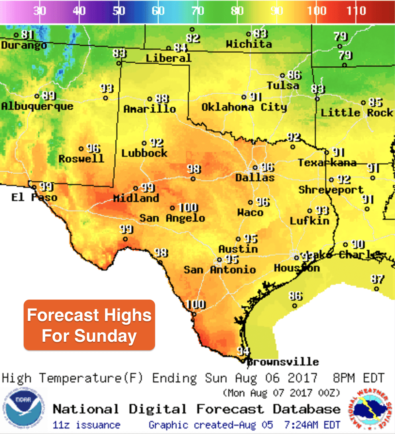
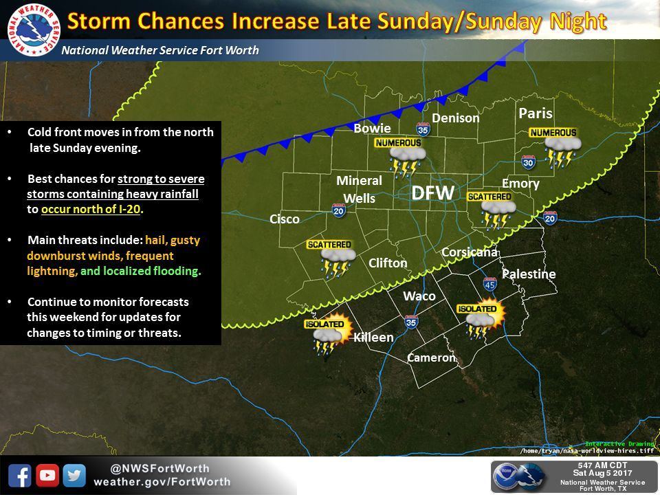
The forecast highlights for this weekend will be slightly warmer temps and continued chances for scattered showers and storms. Temps today across the state will range in the 90s for most, with 100s expected across deep south Texas. Heat index values across parts of south Texas, and along and east of the I-35 corridor, will reach the low 100s this afternoon, so be sure to stay hydrated as we reach peak heating later on. Highs tomorrow will be similar before our next “cool” front arrives which will knock temps down a good 10 degrees for the start of the work week. As always, the further south you are, the less impact you’ll see from this next front. Current trends have it stalling/washing out across central to south central Texas by mid-week. At any rate, at least the northern and central portions of the state will see a return of below normal temperatures along with more widespread rainfall chances beginning late Sunday into early Monday.
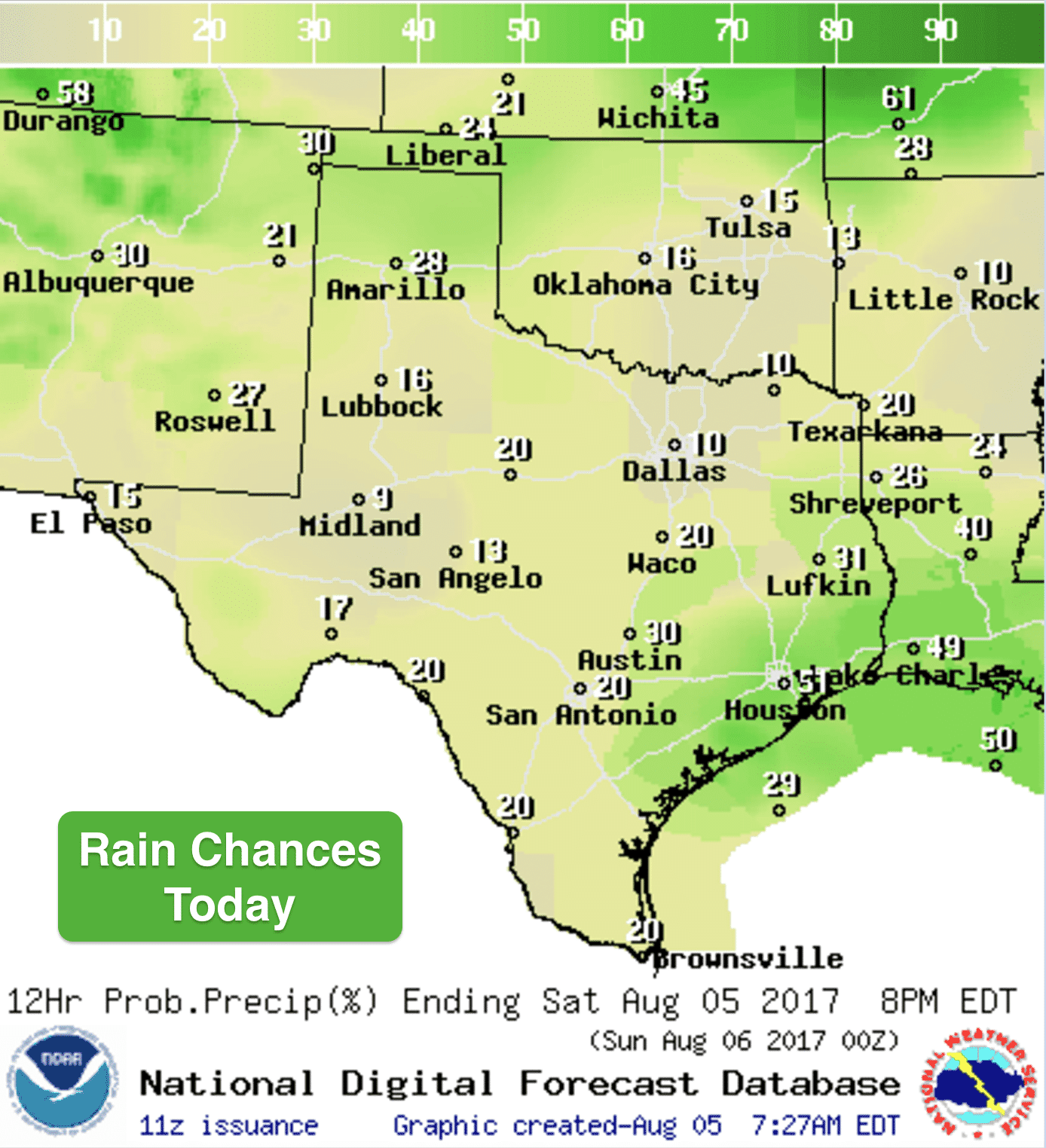
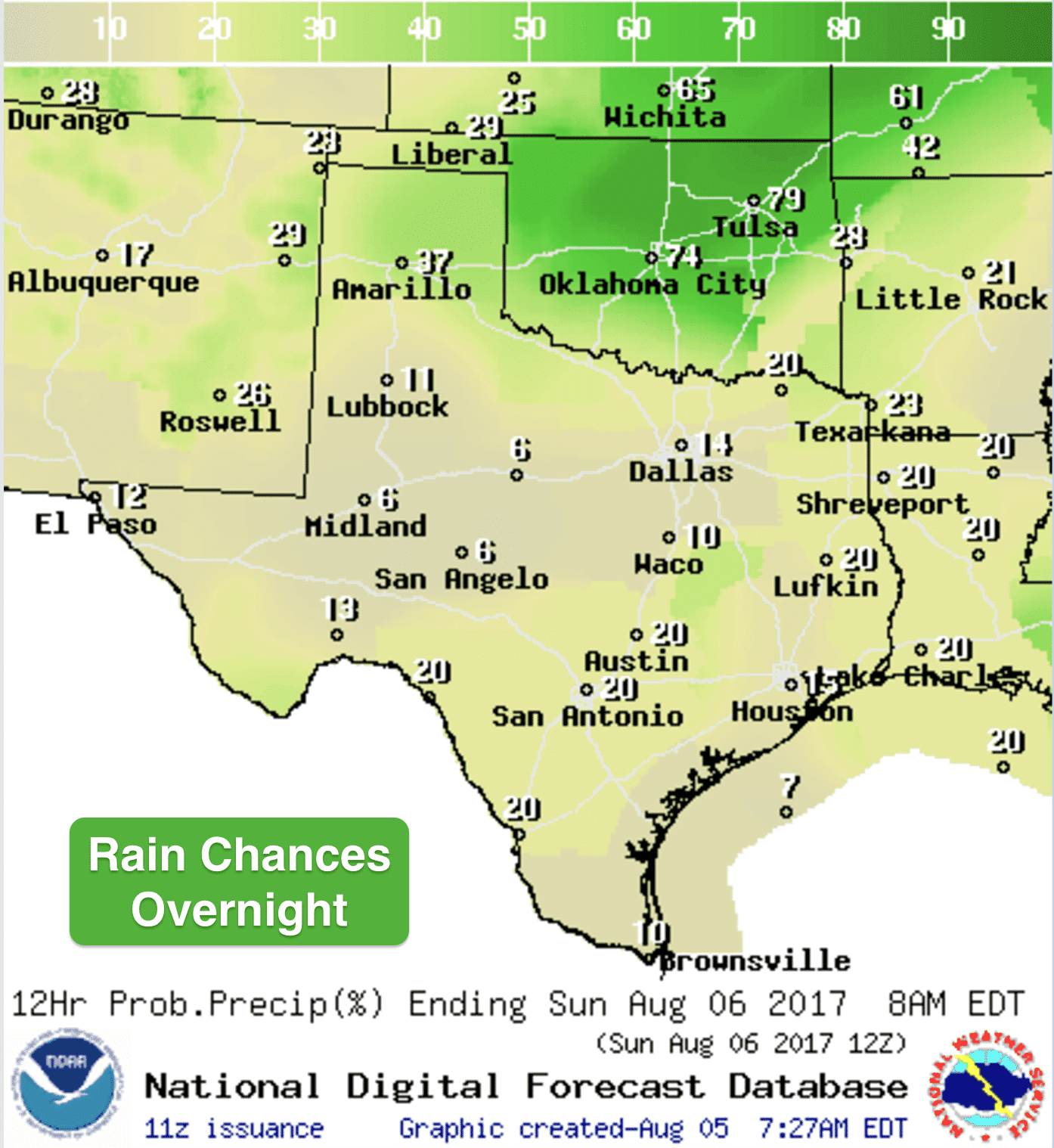
Rain chances today will be most likely across coastal and southeast Texas. Showers have already developed along and just offshore and those will continue to work their way north this morning across southeast Texas up into central and eastern Texas by this afternoon. Coverage will be spotty, so it will be quite hit or miss, but if you end up under one of the stronger storm cells, you could get a quick 1/4 to 1/2 inch of liquid goodness for your lawn or garden. For the panhandle region, we’ll see chances for afternoon storms moving in from the northwest this afternoon…some of which could reach marginally severe levels with gusty winds up to 50mph, small hail and frequent cloud to ground lightning. Widespread severe weather is not expected. On Sunday, a cold front push through the panhandle and bring additional rain and storm chances along with it. We’ll have several chances for rainfall across the panhandle and south plains regions over the next several days, so just expect a rather rainy and stormy pattern to be in place today through the early part of the coming work week. Chances for rain will also extend into north and central Texas as well Monday through Wednesday. We’ll have more specifics on each day’s rain chances as we get a little bit closer.
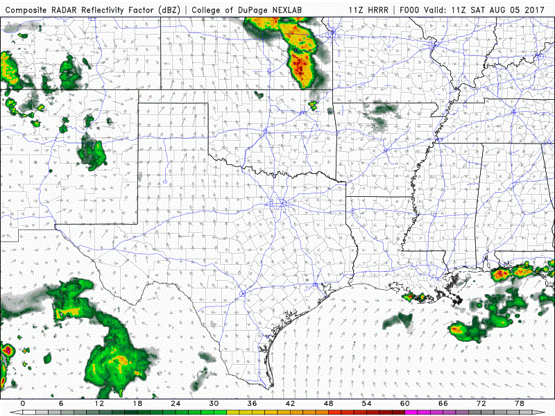
Here’s a look at how the radar may shape up today through about midnight. Keep in mind, this is just a model forecast and not live radar:


0 Comments