
Over the last week or so we’ve been under the influence of an upper-level high pressure. This high pressure is common during the summer months and is partially responsible for our wonderful heat and humidity. Whoever ends up under this large high tends to have little in the way of rain chances along with hot conditions. Luckily for us, this high pressure is going to drift west by this weekend. The western sections of our state will remain under the influence of the high, but the eastern half of Texas will be enough removed to support an increased chance of daily thunderstorm chances. We may even see a weak area of low pressure from the Yucatan Penisula help enhance rainfall chances closer to the coast from South Texas up into Southeast Texas through the first half of the upcoming week. 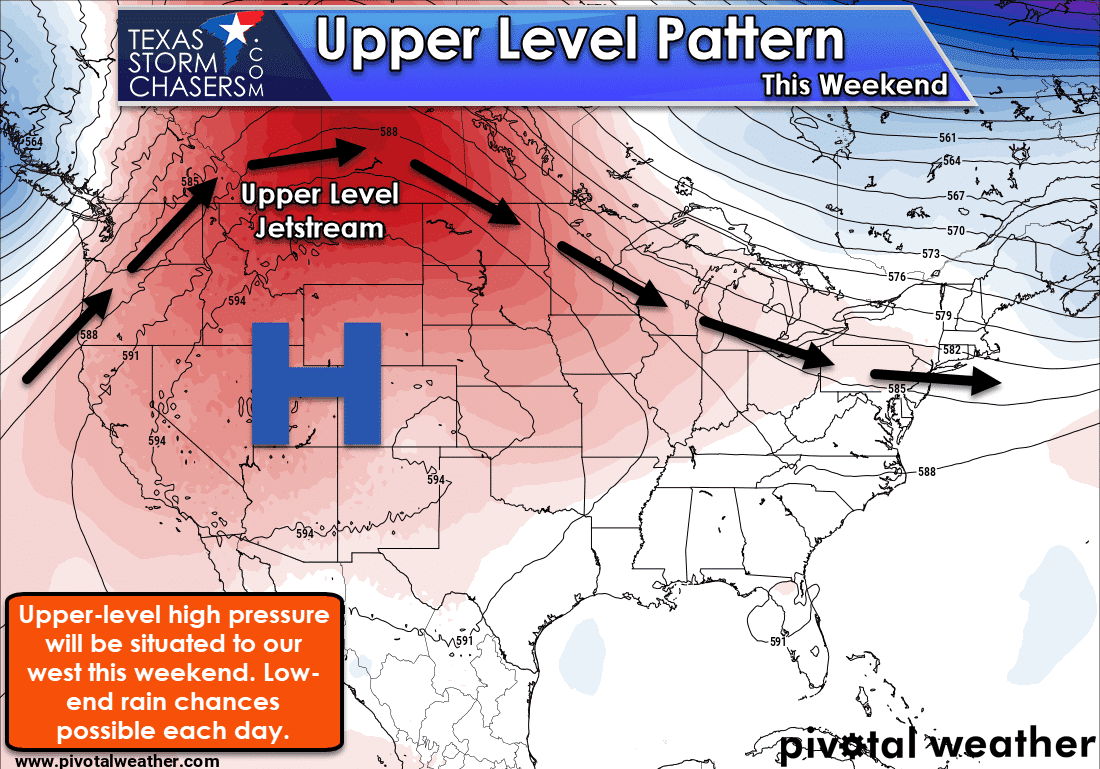
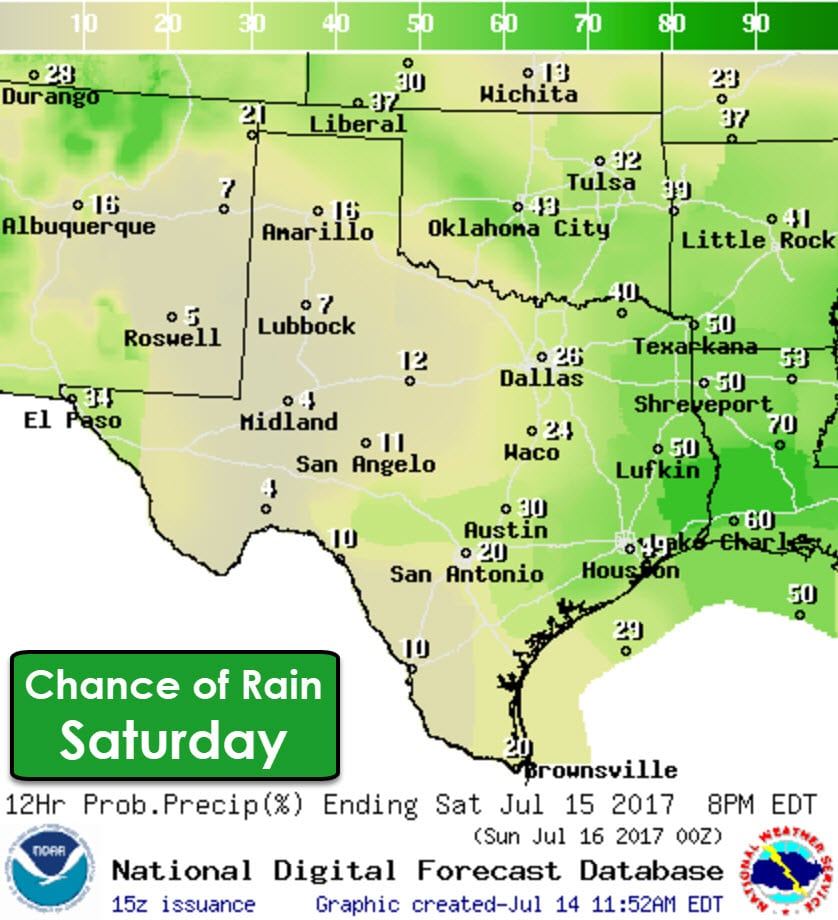
Isolated to widely scattered showers and thunderstorms will be possible on Saturday along and east of Interstate 35/35W. The best chance for an afternoon soaking will be across East Texas and Southeast Texas. A few storms may produce gusty winds, but organized severe weather is not expected. As you might expect with all the humidity this week there will be plenty of moisture available for convection. Copious moisture amounts mean any shower or storm will be able to drop a quick inch or two of rain in a hurry. Minor short-term flooding may occur where we see those heavy rain totals. Spotty showers will remain possible into the evening hours, but the highest coverage of activity will be from late morning to the late afternoon hours.
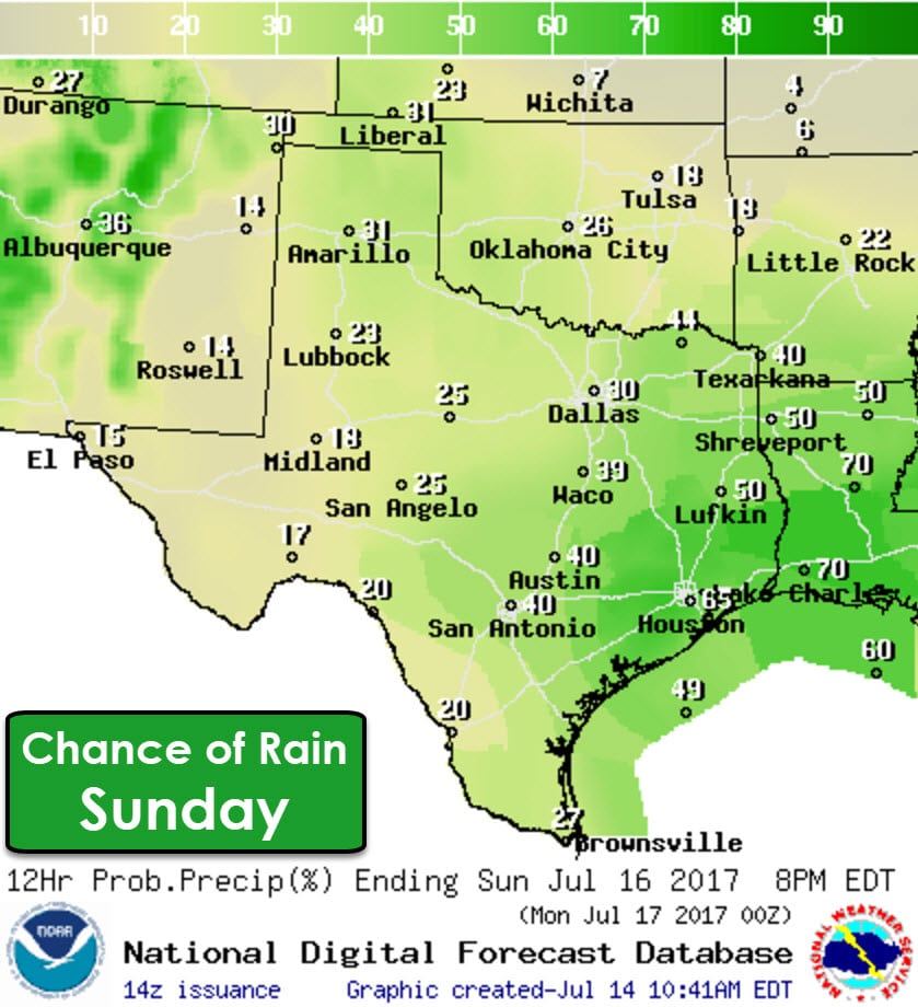
Precipitation chances will increase on Sunday as we see a weak upper-level disturbance help increase lift across the state. Isolated to widely scattered storms will be possible statewide. The best chance for scattered activity will be across South-Central Texas into East Texas and Southeast Texas. Numerous storms are possible on Sunday in Southeast Texas, so it wouldn’t be a bad idea to make sure you have contingency plans if you’re planning on heading outdoors. Elsewhere across the state, we’re not expecting a washout situation. You may see a passing shower/storm this weekend, but it shouldn’t last more than about two hours. Keep in mind any storm will be able to produce lots of lightning, localized gusty winds, and enough rain to make plenty of puddles. On the bright side, you’ll also get a nice cool-off.
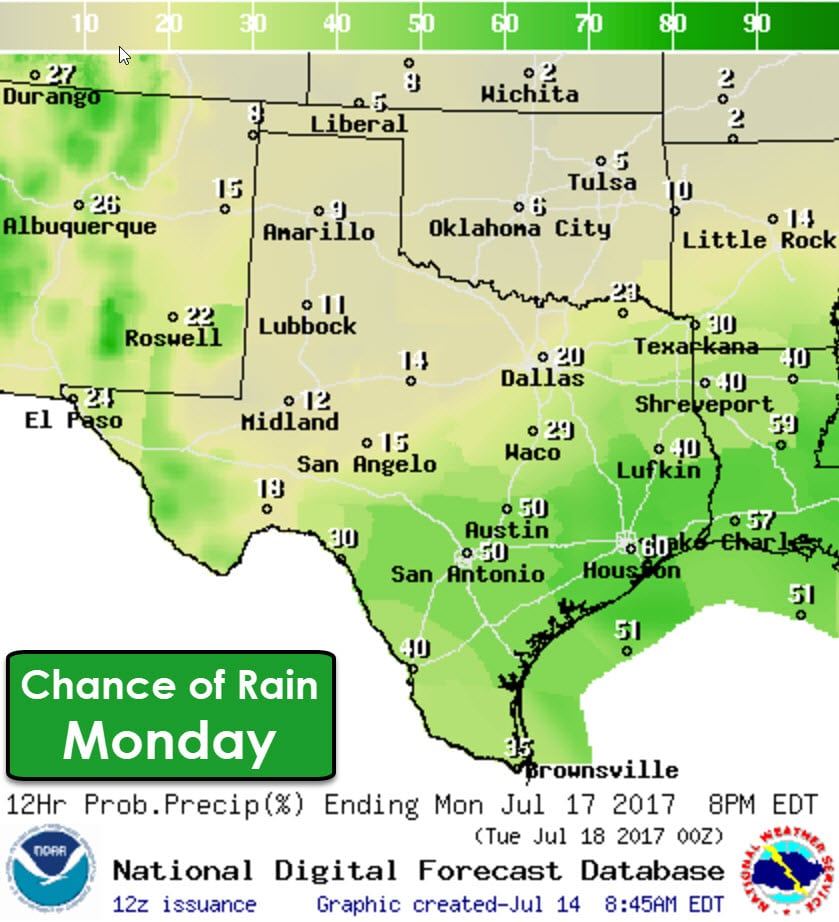
With our summer-time high pressure remaining further northwest through the first half of next week we’ll see isolated to scattered rain chances continue. Monday looks to bring scattered storms to Southeast Texas and South Texas with more isolated coverage across North Texas and East Texas. These daily chances for rain look to continue through Tuesday and Wednesday. Remember that when thunder roars you need to go indoors!


0 Comments