
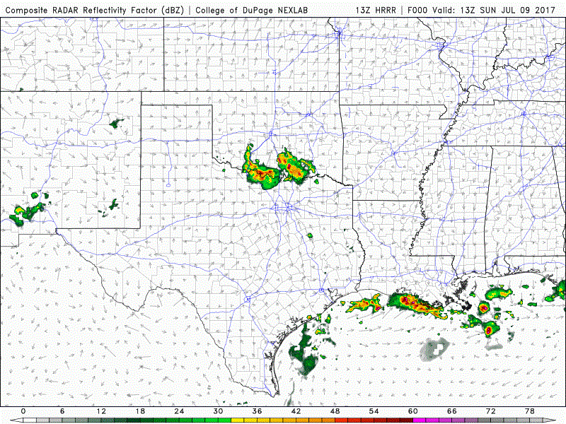
Similar to yesterday, portions of north central Texas, Northeast Texas, East Texas and Southeast Texas are all under a Marginal Risk (Level 1) outlook for scattered strong to severe storms this afternoon. Along the coast this morning, pop-up showers have already formed offshore and will begin to blossom inland between noon and 1pm this afternoon. Movement of storms will be slow which means isolated flash flooding may be possible under some of the stronger cells. Further to the north along the Red River, storms are ongoing this morning with the expectation that we’ll see additional development after 2-3 pm this afternoon across north central, northeast and eastern Texas as we start to reach peak daytime heating. Downburst winds, frequent lightning and isolated episodes of flooding from heavy downpours will be the main threats. For those with outdoor plans across these regions today, you’ll need to keep an eye on the weather and head indoors if storms develop at or near your location. Storms are all expected to die out as we get past sunset and lose daytime heating. Below is an animation from one of the short-range model which will give you a decent idea of how the radar may shape up as we head through the afternoon and evening.
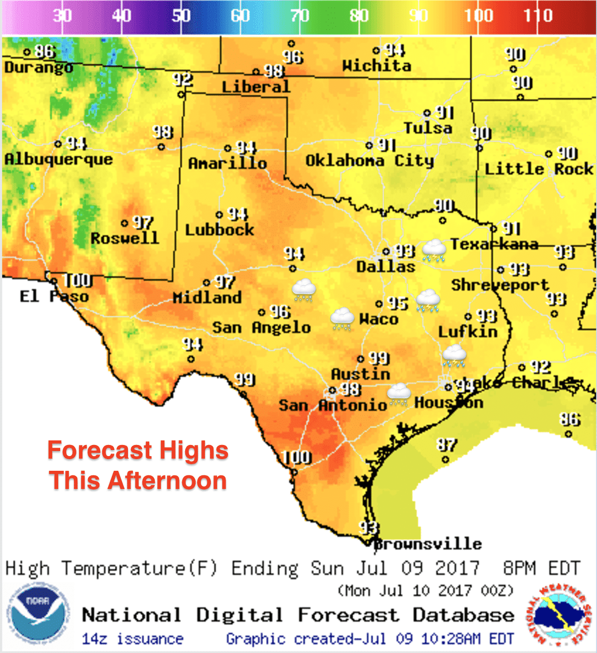
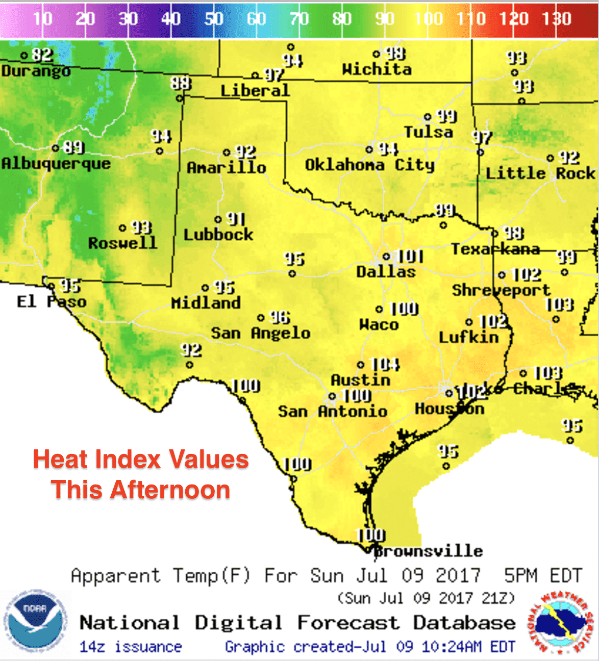
Highs today will be seasonal…a little cooler for areas which will experience thundershowers and residual cloud cover later this afternoon. Those can sure be a real nice break from the afternoon heat! The heat index values this afternoon will still be in the 100-105 degree range across much of the eastern 1/3 of the state where it’s most humid..but hopefully a few showers will move through and cool things off a bit. This pattern of daily pop-up showers and storms will be sticking with us for at least the next several days as we stay wedged between an upper level high out west and an upper level trough to our east.


0 Comments