
Heavy rainfall is expected to continue across parts of the panhandle this morning for at least the next several hours with redevelopment likely this afternoon and evening across the area. Rainfall rates have been quite high for this time of the year and a Flash Flood Watch has been issued covering most of the panhandle region. This Watch covers the following counties and will remain in effect until 7:30pm this evening: Armstrong, Carson, Dallam, Deaf Smith, Hansford, Hartley, Hutchinson, Moore, Oldham, Potter, Randall and Sherman.
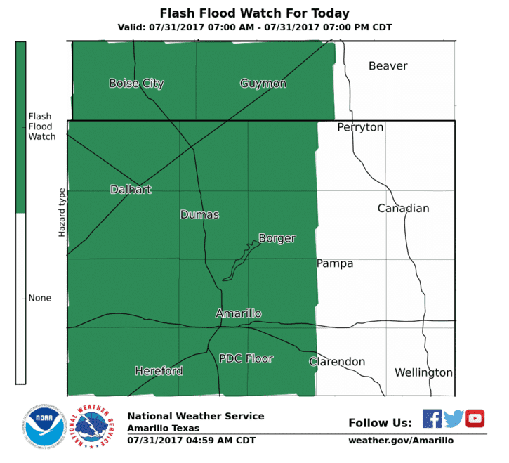
Rain chances today will affect mainly the western half of the state including most all of the Texas panhandle region including the south rolling plains. Far western Texas will see the chances for pop-up afternoon showers typical of the summer North American Monsoon pattern. For portions of south Texas, the decaying weekend frontal boundary will continue to offer support for additional scattered rain and storm chances today. As mentioned above, heavy rainfall and the chance for flash flooding will be the main threats for the panhandle region today. Lightning and gusty winds will be the main threat for portions of western Texas and across south Texas. Severe weather chances are very low.

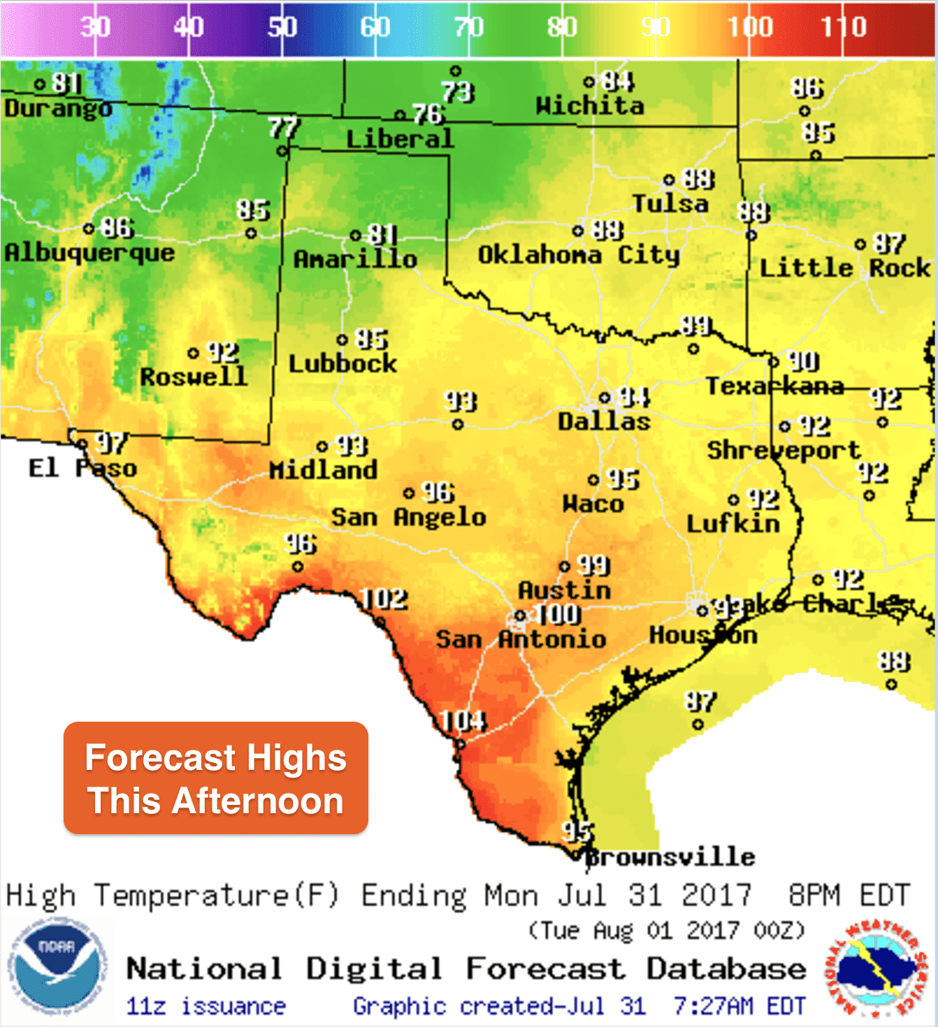
Thanks to this weekend’s “cold front”, temps will be much more agreeable this week for a majority of the state. Drier air filtering in from the east/northeast will keep humidity levels a bit lower than we typically see for the end of July/first of August which will make it much more tolerable to be outdoors each afternoon and evening through the work week ahead. Another cold front is forecast to move in later this week which will help to keep temperatures below normal through the weekend ahead. This will be a nice reprieve from the heatwave we’ve endured the past couple of weeks!


0 Comments