
After a couple weeks of summertime weather, we’re about to undergo a pattern change. The high pressure responsible for our hot and oppressively humid weather will be moving west. In response to that westward shift, we’re going to see a weak north/northwesterly flow aloft. That will allow a weak cool front to progress south into the state this weekend into next week.
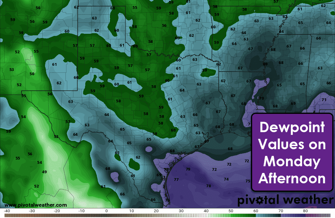
Conditions north of the front will be noticeably less sticky with dewpoints dropping from the middle 70s down into the upper 50s to lower 60s. Temperatures won’t be too much cooler, but we should see a five to ten-degree drop compared to temperatures over the last few weeks. Overnight low temperatures will also be cooler. Folks in the Panhandle will top out in the upper 70s on Wednesday.
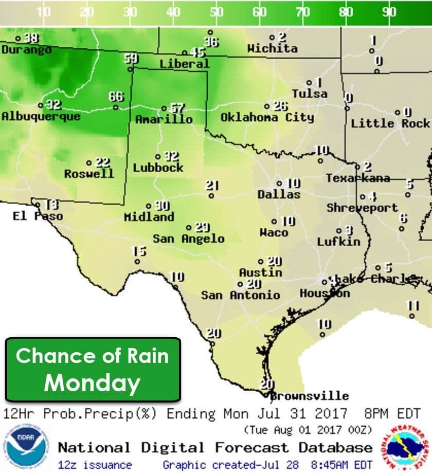
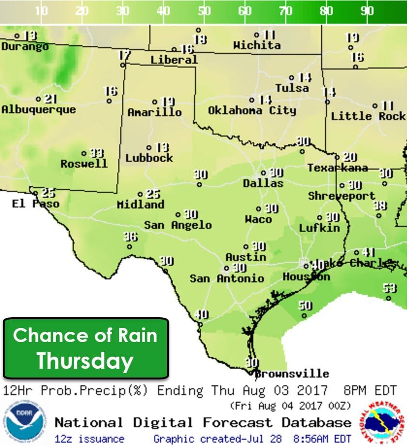


Isolated to widely scattered storms will be possible each day. The highest chance of rain on Monday and Tuesday will be in the Texas Panhandle and West Texas southwest into the Trans-Pecos and Borderland. We could see some decent rainfall amounts in the Panhandle and West Texas next week with two to four inches of rain possible. We’ll have to keep an eye out for flooding potential out that way. Otherwise, today will likely be the hottest day so far this year for parts of the state as very warm low-level temperatures were measured this morning with the weather balloons. Just a few more days until relief arrives.


0 Comments