
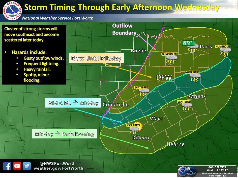
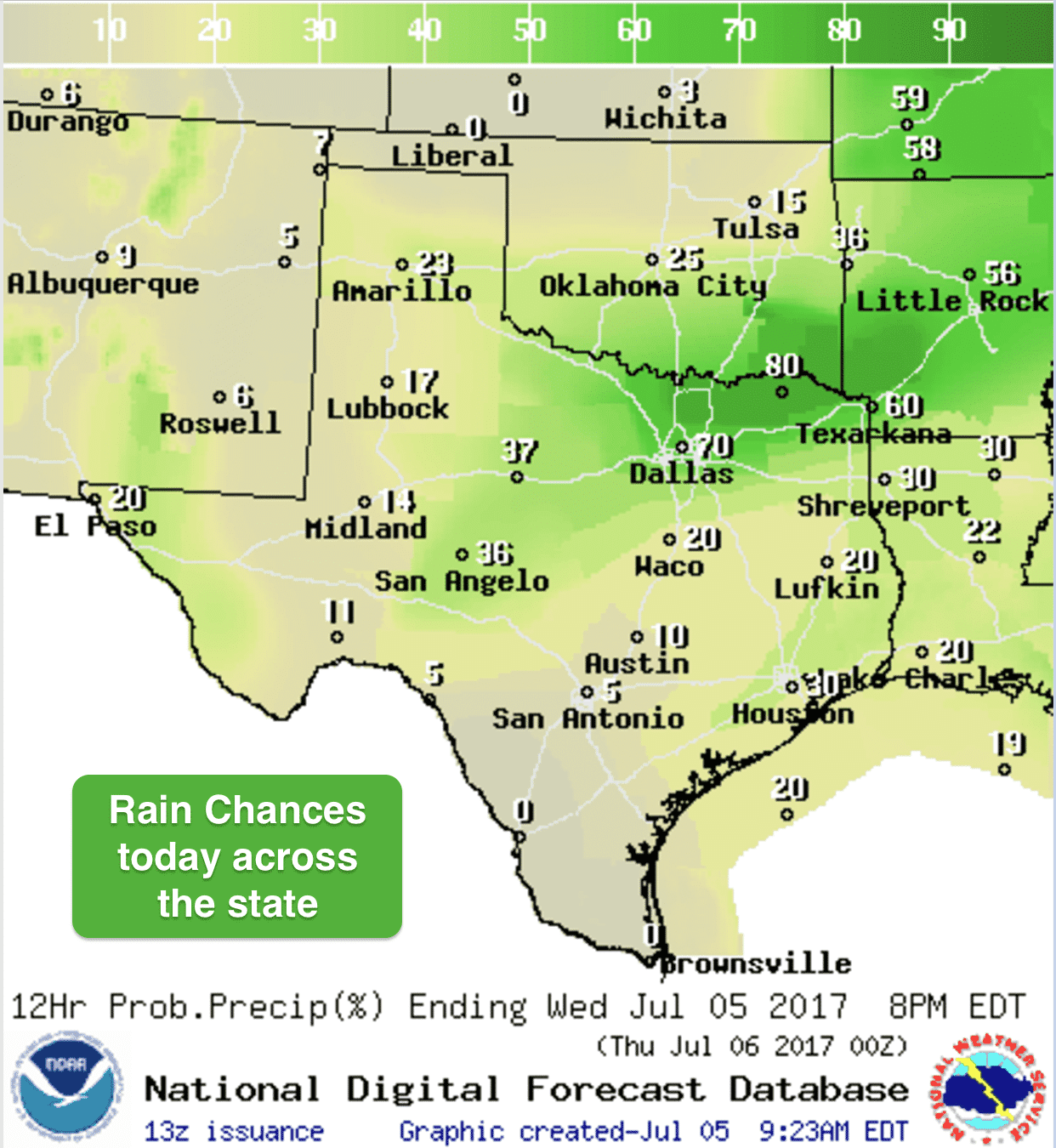
Rain and storm chances today will be concentrated across portions of northeast Texas and north central Texas where the Storm Prediction Center has placed a Marginal Risk (Level 1) for severe weather today. Rain and thunder from an overnight convective system will continue to slowly push southeast across northeast Texas this morning bringing gusty winds, frequent lightning and heavy downpours across the region. Additional development further west is possible this afternoon mainly for areas along and south of the I-20 corridor. A few storms could become marginally severe with damaging wind gusts as the main threat. Folks out west across the panhandle and west Texas regions will finally begin to get a break from evening and overnight storms as high pressure begins to build in from the west just a bit. While this region will not be completely storm free for the next several days, we will see a decrease in activity. Folks along the upper coast will see a chance for pop-up showers moving onshore from the Gulf this morning and through the afternoon hours…nothing severe, but lightning strikes could be an issue with any of the stronger cells that develop.
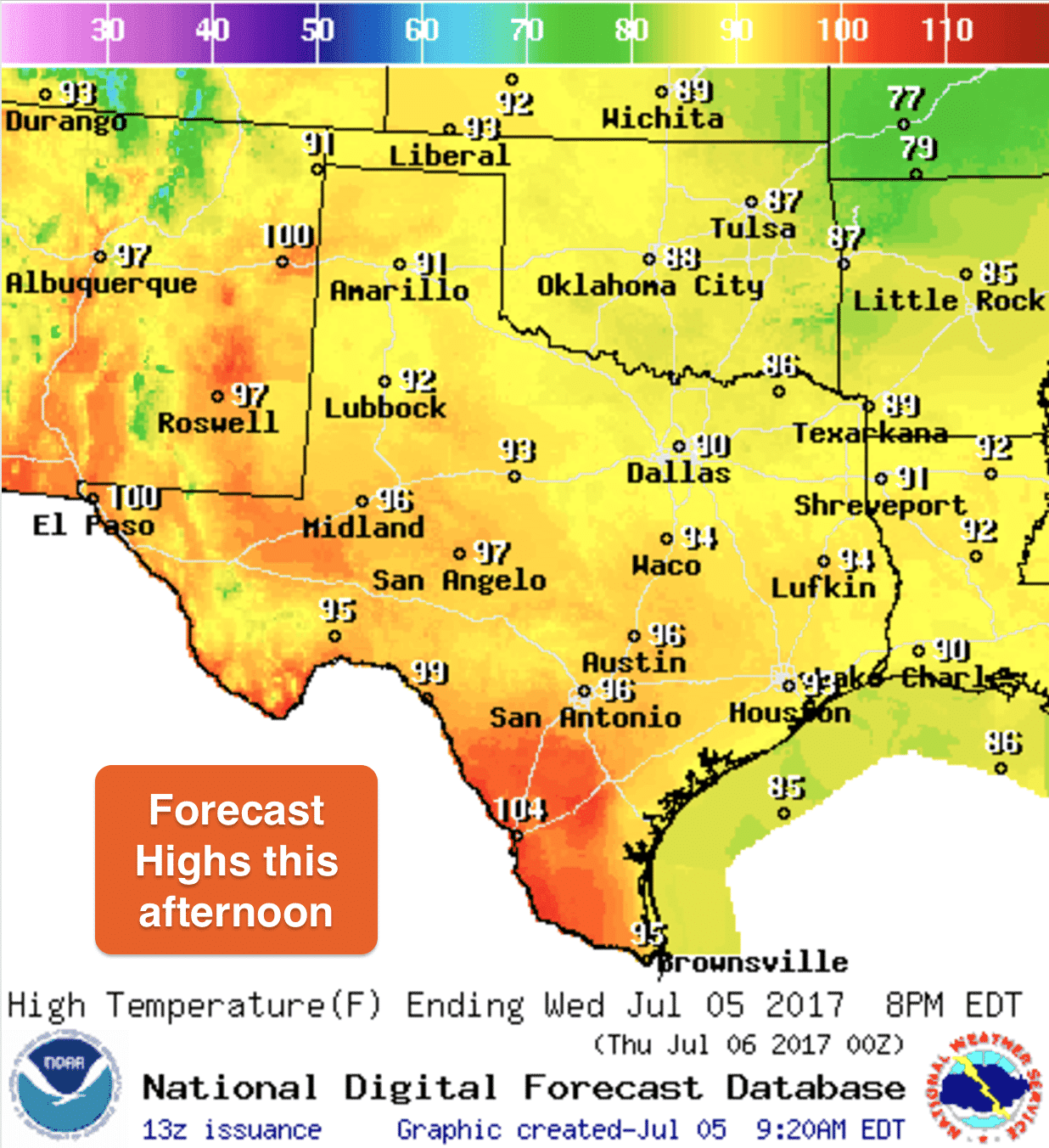
Highs today will be seasonably hot for this time of the year. Very humid conditions will be in place across the eastern half of the state, so it will continue to feel quite muggy and oppressive under the afternoon sun. Heat index values will be greatest across south Texas today, especially along the Rio Grande where temps will reach 100 to 105 today. Elsewhere, not quite as high, but still very uncomfortable for outdoor activities this afternoon. Make sure you stay hydrated and try to limit outdoor activities during the afternoon as much as possible.


0 Comments