
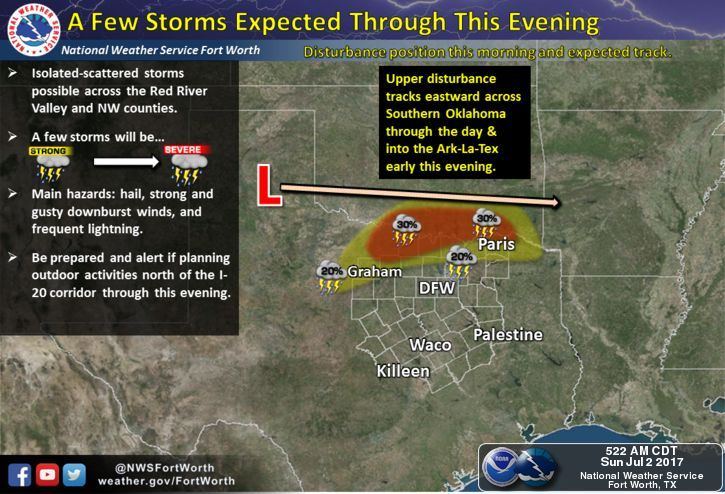
Most of the state will remain hot and dry today…but we do have a couple of chances for strong to severe storms later this afternoon across parts of north central Texas and once again across the panhandle region. For north central Texas, the remains of a boundary kicked off by storms across the panhandle overnight will contribute to the chance for development this afternoon mainly for areas north of the I-20 corridor up towards the Red River. A few of the storms could become marginally severe with downburst winds, hail and frequent lightning as the main threats. For the panhandle region, another round of storms moving east out of the New Mexico plains is expected to arrive later this evening and into the overnight hours. Damaging winds, hail and frequent lightning will be the primary threats along with localized flash flooding. Both of these regions have been placed under a Marginal Risk (Level 1) for severe weather activity today, so if you have outdoor plans this evening, keep an eye on the sky.
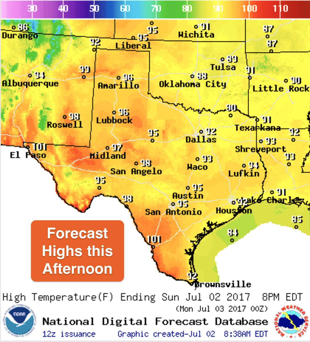
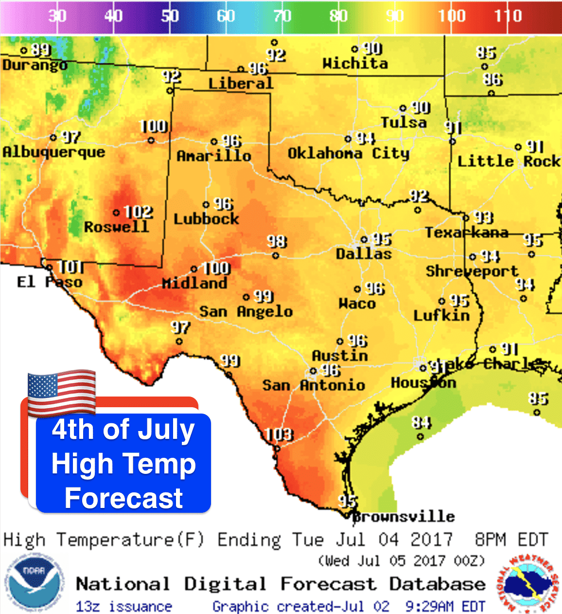
Highs today will be seasonal and in the 90s across most of the state with moist and humid air in place across the eastern half of the state and a bit drier out west. Heat index values this afternoon will creep into the low 100s across much of south and central Texas but should stay just shy of heat advisory criteria. The forecast across the state for the 4th of July looks seasonably hot and mostly dry. There will be a few chances for scattered storms across the panhandle down into the Permian Basin region but probably not enough to rain out anyone’s 4th of July plans.


0 Comments