
The dryline will become active this afternoon across the eastern two-thirds of the Texas Panhandle south/southwest into West Texas and the Permian Basin. By this afternoon temperatures will warm well into the 90s – providing plenty of instability and causing the capping inversion to become weak. With a negative tilt upper trough passing well to our north, but we should see enough ‘lift’ to bust through the cap by the late afternoon hours.
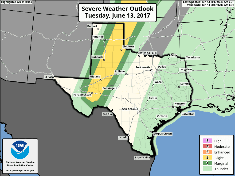
The Storm Prediction Center has outlined the ‘standard’ level two risk of severe weather for the aforementioned regions above. This severe weather corridor isn’t very wide, about 75 to the east of the dryline. That’s because the capping inversion, or the lid that prevents thunderstorms, will be stronger not that far east of the dryline. Also, storms that do fire will likely only move at 10 to 20 MPH. If we have any ‘right movers’, or storms that start moving right of the deviant motion, those may only move at 5 to 10 MPH. The tornado threat this afternoon will be very low, but certainly not zero. The threat for tornadoes is never totally zero when dealing with supercells. Cloud bases will be very high, so that in itself will greatly reduce the threat for tornadoes. What will be likely with the strongest storms is destructive hail and damaging wind gusts. Some of the hail may be up to the size of a baseball.
The High Resolution Rapid Refresh (HRRR) has isolated to widely scattered storms firing up by 5 PM across the eastern Texas Panhandle south into the Permian Basin. The highest storm coverage along the dryline will probably be across the Texas Panhandle – closer to the source of upper level lift. The strongest of the storms will be severe with a risk of very large hail and damaging wind gusts. The general movement of storms will be off to the east at 20 to 25 MPH, but some may tend to move east/southeast at a slower speed. As storms move east toward western Oklahoma, Northwest Texas, and the far western Big Country and Concho Valley they’ll run into the stronger cap. We should see storms in a weakening state by 10 PM, but some showers/storms may continue through about 1 AM in Northwest Texas and the Big Country.


0 Comments