
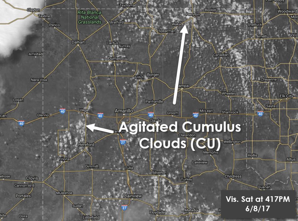
Visible sattilite imagery shows cumulus becoming more agitated across western sections of the Texas Panhandle, and further east across the northeastern Texas Panhandle north into Oklahoma. It appears we’re still an hour or two off from the first storms of the day firing. However, we should have at least one severe storm underway by 7 PM.
The Storm Prediction Center indicates a severe thunderstorm watch will likely be issued for a majority of the Texas Panhandle in the next few hours. This will be due to the risk of isolated supercell thunderstorms. As stated above we should have storm initiation in the 530-7 PM timeframe. We may only have one or two storms initially, but those storms will probably be supercellular with a risk of very large hail. One primary factor in determining cloud base heights, the surface temperature/dewpoint spread, is fairly high. That means cloud bases are expected to be high as well. Those high cloud bases in conjunction with weak low-level wind shear will keep the tornado threat low. The primary severe weather threat with initial storms will be large hail, possibly larger than the size of golfballs. Conditions will also be faovirable for downbursts, some may be stronger then 60 MPH. Storms will tend to move southeast, although any organized supercell may be display deviant motion and move almost due south at 20 to 30 MPH.
Simulated radar model animation through 8 AM Wednesday.
With time we expected one or two clusters of storms to develop across the Texas Panhandle this evening. Once that occurs that cluster will likely be capable of producing damaging straight-line winds and large hail. This evening’s setup is a fairly classic one for one of our south/southeastward propagating thunderstorm clusters. In all likelihood this cluster will impact portions of Northwest Texas, West Texas, and perhaps make it as far south as the eastern Permian Basin and Big Country late tonight before dissipating. Some of the storms in this cluster will likely be strong to severe through the late evening hours. The risk for 60+ MPH winds should decrease after midnight, but storms may continue into the early morning hours Wednesday. Some of these storms could make it as far east/south as western North Texas by the pre-dawn hours Wednesday.


0 Comments