
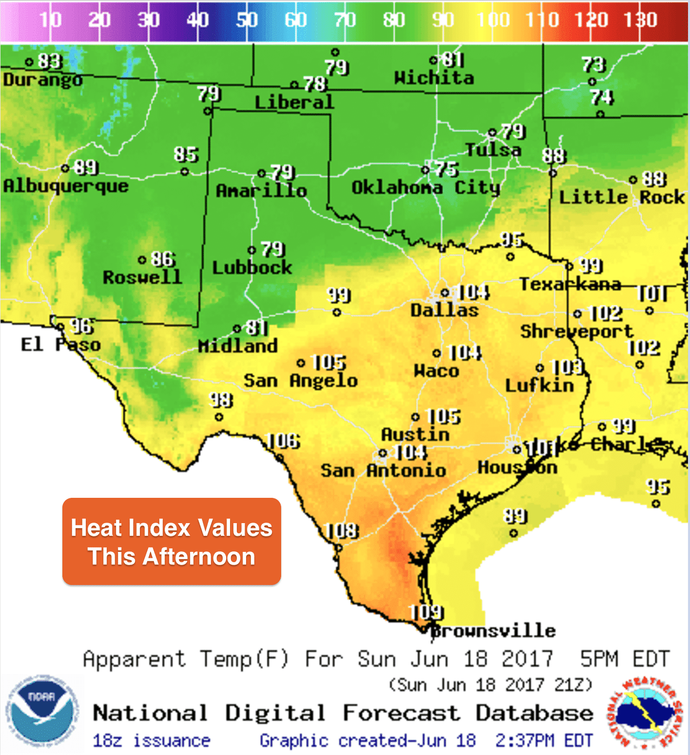
We’re only a few hours away from peak daytime heating. Thankfully, a cold front has moved through the panhandle and folks there are enjoying much cooler temps than they saw both Friday and Saturday. The temperature in Amarillo currently is only 81 and Lubbock is only 79. That’s much better than the 110’s they saw across the region Friday and yesterday! Ahead of the front, still very hot and sticky with head index values expected to be in the low 100s again. The cold front will unfortunately not make it much further south than the I-20 corridor before it stalls and washes out, so folks in the central and southern portions of the state will not benefit from any cooler or less humid air. The ridge that has been sitting over the desert southwest will strengthen once again by the middle of the week and we’ll be seeing temps creeping higher across the western half of the state over the next several days and remaining well into the 90s for everyone else…so it looks like summer is here to stay.

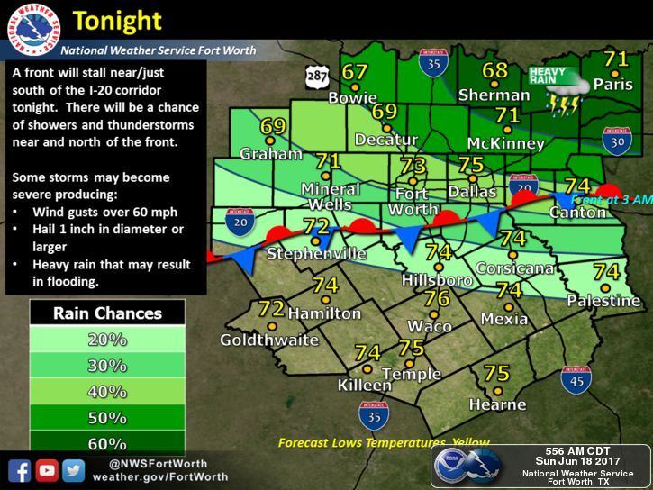
We’ll have a few rain chances overnight mainly across portions of northeast Texas then it looks like we stay mostly dry for the week ahead. The caveat to that will be the potential development of a tropical depression or tropical storm in the Gulf this week. Depending on its eventual development and track, we could see an increase in rain chances along the coast by mid to late-week. As of right now, the forecast models are still showing quite a difference in the eventual development and track of this system, so it will probably have to form into a named storm and sampled by NOAA Hurricane Hunter aircraft before we have better data to feed the forecast models. Be sure to check out David’s most recent blog update on this potential tropical system >> here <<


0 Comments