
The dryline out in western Texas has been very active this week…and such will be the case again for one more day until things calm down for the weekend. The Storm Prediction Center has placed a Slight Risk across much of the eastern panhandle down towards the Lubbock area for this afternoon with the chance for scattered to isolated strong to severe storms with a large hail threat. Hail in excess of 2-3 inches in diameter is possible within any of the stronger cells that develop. Frequent cloud to ground lightning will also be a threat along with isolated very heavy downpours and strong outflow winds. Timing of storm initiation is expected to be around 4pm across the southeastern panhandle with additional development south/southwest along the dryline along the caprock escarpment as the evening wears on. As we’ve seen the past several days, coverage will not be widespread, so not everyone will be impacted.
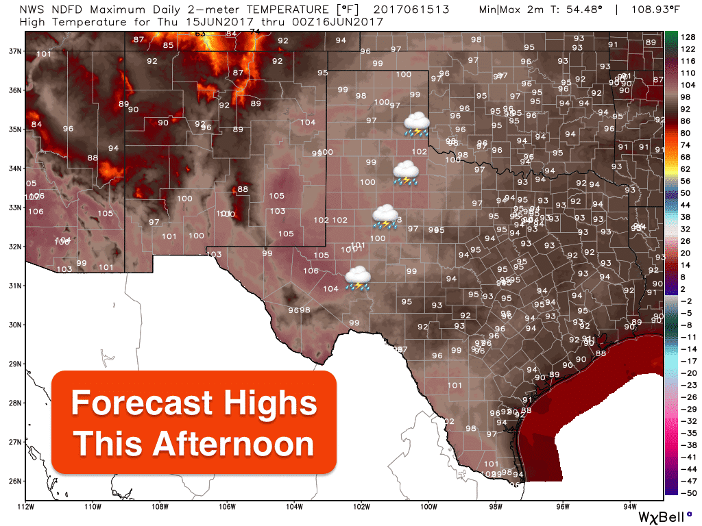
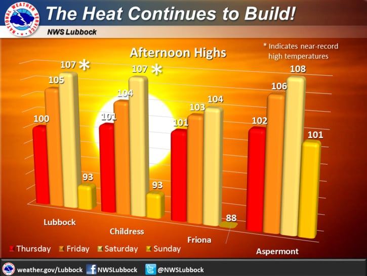
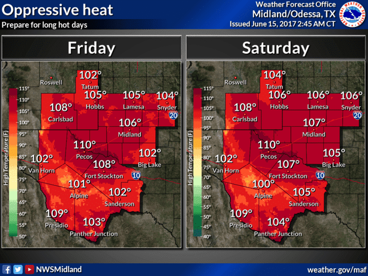
For the remainder of the state warm and humid with a few chances for isolated showers across far southeast Texas. The heat will really build in over the western half of the state both Friday and Saturday as upper level ridging sets in across the region. Near record to record highs are possible across much of the panhandle and western Texas Friday and Saturday…with some places seeing highs jump close to 107 to 110 degrees before a cool front arrives on Sunday.


0 Comments