
June has arrived and with it the 2017 Atlantic Hurricane Season. We’ll have to keep an eye on the Gulf by mid to late June as we start to enter a more climatologically favorable period for Bay of Campeche and western GoM systems. No tropical mischief is expected for the next 10 days at least. What we will be dealing with is a more summer-like pattern across the state. The jetstream has pushed to our north and we’re dealing with small ripples of energy aloft. Combined with weak areas of low pressure that spin up due to storms the previous day along with copious amounts of moisture – we’re going to be playing one of our favorite games… Where will the popcorn storms fire up! Wind shear is modest and that means we’ll be looking forward to multicellular convection. We’ve already got scattered storms firing up at the time of this writing (1030AM) as temperatures warm into the 80s.
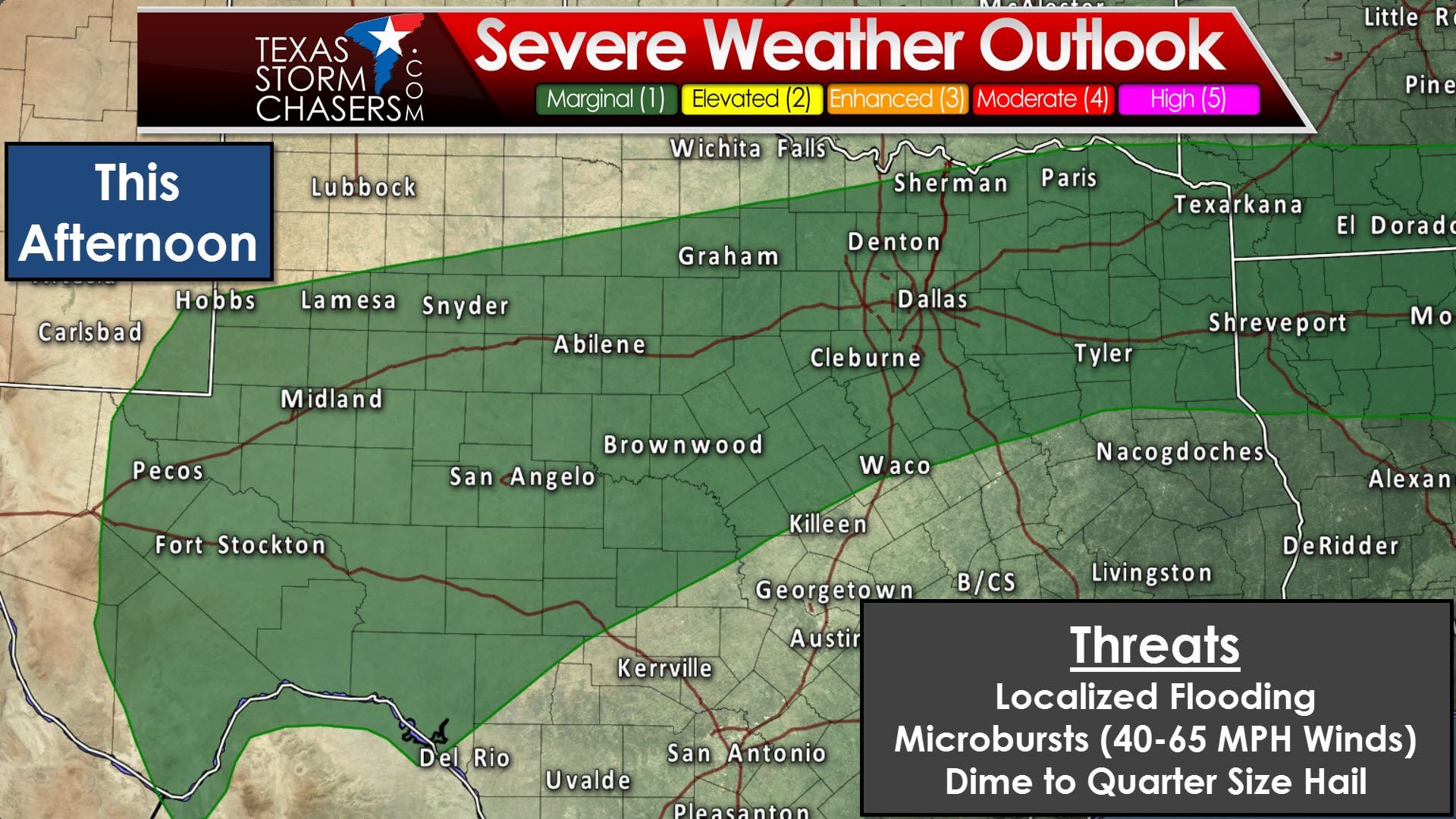
The Storm Prediction Center has broad brushed a marginal risk of severe weather from the Trans-Pecos and Permian Basin eastward through the Big Country, Concho Valley, North Texas, through Northeast Texas and East Texas. This risk is for the possibility of wet microbursts this afternoon along with some smaller hail. Storms in this summer-type enviornment can go up fast, make a ruckus with heavy rainfall, some small hail, and copious amounts of cloud to ground lightning. However, with wind shear values modest, these slow-moving storms will typically rain themselves out within an hour. Outflow generated from the thunderstorm’s collapse acts like a wave and will help new activity go up nearby. That process repeats itself and continues through the late afternoon – before we start to stabilize by the early evening. This is the kind of situation where you may get sprinkles while a mile away gets two inches of rain. Copious amounts of moisture will allow for efficient heavy rainfall production. If you end up under one of the storm’s this afternoon you may get a few inches of rain in a hurry. Localized flooding is possible for a few hours during and after the storm before drainage systems can catch up. We’ll also have to watch for any small clusters of slow-moving storms that can organize – as they would have a slightly higher chance of producing several inches of rain and strong winds within a short period of time.
Isolated to scattered storm chances will continue every day through Sunday. The highest chance of a passing storm will be during the peak-heating hours from late morning through the late afternoon hours. Like today it’ll be a hit or miss sort of game – and we can’t give you any sort of more precise timetable. Its not like a squall line or more predictable event where we can give a precise time window. These popcorn storms don’t work like that. If we see a more organized cluster of storms develop any of these days those storms may continue into the evening hours. Consider it this way – we could either have daily storm chances – or dry weather with high temperatures near 100 degrees. Which would you rather be dealing with?


0 Comments