
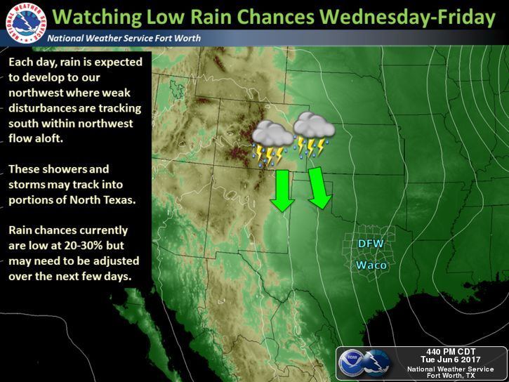
Chances for rain and storms will continue through Thursday for portions of the Texas Panhandle and Trans Pecos regions of west Texas. Much like we saw today, storms will fire up again tomorrow afternoon across eastern New Mexico and southeastern Colorado and travel southeast into the western portions of the state during the late afternoon and evening hours. Coverage of storms is expected to remain scattered and most will remain below severe limits, but a few could become severe with downburst winds and hail as the main threats. After sunset each evening, we’ll see much of the activity diminish and eventually subside by the wee hours Thursday morning.
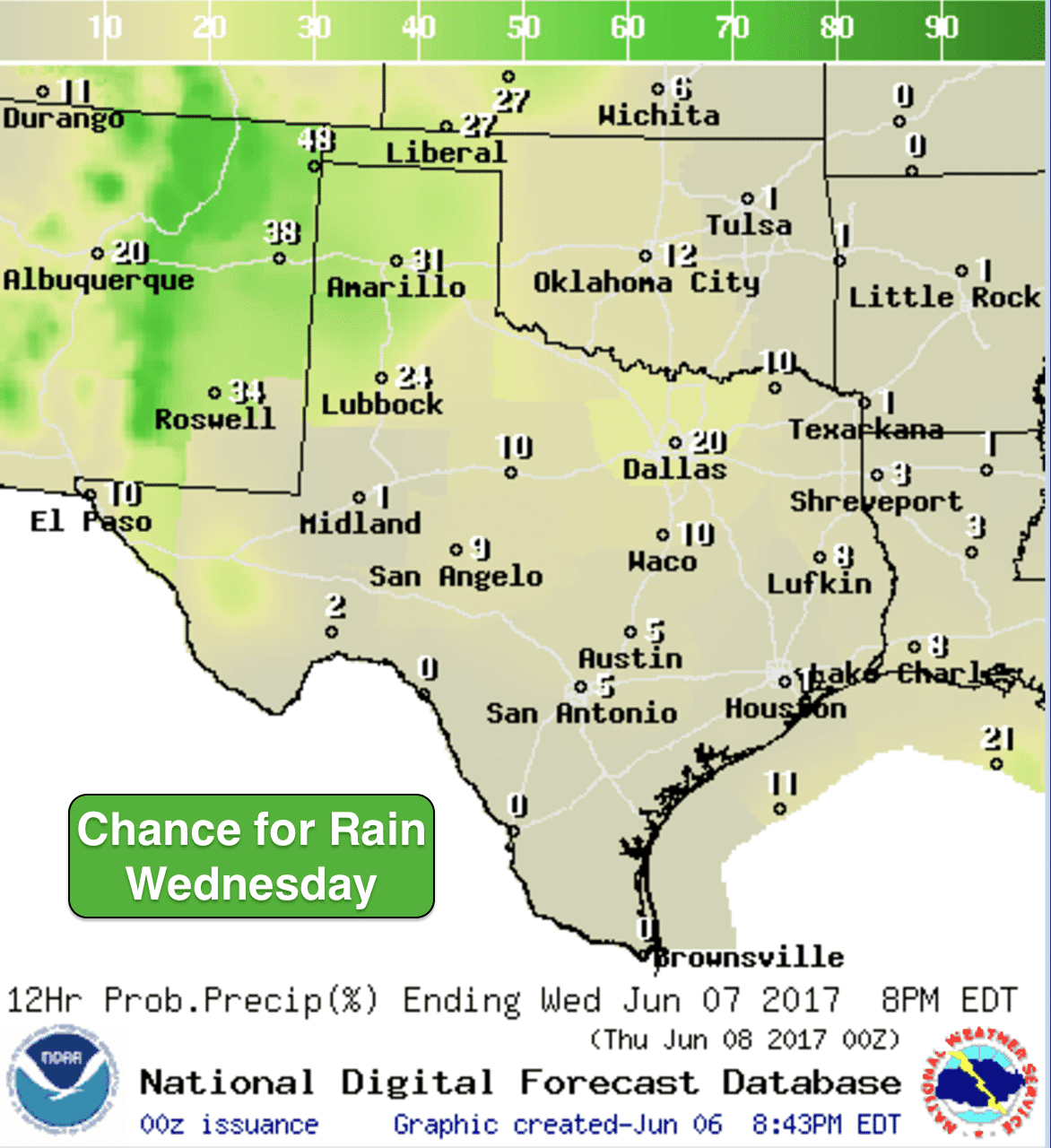
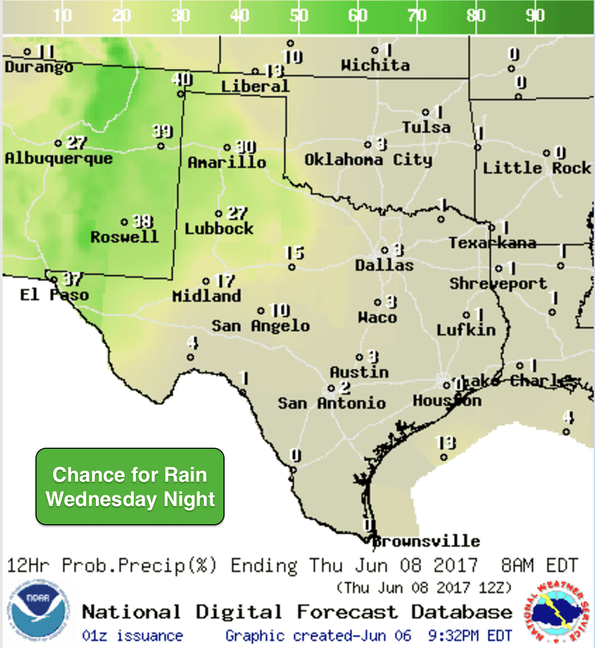
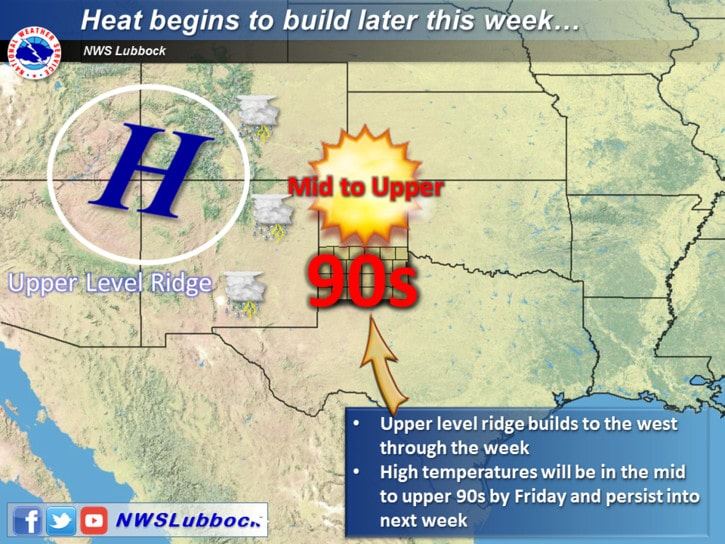
Some of the short range models are showing some of this activity making it into the western portions of north Texas during the nighttime hours both Wednesday and again on Thursday and Friday. The chance for this is pretty low at this time, but we’ll be watching this trend over the next several days as a trough moves in from the west which may push any nocturnal activity a bit further east. Either way, we still expect storm coverage to be scattered…most will not see any impacts…but it will be something to keep an eye on during the late evening and overnight hours. Looking ahead to the weekend, we’ll dry out and heat up with high pressure moving in from the west. Looks like we’ll have a chance to see temps back in the upper 90s to 100s again…a little above where we should be in early June but not too unusual for this time of the year.


0 Comments