
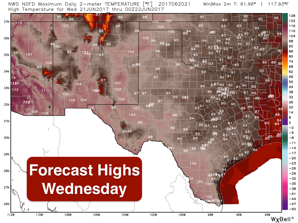
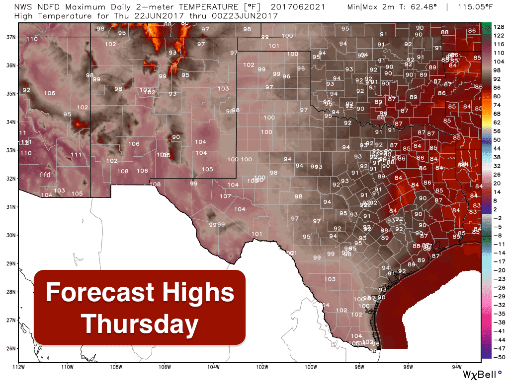
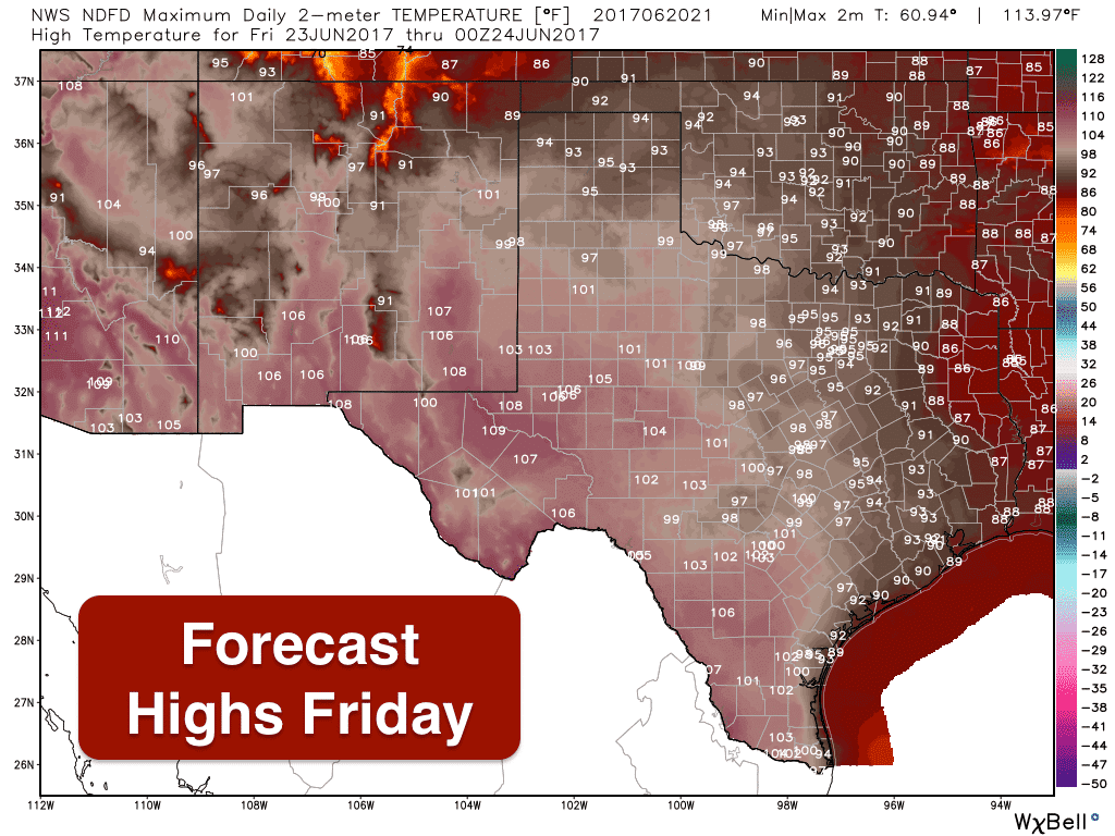
Of course the big weather news this week is the development of Tropical Storm Cindy earlier this afternoon and her expected impacts for portions of southeast and eastern Texas over the next couple of days. But let’s not forget the rest of the state! The Summer Solstice is upon us and at 11:24pm this evening, we’ll transition into our official first day of the Summer season. We all know what that means…hot weather…and yes, that is forecast to continue for much of the state over the next several days. Areas impacted by TS Cindy will see cooler conditions mainly due to cloud cover and rain, but for the rest of the state…mainly the western half…we’ll continue to see temps creeping up a bit tomorrow, Thursday, and Friday. For tomorrow, we’ll see highs across the state remain mostly in the 90s with a majority of the 100 degree readings focused across south Texas. Thursday will likely be the warmest day for folks in the panhandle region with upper 90s to 102 in the forecast. For Friday, a cold front will slowly move south into the panhandle during the day which will keep temps there below 100, but for parts of west, southwest and south Texas along the Rio Grande, we’ll still be dealing with highs between 100 and 110.

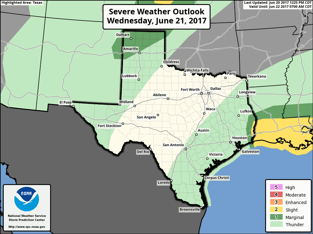
Storms are in the forecast again tomorrow for portions of the Texas panhandle region where we’ll have a Marginal Risk (Level 1) of severe thunderstorms during the afternoon and late evening/overnight hours. This risk will mainly be focused across the northwestern panhandle with mainly a gusty wind/blowing dust and frequent lightning threat as storms move south/southeast off the Colorado front range and the New Mexico plains into the northwestern portions of the panhandle. Coverage of storms is expected to be quite isolated, so most will not see any impacts.
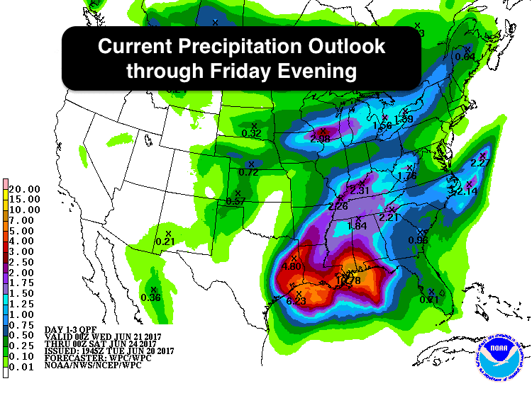
As you would expect, the rainfall outlook between now and the end of the work week is much higher for areas expecting impacts from TS Cindy. Parts of southeast Texas will likely see rainfall totals upwards of 6 inches…and that does not include isolated pockets of higher rainfall totals. Most of the rain across southeast Texas is expected to fall between early Thursday morning as TS Cindy makes landfall, and continue during the day Thursday and through early Friday. For the panhandle/west Texas region, only scant amounts mainly from any scattered to isolated storms moving south into the state from CO and NM.


0 Comments