

A late season cool front will bring a glorious bout of cooler and drier airmass into at least the northern half of Texas for the weekend. At the time of this writing, the cool front was located just north of Lubbock to near Vernon extending east into Central Oklahoma. Temperatures in the Texas Panhandle are only in the 70s with dewpoints in the 40s and 50s. Compare those beautiful temperatures to the 90s/100s with heat index values over 110 south of the cold front all the way to the Gulf Coast. Isolated storms are firing up ahead of the cold front in West Texas to the Red River Valley. Thunderstorm coverage will increase dramatically later tonight as the front continues to push south.
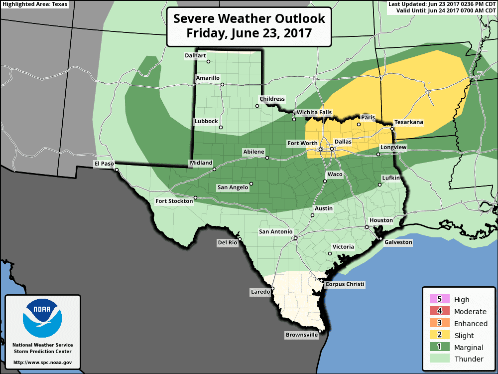
The Storm Prediction Center maintains the ‘standard’ level 2 risk of severe weather for portions of North Texas, Texoma, and Northeast Texas tonight. The ‘marginal’ level 1 risk encompasses the Permian Basin, Big Country, Concho Valley, Hill Country, Central Texas, and East Texas. The hazards will be the same in both risk categories with the strongest storms capable of producing localized winds over 60 MPH and perhaps hail up to the size of quarters. We’ll just see a few more severe storms in the level 2 risk zone compared to the level 1. Most storms will not be severe, but a few will become rowdy. All will produce heavy rain, but not everyone will get rain. The threat for a few severe storms will continue most of the night but will become lower as we get closer to sunrise.
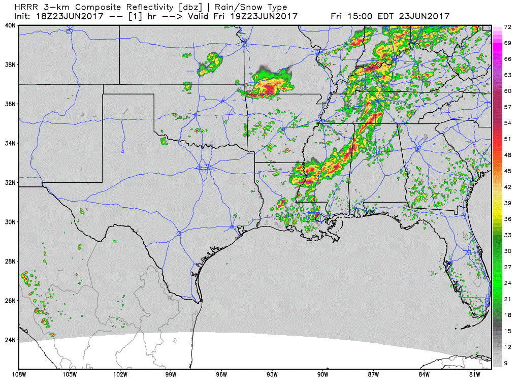
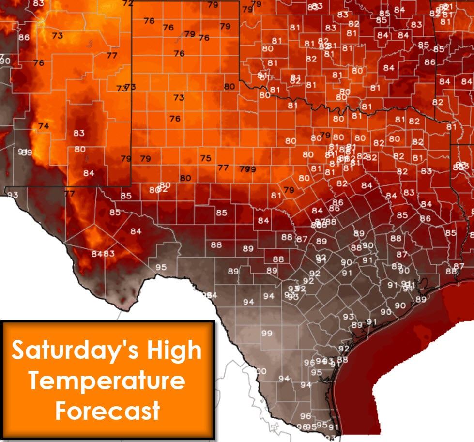
The High-Resolution Rapid Refresh (HRRR) models show a substantial uptick in activity tonight as the cool front pushes south. That will result in scattered to numerous showers and storms from the Permian Basin east into North and Northeast Texas. The first storms may fire up fairly close to Interstate 20/30 in North Texas before we see many more storms fire up overnight. Eventually, we may just be dealing with a fairly large mass of rain/storms. With plenty of moisture in place, I do expect bouts of heavy rainfall. Most locations should pick up one to two inches of rain, which would not cause flooding issues. Localized higher rain totals are expected which may cause some minor flooding. Widespread flooding is not expected at this time. The highest chance for localized flooding will be in Northeast Texas tonight. Scattered showers and storms will continue on Saturday from the Hill Country and Central Texas into East Texas near what will be a stationary cool front. Conditions north of the front look to be pleasant for June temperature-wise with highs in the 70s and 80s. Muggy and hot conditions will continue south of the front with 90s/100s.


0 Comments