
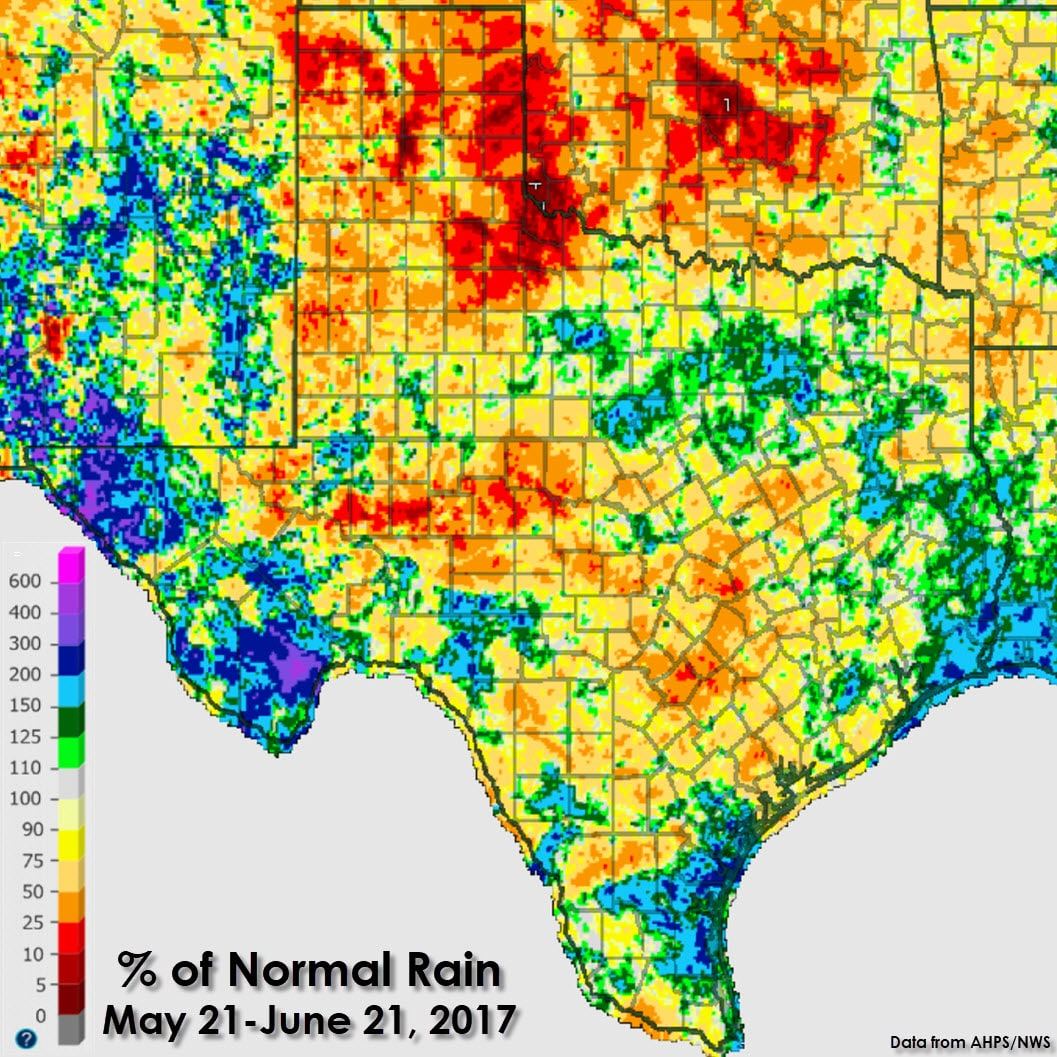
The last 30 days have featured below-average precipitation across the Texas Panhandle, West Texas, Northwest Texas, the Concho Valley, Hill Country, into South-Central Texas. A few spots did receive above-average rain amounts over the last month, including around the Borderland, Alpine, parts of D/FW, the Middle Coastal Bend, and far Southeast Texas. Those areas that did receive heavy rains over the last month mostly did so due to slow-moving summer thunderstorms. Their impacts were limited due to their slow movement, with locations only a few miles away hardly receiving a drop. A few thunderstorm complexes did progress eastward in the early part of June, but those did not alleviate dry weather concerns. The eastern Texas Panhandle, far Northwest Texas, and Southwestern Oklahoma only received 2 to 15 percent of their normal rainfall. Keep in mind this graphic takes into account rains over the last 30 days, a good indicator on how surface fuels may be reacting.
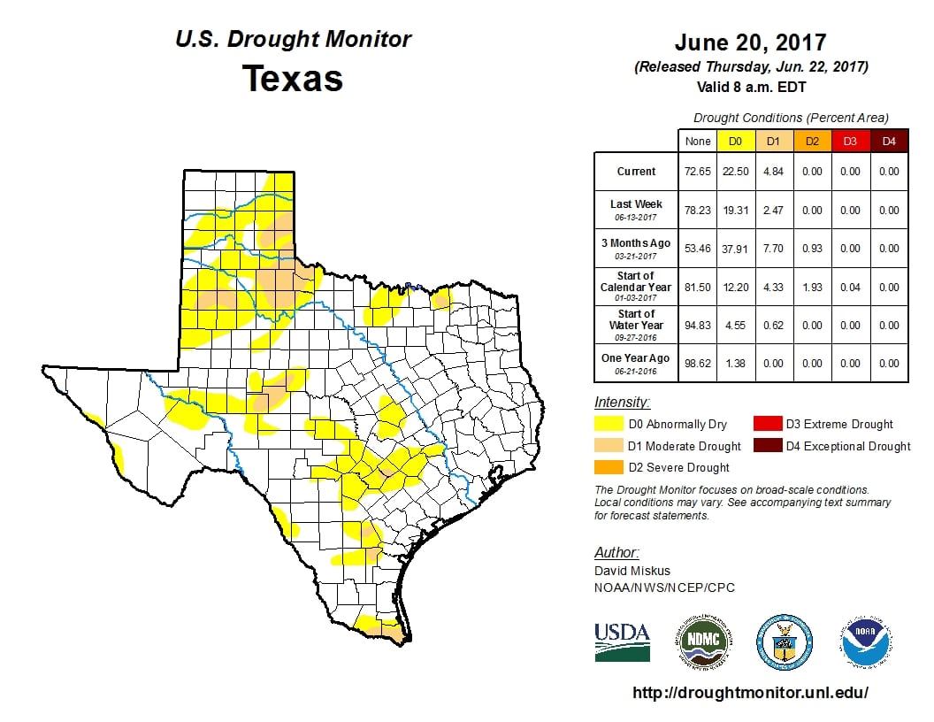
Per the US Drought Monitor, we’ve seen moderate drought conditions have expanded over the last week in the southeastern Texas Panhandle, far Northwest Texas, into portions of West Texas. Abnormally dry conditions now encompass just under a quarter of Texas’s real estate. Most lakes remain in fairly good shape. The concern for the next few weeks, assuming the drought isn’t eliminated by future rainfall, will be the increased risk of wildfires. Summer does not usually feature a big wildfire season in Texas, but if we don’t see rain soon, the spring green-up will start to go dormant. Dormant fuels burn much more easily and the summer heat certainly doesn’t do anything to lessen that risk. We’ve seen an uptick in grass fires over these drier areas over the last ten days. Winds are typically weak during the summer months, so that will help keep the risk of significant wildfire events low. However, there are always exceptions. A landfalling tropical storm in September 2011 brought high winds to the eastern half of Texas during a multi-year drought. What evolved ended up being the most devastating wildfire event in state history – the Bastrop Wildfire Complex – among many others during those few days.
Luckily for us, this isn’t the 2011 drought and so far has had limited impacts. There will be the chance of scattered showers and storms as soon as Saturday and continue into next week in areas that need rain the most. They’ll be hit and miss, but at least there will be some rain chances over the coming days. Expected rain totals won’t eliminate the moderate drought conditions, but may at least bring the overall drought numbers back down for a while. We need any rain we can get before the dog days of summer set in.


0 Comments