
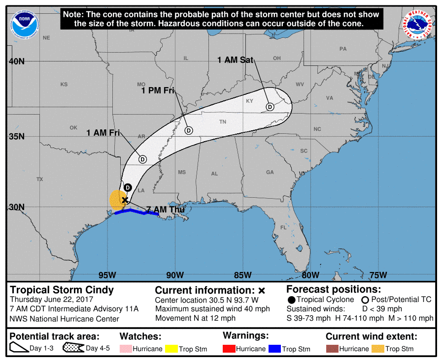
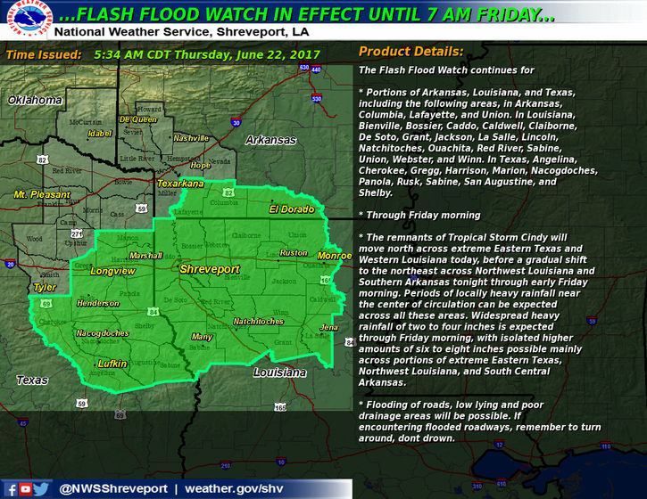
Tropical Storm Cindy made landfall between 2-3am this morning in southwestern Louisiana between between Port Arthur, TX and Cameron, LA. Tropical Storm Warnings have been cancelled for the Houston/Galveston area, but will remain in effect for Beaumont, Port Arthur, Nederland and Sabine Pass until later this evening. TS Cindy will continue to move north along the TX/LA border decreasing in strength throughout the day. The heaviest rainfall at the moment is occurring between Shreveport, LA and Lufkin, TX. Flash Flood Watches will remain in effect until 7am Friday for most of far eastern Texas including the towns of Marshall, Longview, Henderson, Nacogdoches and Lufkin with rainfall between 2-4 inches likely…with some locations seeing locally higher amounts. Periods of on and off heavy rainfall and gusty winds are expected to continue across eastern Texas today and into this evening as Cindy’s rain bands rotate through the region. By early morning on Friday, most of the effects of Cindy will have moved out of the region and the threat for additional rainfall will come to an end.
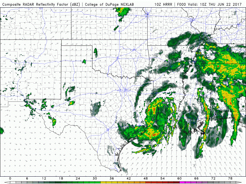
Here’s a look at how the radar may shape up for the remainder of the day. This takes us through about 11pm this evening.


0 Comments