
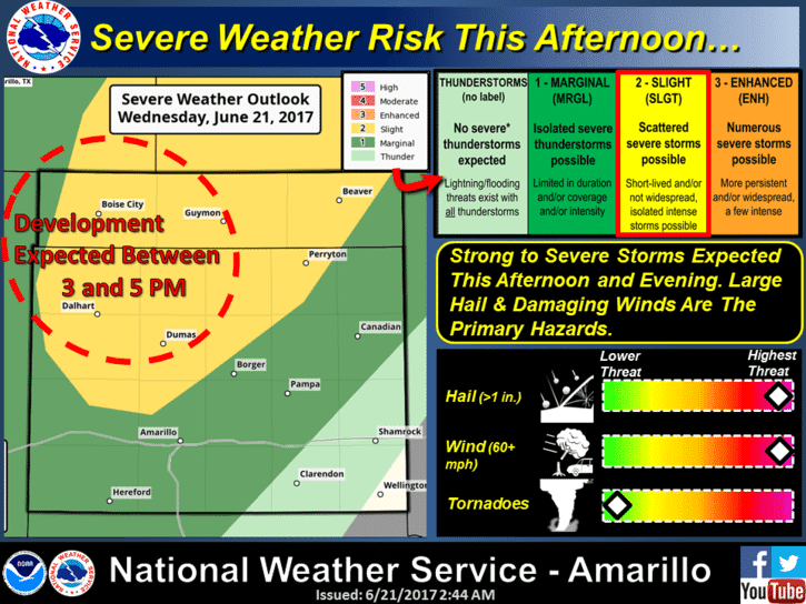
The latest update from the Storm Prediction Center includes a Slight Risk (Level 2) for severe weather across the northern panhandle this afternoon and evening. The main threats will be damaging winds and large hail. Storms are expected to form after 3pm this afternoon across the northwestern panhandle and track southeast across the area through the evening hours. Initially, these storms will form into slow moving clusters which will bring an isolated heavy rainfall threat if you happen to be under one of them. As the evening progresses, the clusters of storms are expected to congeal into somewhat of a squall line which will then move southeast across the region. Hail up to 2 inches is possible along with blowing dust out ahead of the storms and frequent cloud to ground lightning. Some areas could see some localized flooding or ponding on roadways and in fields, but widespread flooding issues are not expected at this time.
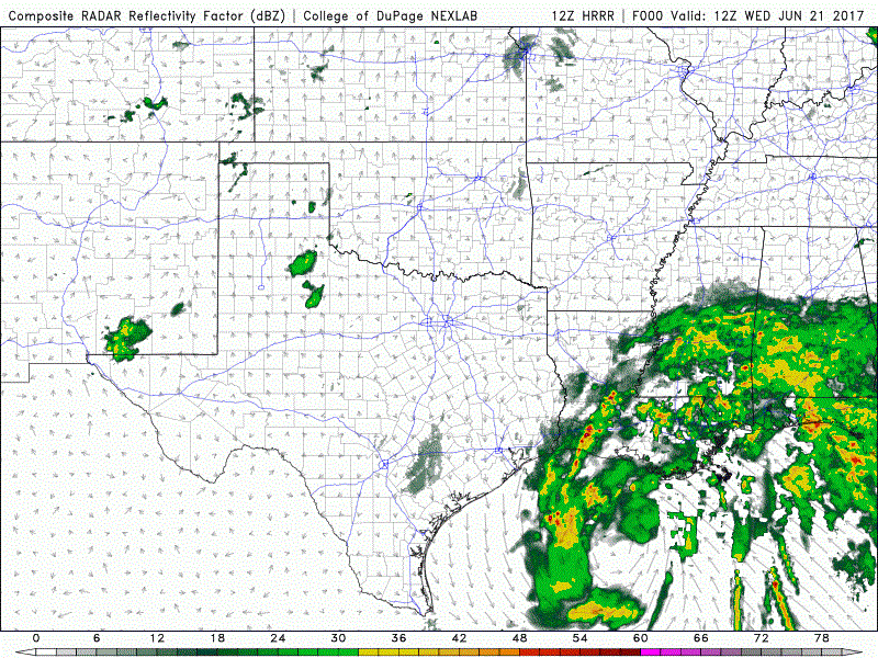
Here’s a look at the latest run of the high-resolution HRRR forecast model which takes us through about 1am tomorrow morning. This also provides a good look at how things may shape up across southeast Texas this afternoon and evening as TS Cindy gets closer to making landfall.


0 Comments