
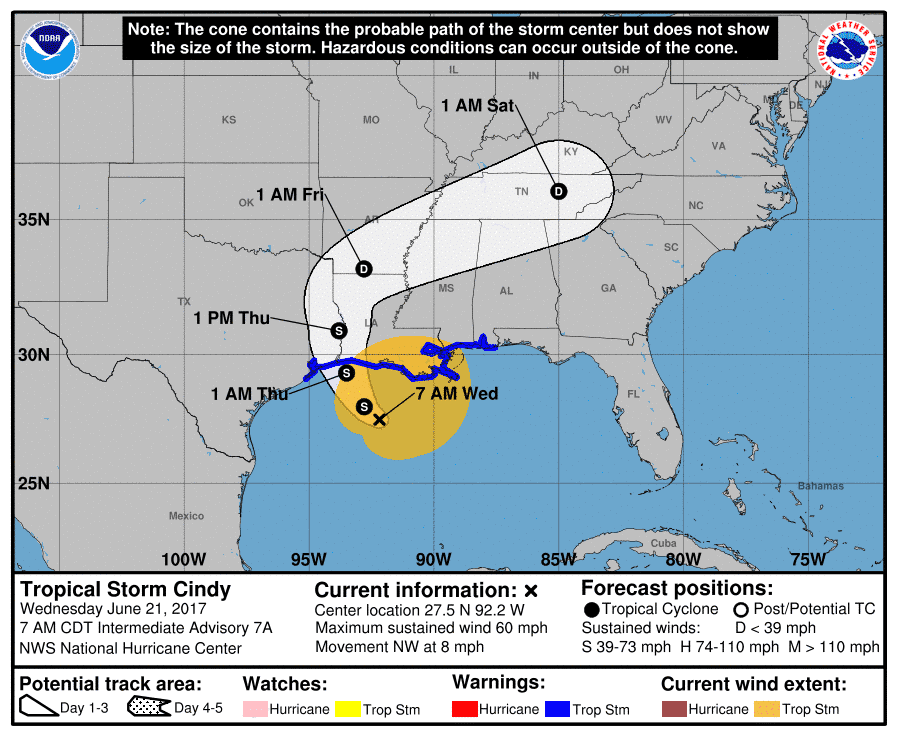
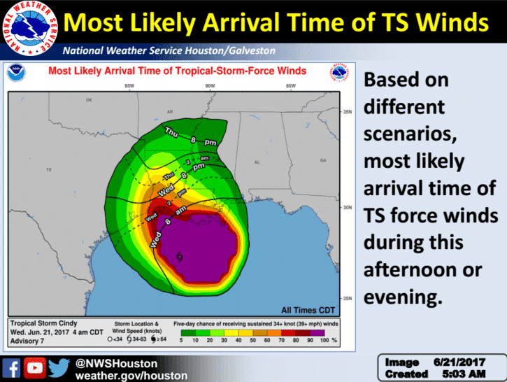
Not much change during the overnight with TS Cindy. Max sustained winds are still around 60mph and she continued a slow movement off to the northwest at 7mph. Time of landfall early Thursday morning looks to be in the 1am to 6am timeframe. Tropical Storm Warnings remain in effect from the San Luis Pass all the way east to the Alabama-Florida border. For Texas, this includes the counties of Harris, Galveston, Liberty, Chambers, Hardin, Jefferson, Orange, Jasper and Newton.

Wind speed at landfall: As Cindy makes landfall early Thursday, the Houston area can expect sustained winds of 20-25mph with gusts up to 35mph. For the Galveston area, expect sustained winds of 25-35mph with gusts as high as 50mph. For the Beaumont area, expect sustained winds of 30 to 40mph with gusts up to 55mph. For the Port Arthur area, expect sustained winds of 35-45mph with gusts up to 60mph.
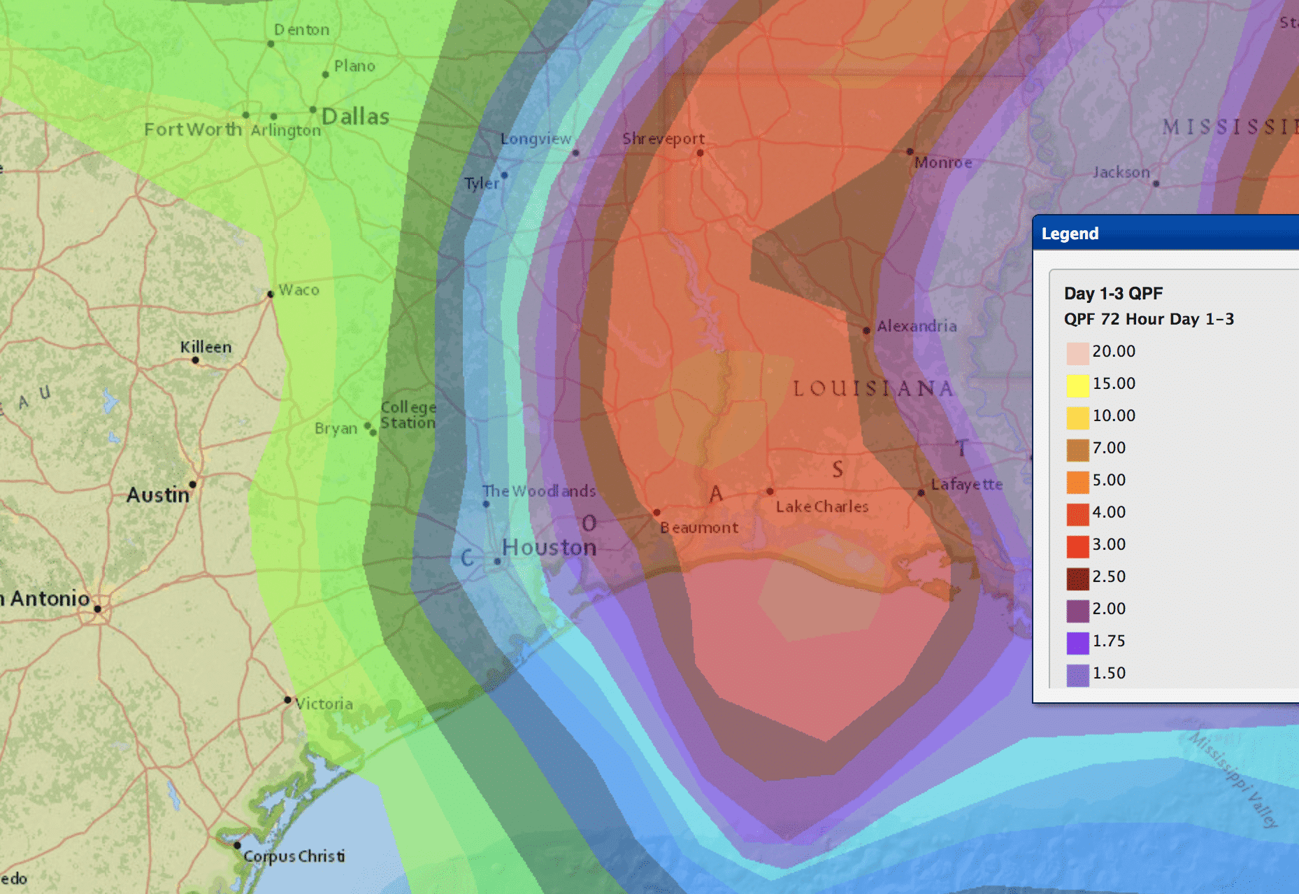
Rainfall Impacts: Periods of very heavy rainfall are expected across southeast Texas today and tonight; however, the distance between locations that see a whole lot of rain and those who barely see any will be small. Locations in and around Beaumont/Port Arthur will likely see the highest rainfall totals…possibly exceeding 6 to 8 inches in some locations depending on where the heaviest bands of rain occur. Further west towards Houston and Galveston, lesser amounts between 2-4 inches. Keep in mind though that any westward shift in the track of TS Cindy would mean a greater risk of heavy rainfall and flooding for the Houston/Galveston area, so residents all along the southeast coast will need to be prepared for the worst…especially if you live in a historically flood-prone area.


0 Comments