
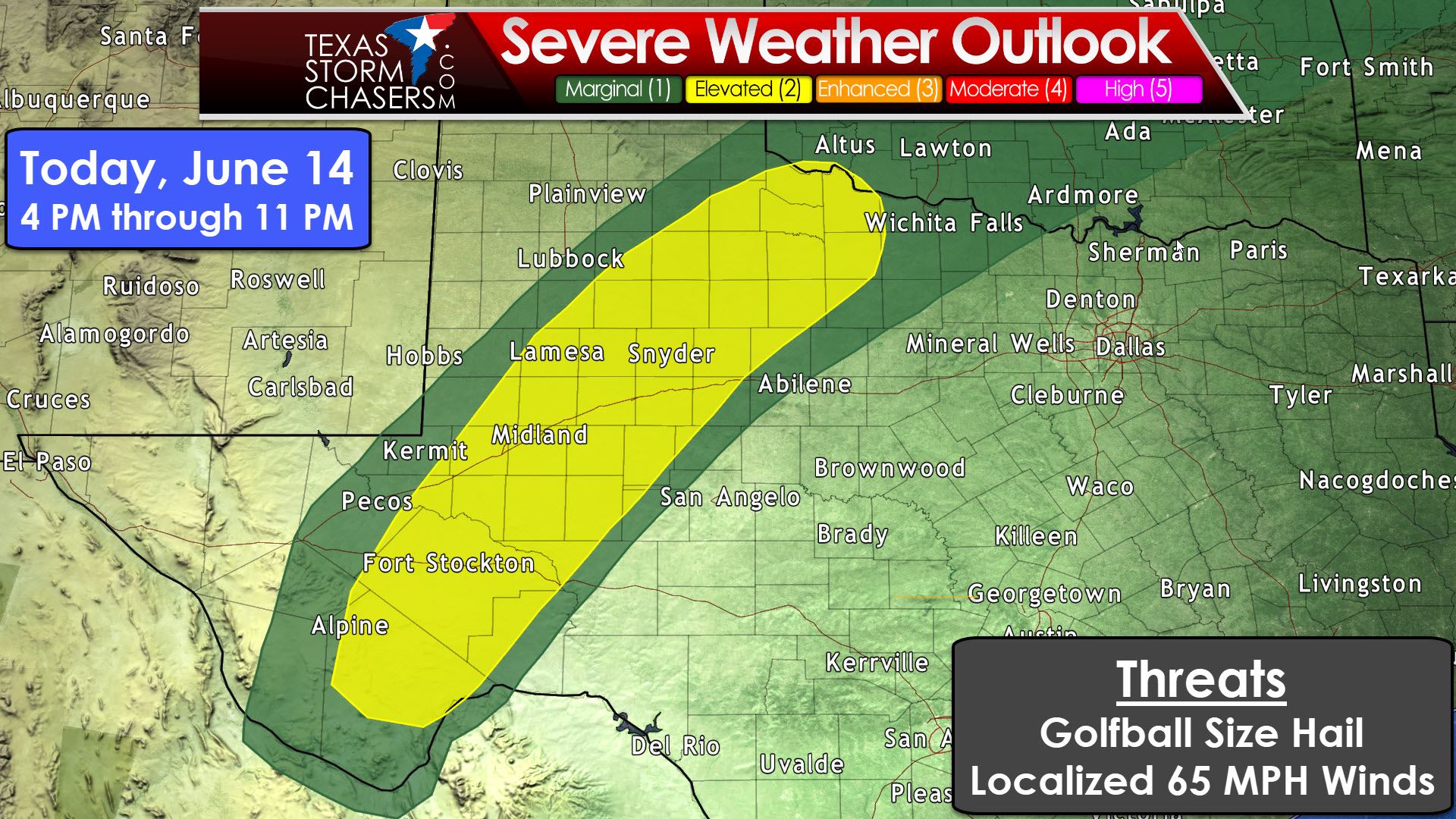
The dryline will once again become active this afternoon as temperatures warm into the upper 90s to near 100 degrees. Thunderstorm coverage and overall intensity should be lower compared to yesterday, but we’ll still see isolated to widely scattered afternoon storms. The Storm Prediction Center has placed their “standard” level 2 risk of severe weather from near Alpine and Fort Stockton northeast through the Permian Basin into WestCentral and Northwest Texas. Alpine, Fort Stockton, Crane, Odessa, Midland, Big Spring, Sweetwater, Colorado City, Lamesa, Post, Aspermont, Paducah, Quanah, Vernon, and Seymour are a few towns included. There is a “marginal” level 1 risk in the immediate vicinity of the level 2 zone, but we shouldn’t see storms move too far east of the dryline this afternoon or early evening. The strongest of these storms may produce hail up to the size of golfballs and localized damaging wind gusts up to 65 MPH. We won’t see many storms today, but those that form will likely be severe. I can’t rule out a very localized threat of larger hail, but that will be dependent on a more intense supercell developing. Whatever storms do develop aren’t going to be moving east very quickly, but should be fairly photogenic.

Simulated Radar from 14Z HRRR
The first storms should develop by 4-5 PM just east of the dryline as the cap weakens. Any storm that does develop could become strong rapidly in a hot and unstable environment. Splitting supercells are expected which means we’ll see some move northeast and some southeast. The most intense activity should be near to 75 miles east of the dryline. As storms get further east by 8-9 PM they’ll run into a strengthening cap. That cap will cause storms to weaken fairly quickly. We should a majority of the activity rapidly weakening or already gone by 11 PM. We’ll see a quiet night. More storms will fire up in West Texas on Thursday afternoon once again.


0 Comments