
A stalled frontal boundary across south central Texas, combined with a continuous feed of upper level energy across the region, will continue to support the chance for strong to severe thunderstorm development today and into the overnight hours from southwest Texas into the coastal bend region. Best chances for strong to severe storms today will be across the western portions of south and south central Texas, especially as we get into the afternoon hours. The Storm Prediction Center has outlined areas from the Texas Big Bend Region down along the Rio Grande Valley and western south Texas with a Slight Risk (Level 2) of severe weather today and this evening. Hail and damaging winds are expected to be the main threats. The tornado threat is low, but can’t be completely ruled out. Heavy rainfall and scattered issues with flooding will also be a concern wherever the most prolific bands of rainfall set up. Currently, that looks to be closer to the Rio Grande near Laredo, but again, that will depend on where the heaviest cells set up later this afternoon and overnight.
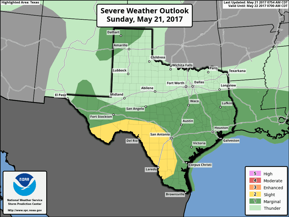
Further north behind the frontal boundary, a continuous feed of moisture above the cooler post frontal air will continue to support scattered showers this morning and into the afternoon hours. Most of these showers will stay sub-severe and brief, but a few, mainly south of the I-20 corridor, may briefly reach severe limits with gusty winds and hail up to 1 inch. As we get into the afternoon hours, we should see these showers and storms shift further south across central Texas leaving most of north Texas with a lull in precipitation chances. Overnight, we may see another uptick in rain which may include parts of the DFW metroplex, but the overall threat for any severe weather is very low for both north and central Texas. For the Texas panhandle region, a Marginal Risk (Level 1) is in place across the northwestern portions of the panhandle for storm development later this evening and into the early overnight hours. Storms are expected to develop this afternoon across the high terrain of southeastern Colorado and northeastern New Mexico and drift southeast into Texas. Hail and high winds will be the main threat, and should decrease in intensity after sunset.


0 Comments