
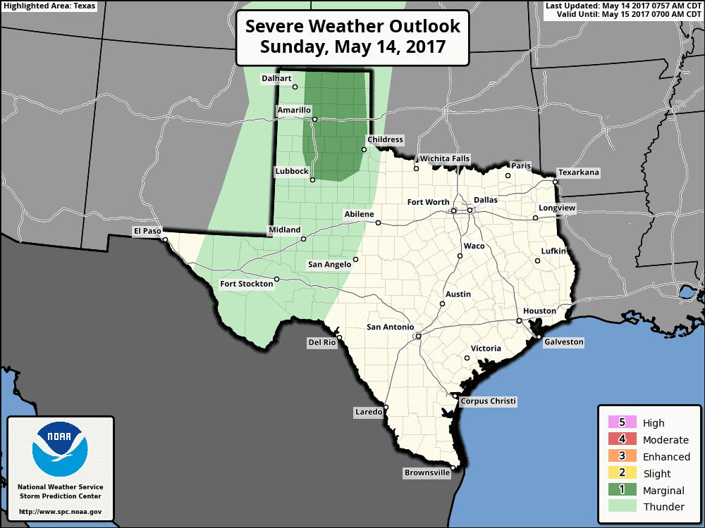
Happy Sunday and Happy Mothers Day to all the Moms! Another quiet day is expected across a majority of the state today with exception of the panhandle region which may see isolated to scattered storms develop later this afternoon. More on that risk further down in the blog. Highs today out west will soar into the 90s, while highs further east under slightly more humid conditions will reach the mid 80s. Sunshine will be abundant once again, but we’ll see a few more clouds today than yesterday with a little more moisture in place. Today marks the first in a string of days this week where the dryline out west becomes active. The Storm Prediction Center has placed a Marginal risk of severe storms across much of the central panhandle region for later this afternoon with storms expected to develop near the TX/NM border by around 5pm this afternoon and build slowly eastward through the evening hours. The threats today will be mostly downburst winds, large hail and lightning as cloud bases will be very high. This will also reduce any threat for tornados. Storms this afternoon should die out fairly quickly after sunset due to loss of daytime heating.
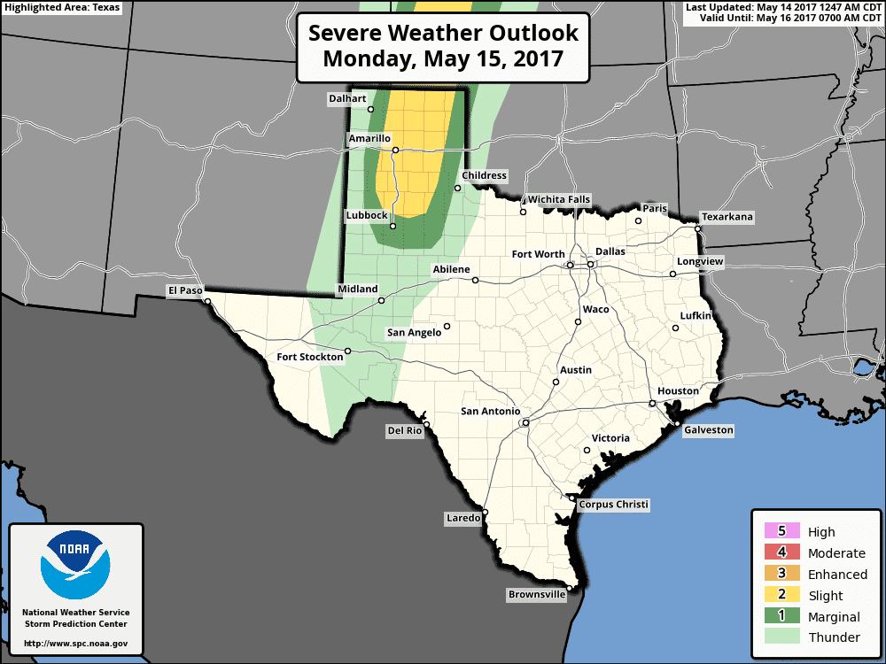
For Monday, we’ll have a Slight Risk of severe storms by the evening hours with the main threats once again being downburst winds, large hail and frequent lighting. Storms on Monday evening are expected to be a bit more organized than we’ll see today, but we’ll still have relatively high cloud bases in place which should limit any threat for tornadoes. Once again, storms should die out fairly quickly after sunset as we lose daytime heating.
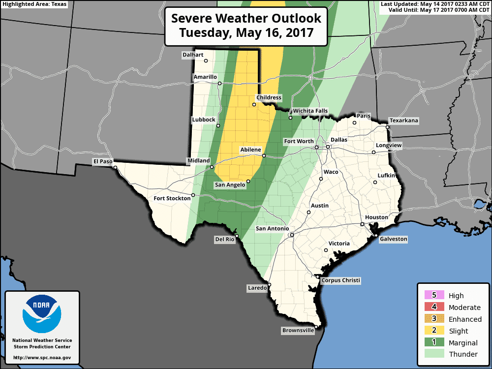
Tuesday, the threat for storms will shift a bit further east with a Slight Risk extending from the eastern panhandle down into the south plains, western Big Country and eastern Permian Basin regions. There is some uncertainty in where the dryline will set up on Tuesday, so we expect to see a few changes to this outlook for the coming days. Strong capping will keep storms at bay most of the day, but as afternoon heating peaks, we could see isolated to scattered development by late afternoon and early evening. At this time, large hail and damaging wind gusts appear to be the main threats, with the tornado threat staying relatively low. However, if we see more abundant moisture flow into the region immediately ahead of the dryline on Tuesday, we may see the threat for tornados increase.
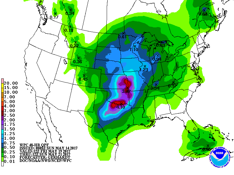
For the long range forecast this week…rain chances, including heavy rain, appears to be on the horizon for late this week and into the weekend for portions of north Texas. The Weather Prediction Center has totals upwards of 3-4 inches likely…but as always, these are just “trends” so don’t get too focused on exact amounts or locations for heavy rainfall just yet. We’ll have more on this chance as we get further into the week ahead.


0 Comments