
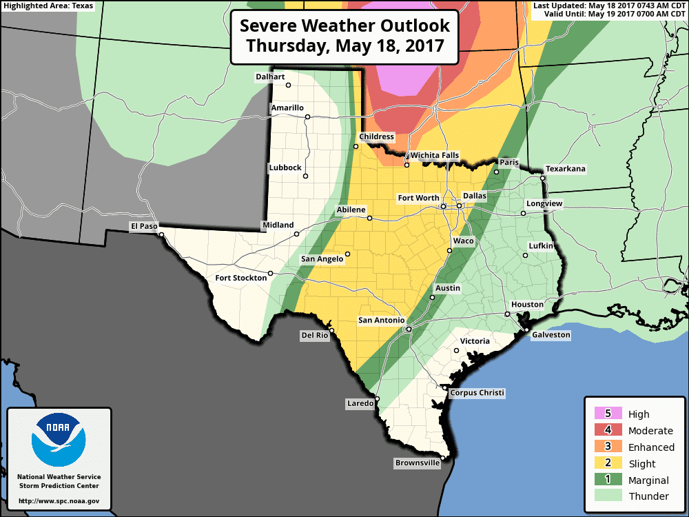
A busy upcoming weather period is expected with a dual threat of severe weather and heavy rain. We have a “standard” level 2 risk of severe weather this afternoon and evening across a large area of real estate. This level 2 risk includes the far eastern Texas Panhandle, Northwest Texas, North Texas, Big Country, Concho Valley, Southwest Texas, Hill Country, and western sections of Central Texas. We do note that probabilities ramp up quite quickly on the Oklahoma side of the state line with a level 5 ‘high’ risk of severe weather. A major outbreak of tornadoes is expected in that region this afternoon. The severe weather window in Texas will open up rather early today, perhaps by 1-2 PM in the Big Country and western North Texas. We should start to see things calming down by the mid-evening hours, say by around 10 PM. The strongest storms in Texas may produce hail up to the size of baseballs, localized damaging wind gusts over 70 MPH, and a couple of tornadoes. The highest threat for tornadoes looks to be in Oklahoma and Kansas today where low-level wind shear will be stronger.
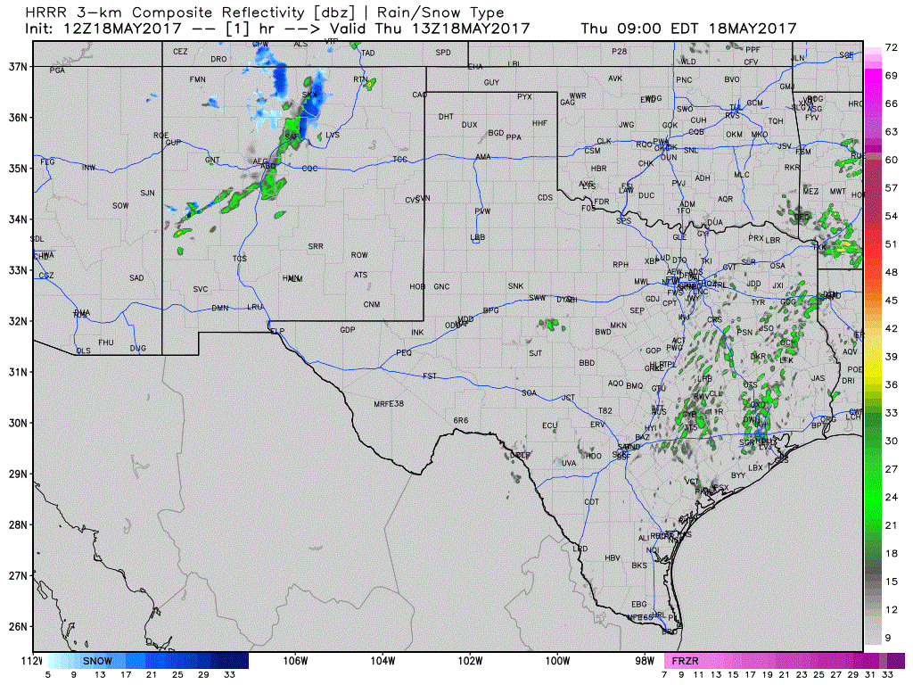
Simulated Model Radar through Tonight
High resolution weather models are indicating the first thunderstorm development may occur by 1-3 PM in the Big Country to western North Texas – just east of a dryline. You can thank a weak cap and rather strong upper level lift for the earlier than usual initiation time for storms. These storms will likely become severe rather quickly in an enviornment supportive of supercells. The strongest of these storms may produce all modes of severe weather, but very large hail will be the primary threat. Storms should move off to the east at 20-25 MPH. They could approach Interstate 35 between about 5 PM and 10 PM. Some may be severe. We’re going to have to see how mesoscale (small-scale) features play out today as those will dictate localized zones of higher severe weather potential.

The risk of severe weather returns on Friday is almost the same locations as today. We do note a level 3 “enhanced” risk across portions of Northwest Texas extending into Central Oklahoma. I expect there to be changes in future updates with this outlook, so be sure to check back. Friday has the potential of being another busy severe weather day across the southern United States. The strongest storms may produce very large hail, localized damaging wind gusts, and isolated tornadoes. A squall line is going to likely fire up tomorrow evening that could impact portions of North Texas and the Big Country as a cold front moves south. Today’s setup will play a big role in how tomorrow sets up, so we’ll be able to get much more specific later today and on Friday morning. Rain chances will continue into Saturday and Sunday across the southeastern half of Texas. You can get Your Local Forecast information here.


0 Comments