
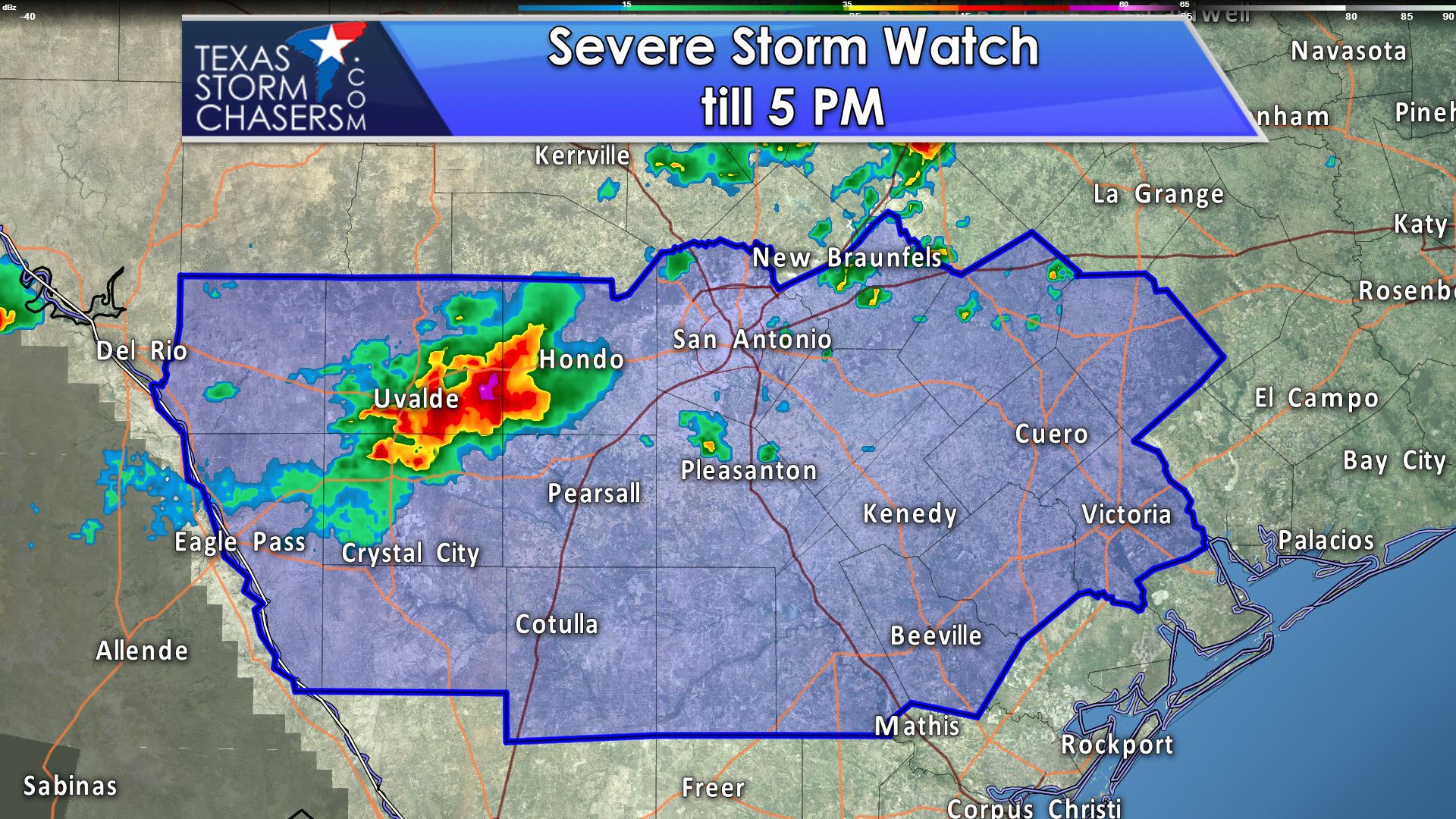
The National Weather Service and Storm Prediction Center have issued a severe thunderstorm watch for South-Central Texas until 5 PM today. Eagle Pass, Crystal City, Cotulla, Beeville, Victoria, Kenedy, Pearsall, Hondo, Uvalde, San Antonio, and Cuero are a a few towns included. The strongest storms through the afternoon hours may produce large hail up to the size of tennis-balls, localized wind gusts up to 70 MPH, and heavy rainfall. An isolated tornado is not out of the question. Storms located between Uvalde and Hondo should generally move to the east/southeast and possibly become a small cluster of severe storms as they move into a relatively unstable airmass.
Severe Thunderstorm Watch Number 253
   NWS Storm Prediction Center Norman OK
   1010 AM CDT Sat May 20 2017

   The NWS Storm Prediction Center has issued a

   * Severe Thunderstorm Watch for portions of
     South Central Texas

   * Effective this Saturday morning and afternoon from 1010 AM
     until 500 PM CDT.

   * Primary threats include...
     Scattered large hail and isolated very large hail events to 2.5
       inches in diameter possible
     Scattered damaging wind gusts to 70 mph possible
     A tornado or two possible

   SUMMARY...Strong/severe storms currently west of San Antonio are
   expected to develop eastward and southeastward along an outflow
   boundary into a very warm and moist air mass.  The stronger storms
   will be capable of producing large hail and damaging wind gusts.

   The severe thunderstorm watch area is approximately along and 60
   statute miles either side of a line from 90 miles west northwest of
   Cotulla TX to 20 miles east northeast of Victoria TX. For a complete
   depiction of the watch see the associated watch outline update
   (WOUS64 KWNS WOU3).


0 Comments