
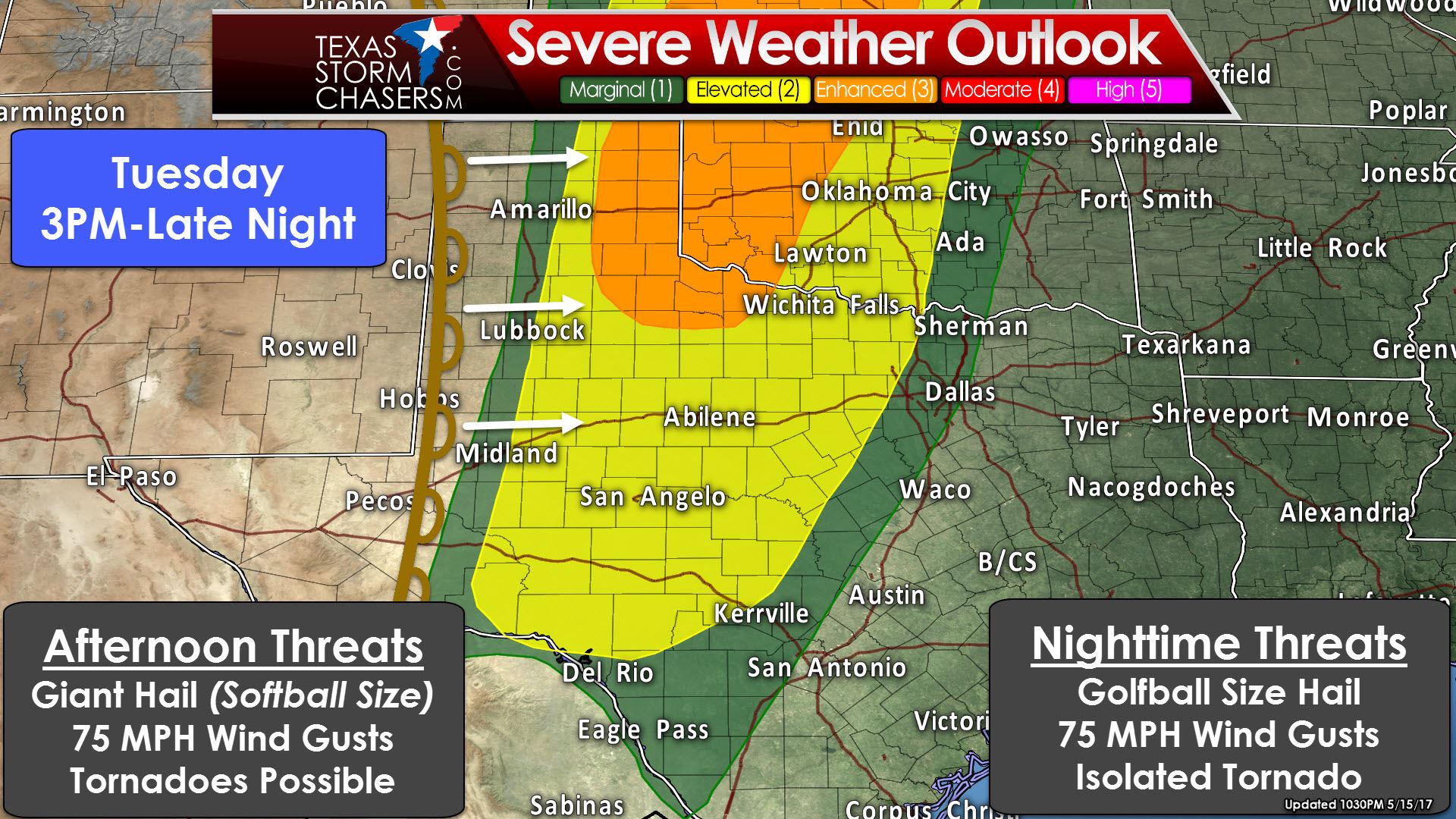
The risk of severe thunderstorms will increase Tuesday afternoon in the eastern Texas Panhandle and Northwest Texas where a ‘enhanced’ level 3 risk is in place. All modes of severe weather will be possible with discrete supercells in this region through the early evening hours. Giant hail up to the size of softballs, damaging wind gusts up to 75 MPH, and tornadoes are all possible. The tornado threat could be locally enhanced if an intense supercell interacts with an outflow boundary – most likely in the eastern Texas Panhandle into western Oklahoma. The timeframe at this point looks to be 3 PM to about 10 PM, but will be adjusted as needed tomorrow. Not all storms will be intense, but those that are could be significant and a direct threat to life and property. They’ll generally move northeast around 45 MPH.
The ‘standard’ level 2 risk of severe weather includes much of West Texas, the Big Country, Concho Valley, Northwest Texas, into western North Texas and western Central Texas. A line of thunderstorms is expected to develop by the mid-evening hours Tuesday. This line of storms may be severe with a threat of large hail up to the size of golfballs and localized wind gusts up to 70-75 MPH. An isolated tornado cannot be ruled out, but the threat will be much lower than with the discrete storms earlier in the day. The squall line will move east into the aforementioned regions late Tuesday into the predawn hours Wednesday. Storms should be weakening as they approach Interstate 35 by 5 AM Wednesday in North Texas.
For more details on the overall forecast please see our detailed blog post from earlier today. We’ll have our next blog out around 9:30 AM Tuesday. Keep in mind we are in the midst of our peak severe weather period in Texas. These kind of threats are not unusual nor should they frighten anyone. Just keep an eye to the sky and stay tuned to your preferred local weather sources. The National Weather Service is a great one to follow! Wednesday should be a in-between and quiet day before a severe weather threat returns Thursday.


0 Comments