
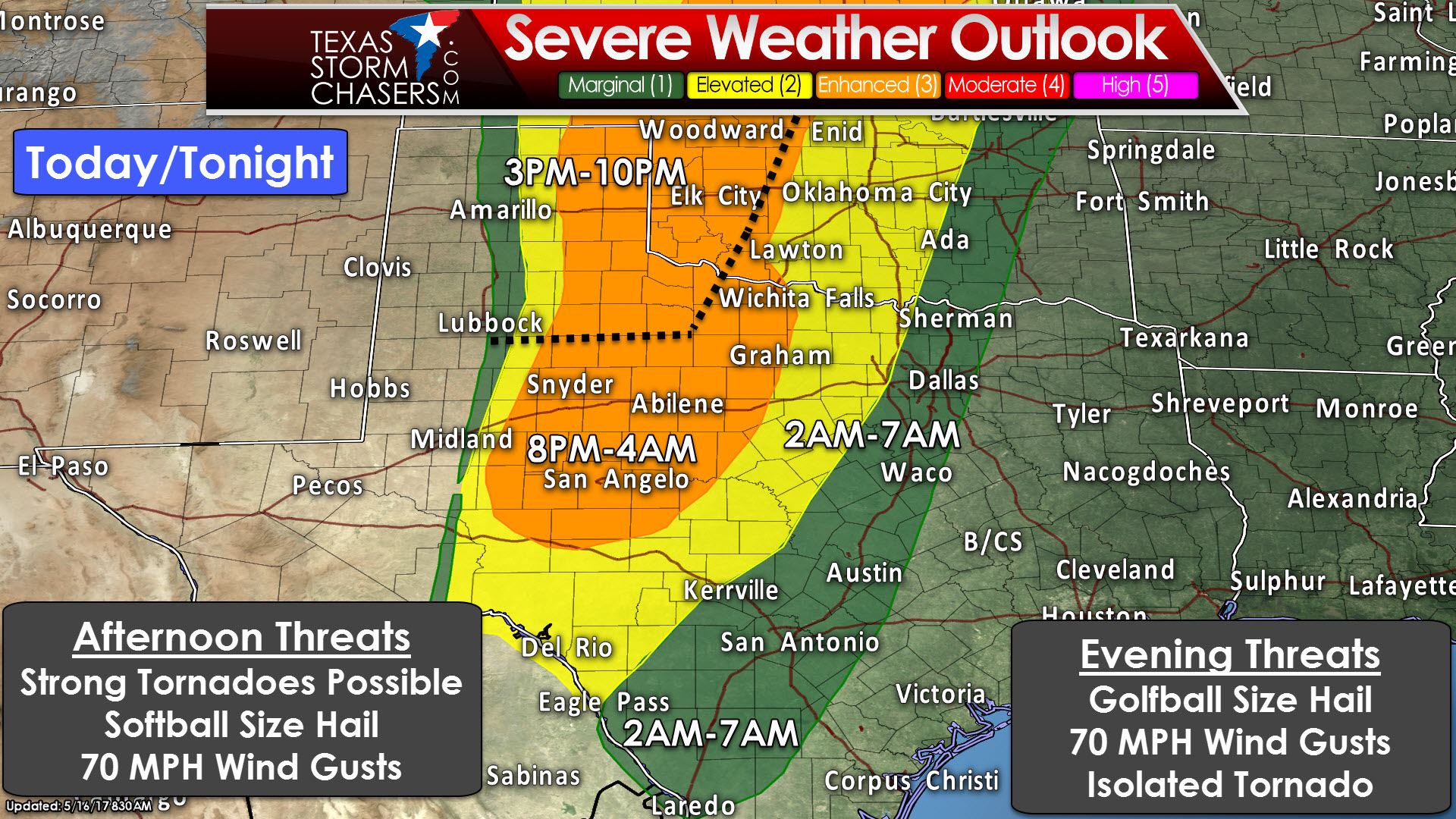
A busy severe weather day is in store across western sections of the state. The Storm Prediction Center has placed an ‘enhanced’ level 3 risk of severe weather for the eastern Texas Panhandle, West-Central Texas, the Big Country, Concho Valley, Northwest Texas, and western sections of North Texas. There will be two distinct time-windows for severe weather, so please check below for more information. A ‘standard’ level 2 risk of severe weather includes Southwest Texas, the Hill Country, Texoma, and North Texas generally west of Interstate 35W. A “marginal” level 1 risk of severe weather includes North Texas, Central Texas, and South-Central Texas. The severe weather threat for the Texas Panhandle and portions of Northwest Texas will begin around 3 PM and continue into the early evening hours. Tonight’s severe weather threat will be in the form of a squall line in the Big Country, Concho Valley, into Northwest Texas. That squall line will move east into the predawn hours Wednesday.
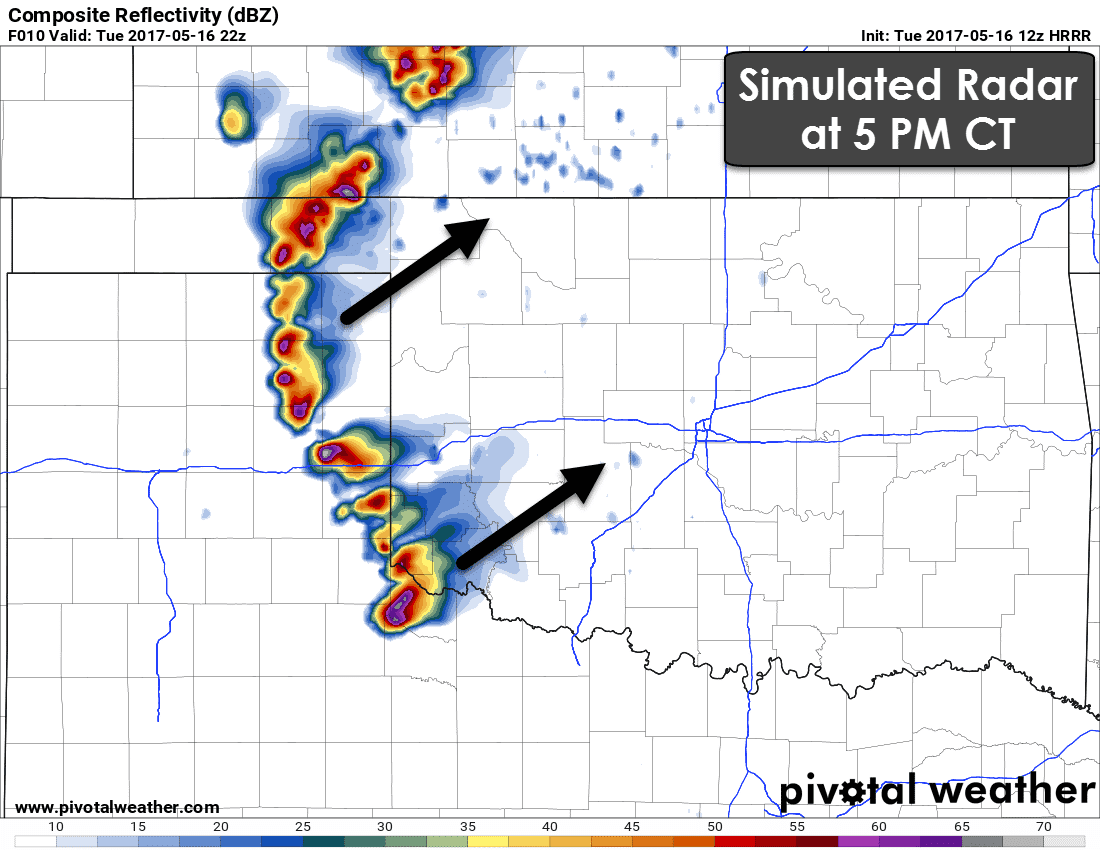
A potentially significant severe weather event may unfold in the eastern Texas Panhandle this afternoon. Ingredients appear to be coming together to support all modes of severe weather. Giant hail up to the size of softballs, damaging wind gusts over 70 MPH, and tornadoes will be possible. If an intense supercell is able to sustain itself a strong/long-lived tornado threat cannot be ruled out. The highest threat of a tornado will be in the eastern Texas Panhandle, far Northwest Texas, extending into western Oklahoma. Supercells that develop this afternoon will tend to move northeast around 35 to 45 MPH. There may not be many storms this afternoon, but those that form will likely be severe.
A brief lull may occur early this evening before we get rockin by the mid-evening hours. As upper level ascent increases along the dryline we expect a squall line to quickly develop in the eastern Texas Panhandle, Northwest Texas, Big Country, and the Concho Valley. Portions of this squall line could be severe with damaging straight-line winds over 70 MPH and hail up to the size of golfballs. An isolated tornado or two cannot be ruled out, but the threat for tornadoes will be much lower than this afternoon’s activity. The squall line will move east into the pre-dawn hours Wednesday toward Interstate 35. The threat of severe weather will decrease as the squall line moves east into North and Central Texas. The severe weather outlook posted above shows the eastern delineations of the risk fairly well.


0 Comments