
A very complex forecast is in store for today. At the time of this blog writing we have an area of showers and thunderstorms slowly progressing northeast across western North Texas. Renewed convective development – some severe – is underway along Interstate 20 in the Big Country. The eastern edge of this thunderstorm cluster is slowly progressing east, right behind an outflow boundary. This will be critical in dictating the potential for severe weather this afternoon. Locations behind this boundary are generally more stable with southwest winds. However, as the new storms in the Big Country show, some destabilization is occuring right behind this rain cluster. Today’s severe weather setup is overall pretty messy – which means considerable forecast adjustments are likely throughout the day. This is not a clear cut severe weather day as that rain cluster will likely cause localized reductions in the risk areas, while we could see a localized enhancement where-ever any outflow boundaries set up this afternoon. With that said – here is the latest severe weather outlook from the Storm Prediction Center.

We have an “enhanced” level 3 risk across portions of the Big Country extending eastward into North Texas. This does include Abilene, D/FW, Wichita Falls, east to Paris. The “standard” level 2 risk includes Northwest Texas, the Concho Valley, Hill Country, and the remainder of North Texas. The strongest storms may produce large hail up to the size of two inches, localized damaging wind gusts up to 70 MPH, and a few tornadoes. The risk for tornadoes is not as high as we saw yesterday, but we’ll have to watch for any storm interactions with boundaries. Again, this outlook is probably going to be changed so please don’t pay that much attention to the exact lines/risk zones. The timeframe for this is pretty much for the rest of the day as evidenced by the ongoing severe storms in the Big Country.
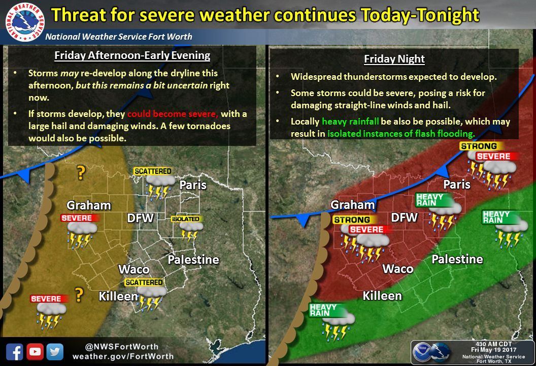
The dryline is expected to remain out toward Northwest Texas, the Big Country, and Concho Valley this afternoon. If we’re able to get destabilization behind this morning’s storms we may see additional severe storms pop up this afternoon. Likewise and not explicitly shown on this graphic, we’ll have to watch for any outflow boundaries in North Texas this afternoon that may be focal points for new storm development. Regardless of what we see this afternoon the threat for widespread rain/storms ramps up tonight as a cold front arrives from the north. Some of the storms may contain hail up to the size of golfballs and localized wind gusts toward 70 MPH. Heavy rain and localized flooding is also possible.
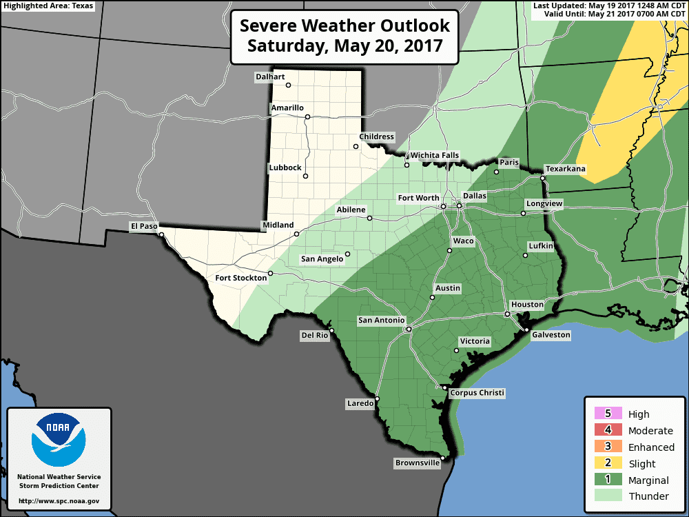
We have a “marginal” level 1 risk for severe weather across the southern half of Texas on Saturday. The cool front will continue to move south with chances of showers and thunderstorms. The chance for severe weather doesn’t look impressive on Saturday with better chances for widespread rain. You can check out the rain chances for your local area with TSC’s Your Local Weather here.


0 Comments