
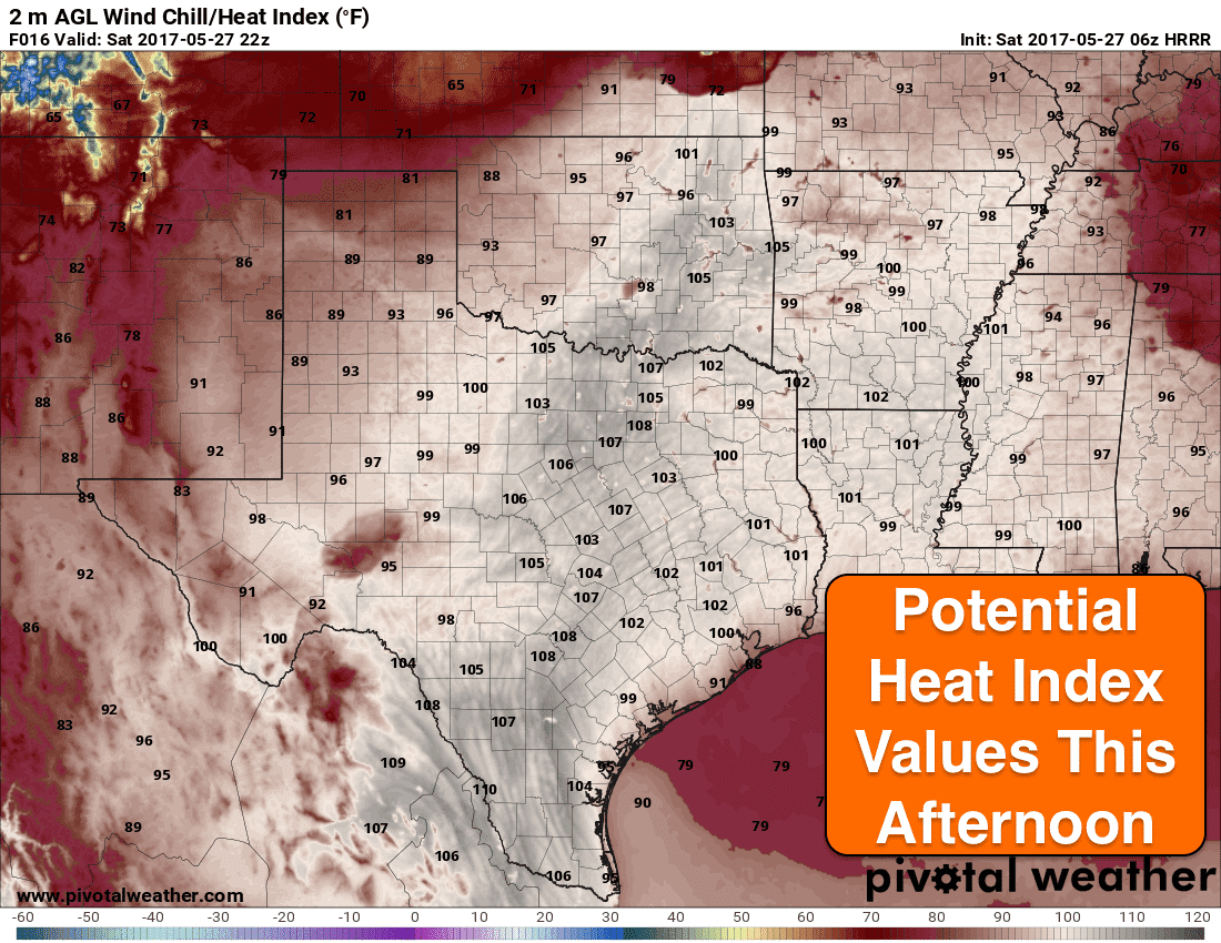
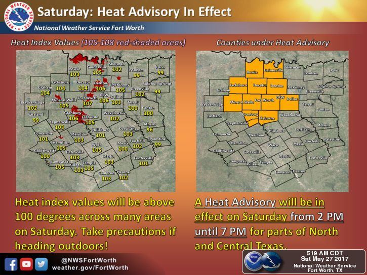
Oppressive heat is in the forecast today for areas east of the dryline. In a few areas across north central Texas, we’ll be bordering on dangerous heat index values as we head into the afternoon. Heat Advisories are already in place across numerous north central Texas counties for today: Cook, Dallas, Denton, Hood, Jack, Johnson, Montague, Palo Pinto, Parker, Somervell, Tarrant and Wise. Most will see heat index values around 100, but a few locations could see them reach between 105 and 108 this afternoon. Obviously, anyone with outdoor plans today will need to take extra precautions to avoid overexertion and stay hydrated. Also be sure to check on elderly neighbors and ensure pets and livestock also have adequate access to water and some shade.
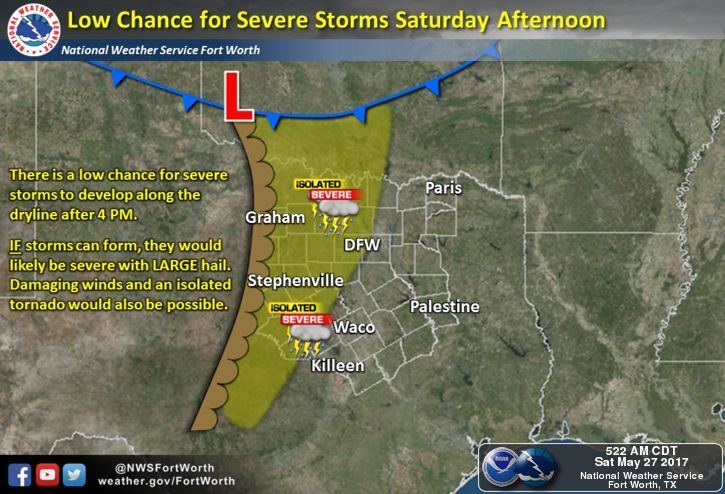
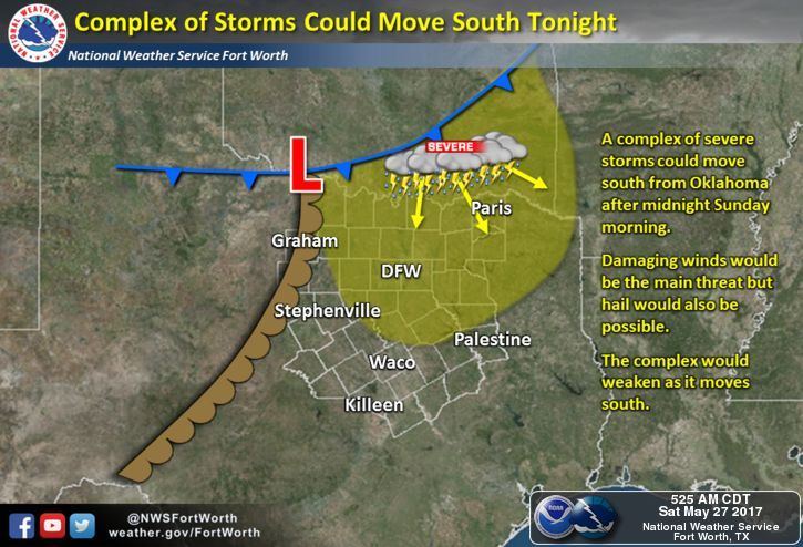
Storm chances this afternoon south of the Red River do not look very likely at this point. While we can’t rule them completely out, it does appear that lack of any forcing and a strong cap will keep storms from developing. However….we will have very strong instability in place, so that if one does develop, it will have the potential to become severe with very large hail and damaging winds as the main threats. There will also be a chance for a line of storms to develop late tonight, crossing the Red River into northeast Texas after midnight along a cold front. These storms will carry the threat of damaging winds and hail. In a nutshell, the likelihood of severe weather is low, so no need to cancel any outdoor plans you may have today. Just keep an eye on the sky this afternoon and if you do see something developing in your area, make sure you have a way to receive weather warnings and have place to seek shelter. We will continue to monitor things this afternoon and update you if anything begins to develop or if there’s any changes to the current forecast.


0 Comments