
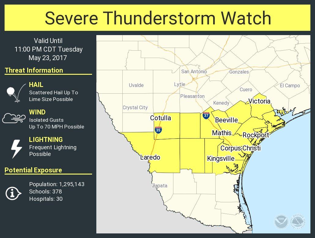
A severe thunderstorm watch has been issued for South Texas and the Middle Coast. This watch is in effect until 11 PM. Laredo, Cotulla, Beeville, Mathis, Kingsville, Corpus Christi, Rockport, and Victoria are a few cities included in this watch. The strongest storms over the next few hours may produce hail slightly larger than the size of a golfball, localized wind gusts up to 70 MPH, and locally heavy rainfall. We expect scattered strong to severe storms to move into northern sections of the watch area by 8 PM – and storms as a whole will progress south through the evening hours as a cold front pushes through. The threat for severe weather should be concluding by the late evening as storms either move out in the Gulf of move south into the Rio Grande Valley. You can keep tabs on the storms by using our free interactive weather radar here on our website. That link is on the top of this page.
Severe Thunderstorm Watch Number 260
NWS Storm Prediction Center Norman OK
640 PM CDT Tue May 23 2017
The NWS Storm Prediction Center has issued a
* Severe Thunderstorm Watch for portions of
South Texas
Coastal Waters
* Effective this Tuesday evening from 640 PM until 1100 PM CDT.
* Primary threats include…
Scattered large hail and isolated very large hail events to 2
inches in diameter possible
Isolated damaging wind gusts to 70 mph possible
SUMMARY…Thunderstorms over south-central Texas will track
southeastward across the watch area this evening, posing a risk of
large hail and damaging wind gusts.


0 Comments