
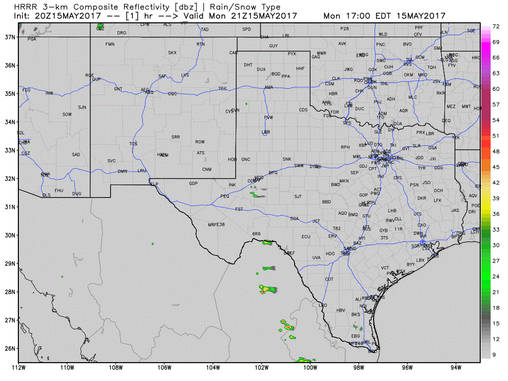
3PM HRRR Simulated Radar through Tonight
The first storms of the day are firing up from near Hereford and Vega northeast to Cactus in the Texas Panhandle. These storms are moving to the north, but we may see a more northeasterly motion take hold if stronger updrafts are able to materialize. A few of these storms will probably become severe this evening with a risk of large hail and localized damaging wind gusts. Their reign will be short-lived as the cap comes back in force shortly after sunset.
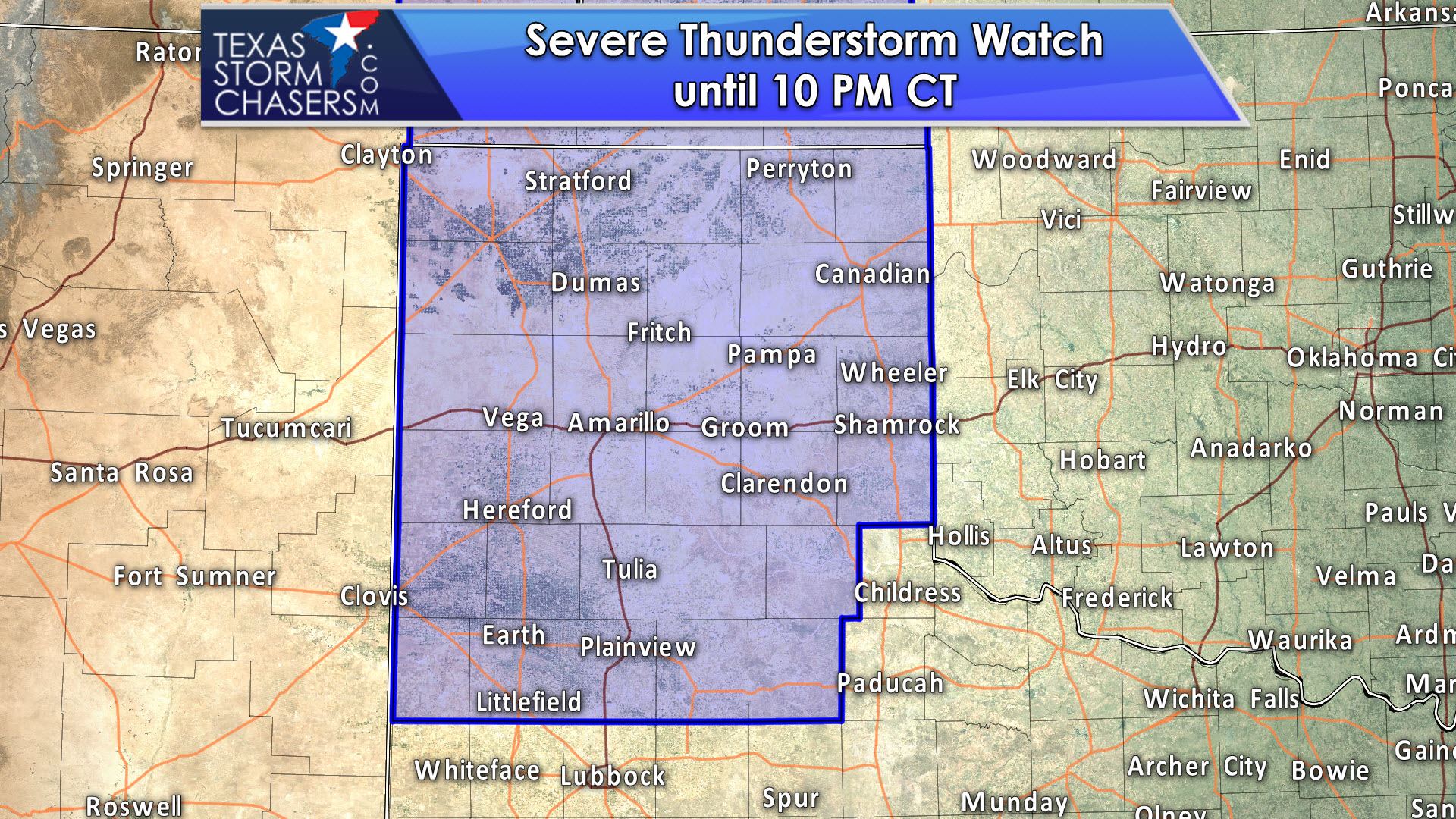
The National Weather Service in conjunction with the Storm Prediction Center have issued a severe thunderstorm watch for the Texas Panhandle and northern sections of West Texas. This watch is in effect through 10 PM and was issued shortly before 4 PM. The strongest storms in the coming hours may produce large hail and localized damaging wind gusts. They should be weakening not long after sunset as a strong cap quickly develops and squashes them into oblivion.
Severe Thunderstorm Watch Number 213
NWS Storm Prediction Center Norman OK
340 PM CDT Mon May 15 2017
The NWS Storm Prediction Center has issued a
* Severe Thunderstorm Watch for portions of
southeastern Colorado
western Kansas
southwestern Nebraska
the Oklahoma panhandle
much of the Texas panhandle
* Effective this Monday afternoon and evening from 340 PM until
1000 PM CDT.
* Primary threats include…
Scattered damaging wind gusts to 70 mph possible
Isolated large hail events to 1.5 inches in diameter possible
SUMMARY…Thunderstorms are expected to increase in coverage and
intensity across much of the south central high Plains through this
evening, in an environment conducive to strong downbursts and
surface cold pool development accompanied by the risk for severe
wind gusts. Stronger storms may also produce some severe hail.
The severe thunderstorm watch area is approximately along and 65
statute miles east and west of a line from 60 miles northwest of
Hill City KS to 60 miles south of Amarillo TX. For a complete
depiction of the watch see the associated watch outline update
(WOUS64 KWNS WOU3).
PRECAUTIONARY/PREPAREDNESS ACTIONS…
REMEMBER…A Severe Thunderstorm Watch means conditions are
favorable for severe thunderstorms in and close to the watch area.
Persons in these areas should be on the lookout for threatening
weather conditions and listen for later statements and possible
warnings. Severe thunderstorms can and occasionally do produce
tornadoes.


0 Comments