
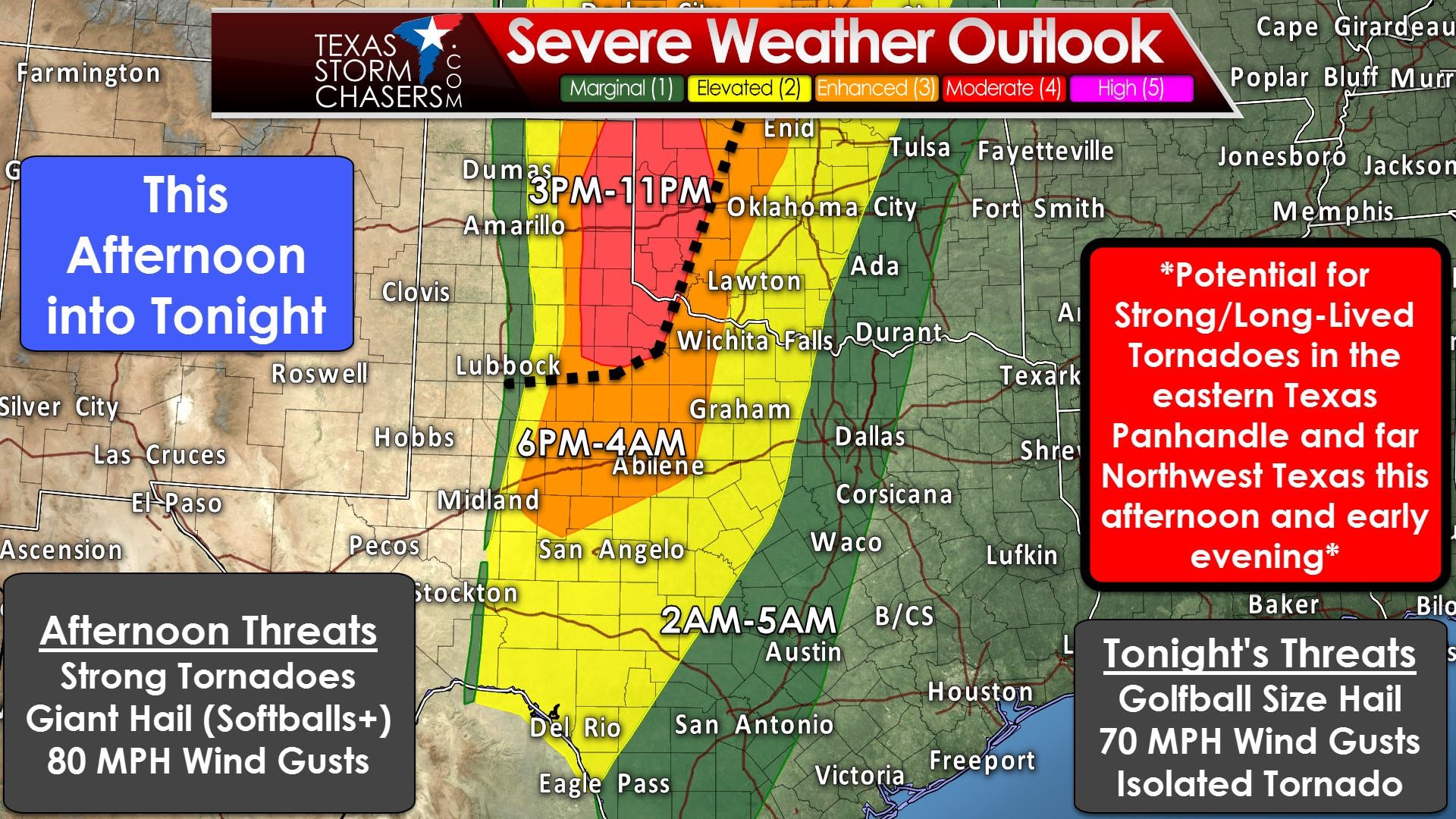
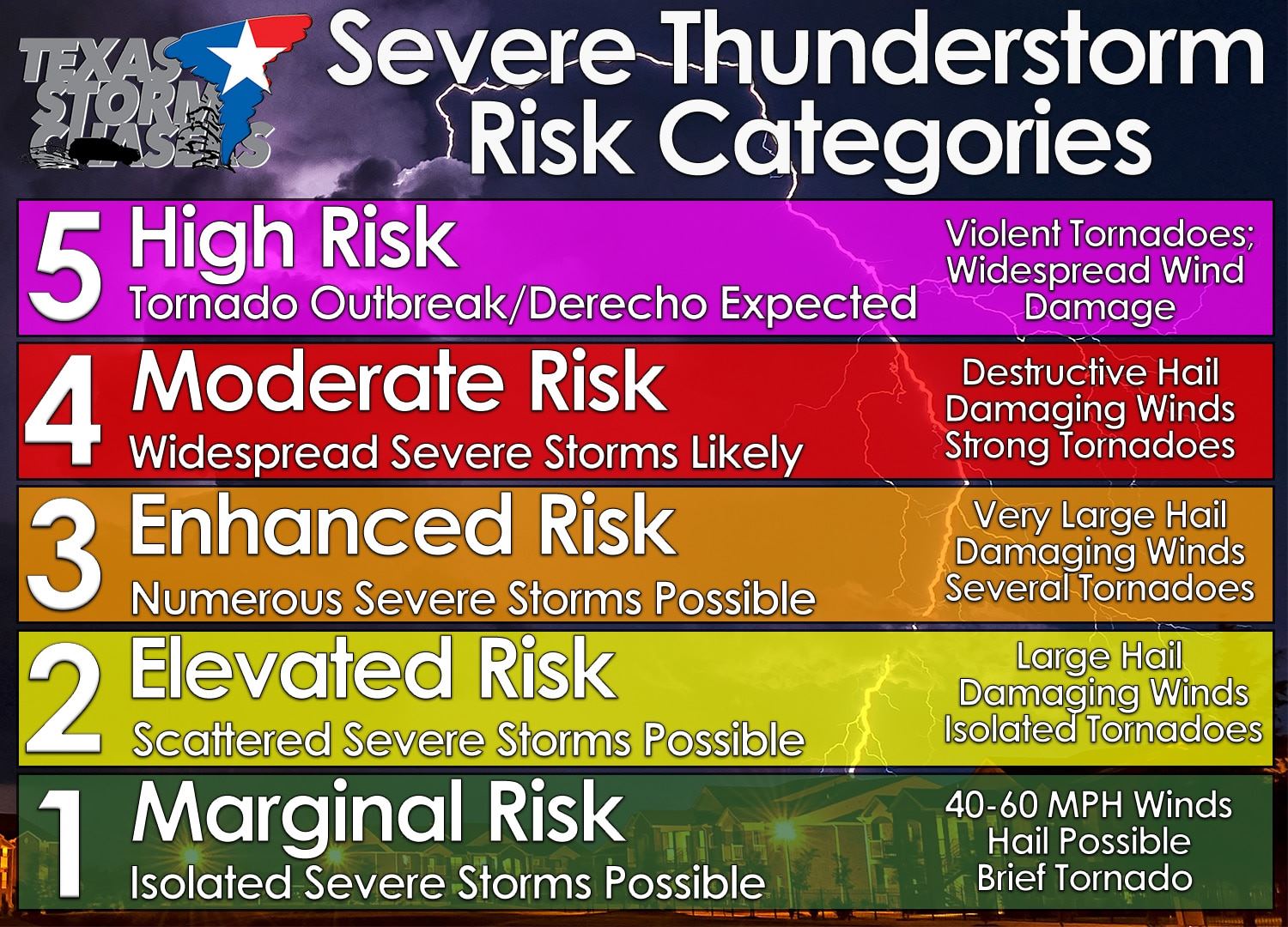
The Storm Prediction Center has upgraded much of the eastern Texas Panhandle, far northwest Texas, and western Oklahoma to a “moderate” level 4 risk of severe weather. On a five-level system we’re now at level 4. This means there is the potential for a significant severe weather threat, including giant hail to the size of softballs, damaging wind gusts up to 80 MPH, and tornadoes. Some of the tornadoes may be strong (EF2+) and long-lived. Canadian, Wheeler, Shamrock, Wellington, Childress, Memphis, and Paducah. An “enhanced” level 3 risk includes the big Country, West-Central Texas, and Northwest Texas. The “standard” level 2 risk includes the Concho Valley, western North Texas, and the Hill Country. We will have two distinct periods of severe weather potential today and tonight.
The first time window opens up by 2-3 PM in the eastern Texas Panhandle to West-Central Texas. A surface dryline will be the demarcation line between no severe weather threat to the west and a severe weather threat to the east. The severe weather outlook above shows where the western edge of the severe risk (and dryline) should be. The first storms that fire up this afternoon may take an hour or two to organize, but we do expect scattered intense supercells. These storms will move northeast at 35 to 45 MPH. The strongest supercells will be capable of producing all modes of severe weather – including strong tornadoes, softball size hail, and 80 MPH wind gusts. Not all storms will produce tornadoes today nor will all storms produce softball size.
Scattered supercells will likely continue into the late afternoon and early evening with a continued risk of all modes of severe weather. Additional storms may develop after 5-6 PM in West Texas and the Big Country. The strongest storms may produce very large hail and localized damaging wind gusts. An isolated tornado can’t be ruled out, but the best juxtaposition of low level wind shear and dewpoints above 65 degrees will be in the eastern Panhandle and Northwest Texas.
By the mid-evening hours a squall line will be taking shape in the eastern Texas Panhandle, Northwest Texas, Big Country, south into the Concho Valley. Once storms have congealed into a squall line the threat for tornadoes will become low, but not zero. The primary severe weather threats at that point will be large hail up to the size of golfballs and damaging wind gusts up to 60-75 MPH. The squall line will progress east into the predawn hours Wednesday. It should make it into western North Texas and the Hill Country while weakening. Scattered storms, some still strong, may make it to Interstate 35 by 4-6AM Wednesday.


0 Comments