
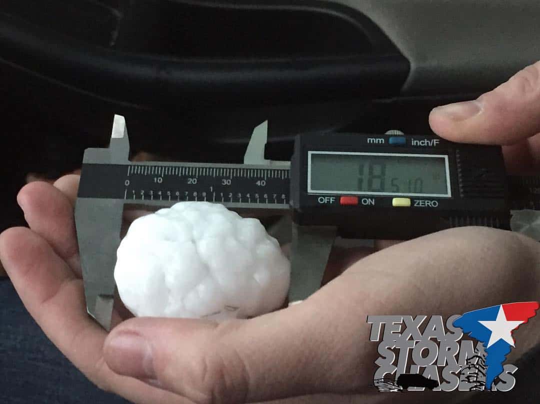
A Severe Thunderstorm WATCH is in place until 10pm for the central and western Texas panhandle region. Large hail in up to 2 inches in diameter and damaging winds will be the main threat within any of the isolated cells that develop along the dryline this afternoon near or just east of the TX/NM border. One storm which developed in the past hour near Bovina just east of the TX/NM border has seen reports of hail up to 1.85 inches. Widespread thunderstorm coverage is not expected this afternoon, but additional very isolated development is possible anywhere along the dryline from far west TX along the I-10 corridor all the way up into the western and central panhandle region. Once we begin to lose daytime heating after sunset, any activity that has developed is expected to quickly die off.
Severe Thunderstorm Watch Number 142
   NWS Storm Prediction Center Norman OK
   350 PM CDT Fri Apr 14 2017

   The NWS Storm Prediction Center has issued a

   * Severe Thunderstorm Watch for portions of
     The western Texas Panhandle

   * Effective this Friday afternoon and evening from 350 PM until
     1000 PM CDT.

   * Primary threats include...
     Isolated very large hail events to 2 inches in diameter possible
     Isolated damaging wind gusts to 70 mph possible

   SUMMARY...Deepening cumulus along the Texas/New Mexico border will
   likely evolve into a couple of storms over the next few hours, with
   other isolated storm development possible into the northwest Texas
   Panhandle.  The storm environment will support supercells with a
   primary risk of large hail through late evening.

   The severe thunderstorm watch area is approximately along and 35
   statute miles east and west of a line from 25 miles northeast of
   Dalhart TX to 105 miles south southwest of Amarillo TX.


0 Comments