
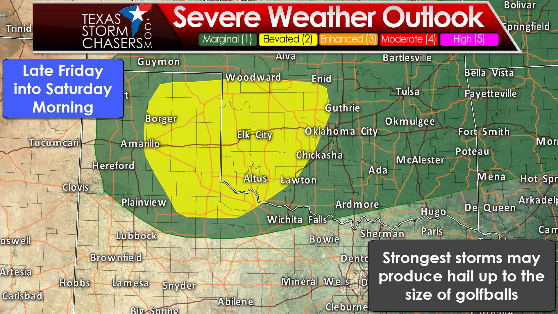
The potential for active weather will return late tomorrow evening. Most of Thursday will be dry with a strong capping inversion in place. That strong cap will prevent daytime thunderstorm development ahead of the dryline. By late Thursday evening enough upper-level ascent will be available for elevated storms to fire up. These elevated storms will be above the cap, with the threat for tornadoes being minimal. These elevated storms will still have plenty of unstable air to work with in the mid-levels of the atmosphere. A level two risk of severe storms has been issued for the eastern Texas Panhandle into western Oklahoma. The timeframe for storm development will likely be 10 PM through 7 AM. The strongest storms may produce hail up to the size of golfballs and localized flooding. Damaging winds are not out of the question, but the risk will be reduced since storms will be rooted above the capping inversion. The hail may not be good for farmers, but rain is certainly welcome.
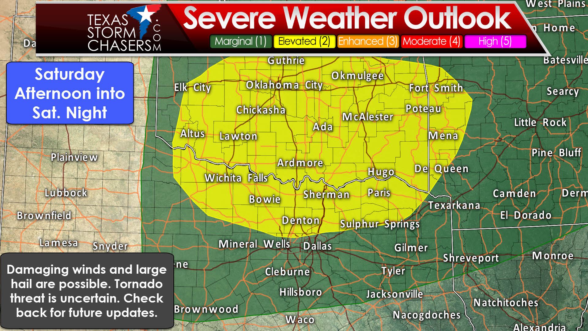
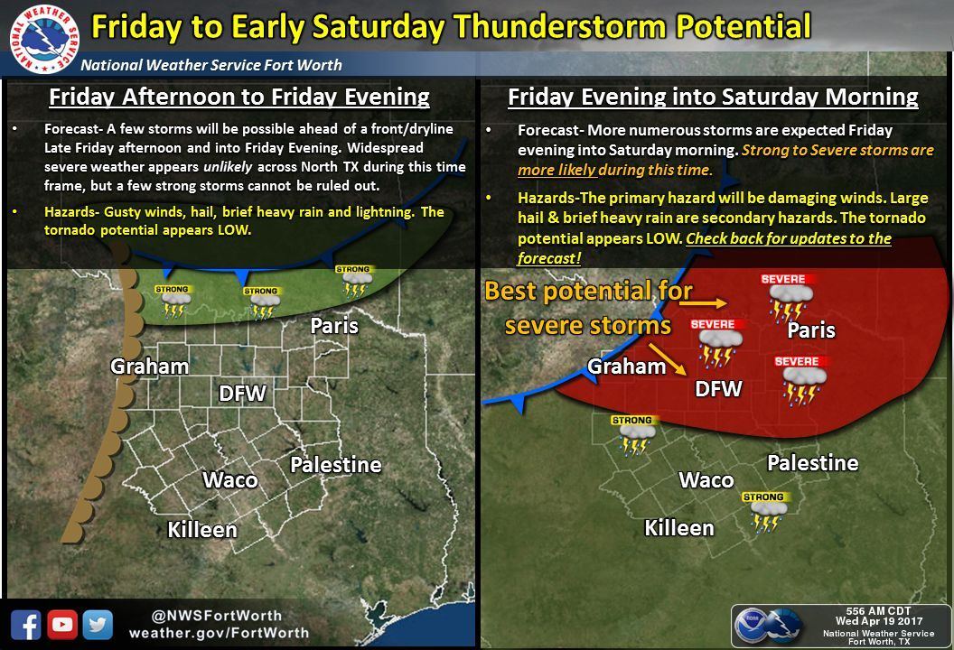
On Friday we’ll see the potential for more active weather. A fairly strong cold front will be moving south through Texas and Oklahoma. The front’s timing and location will play a role in where we see the best thunderstorm chances. North of the front we’ll see a drier surface air mass move in, helping to quickly reduce the threat for severe storms. South of the front there will be adequate moisture and wind shear to support organized thunderstorms. A capping inversion may help prevent most discrete storm development, although that is something we’ll refine tomorrow. Our best thunderstorm chances may be along the cold front as a squall line develops by late Friday afternoon into the evening hours. That line of storms, along with the cold front, would move south. At this time we have a level two risk of severe weather for portions of Northwest Texas, Texoma, and Northwest Texas – generally along/north of a Quanah-DFW Airport-Mount Pleasant line. A level one risk includes the Big Country, Central Texas, and East Texas – or north of a Brownwood to West to Jacksonville line. These outlook delineations will be adjusted tomorrow as better model data arrives. The primary severe weather threat with a squall line would be damaging wind gusts up to 70 MPH and perhaps some large hail. Should we see discrete thunderstorms they could be capable of producing very large hail and the threat for isolated tornadoes. The graphic below from the National Weather Service in Fort Worth sums up the threat windows fairly nicely. Localized flooding may be a threat, but shouldn’t be near the level we saw last week.
Scattered showers and storms will be possible on Saturday in Northeast Texas, East Texas, Southeast Texas, and the Middle Coast. At this time no formal severe weather risk has been highlighted as the best dynamics will be in the Southeast United States.


0 Comments