
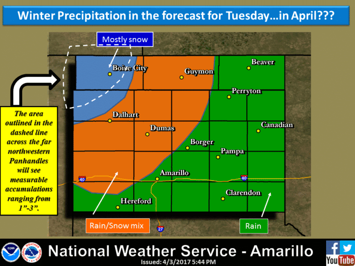
Parts of the Texas Panhandle are still on track for snow and a rain/snow mix on Tuesday as a compact, but strong, upper level system moves across the region. Accumulating snow between 1 and 3 inches will be most likely across the far northwestern portions of the panhandle…from about Dalhart northward. South of there, a mix of rain and snow will be possible for areas mainly north of Amarillo. Gusty north winds between 20 and 30mph will create conditions for blowing snow and reduced visibility at times, so folks out on the roadways across this region will need to keep that in mind tomorrow afternoon. Dallam County is under a Winter Weather Advisory from 7am until 10pm tomorrow. Yes, a WWA in April. For areas further south towards Lubbock, your weather tomorrow will depend on whether your behind the front…with gusty north winds and a chance for rain/snow mix, or if you’re ahead of the front…where you’ll enjoy much warmer temps and blowing dust. Oh joy! Take your pick!
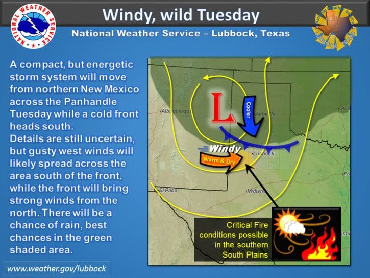
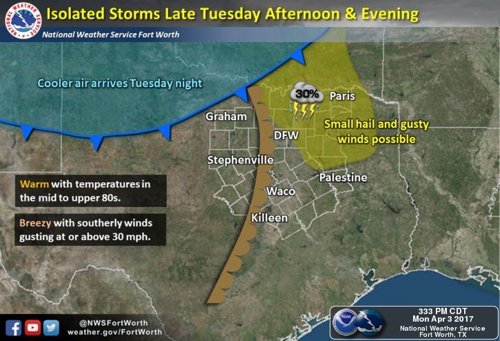
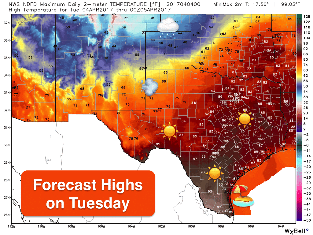
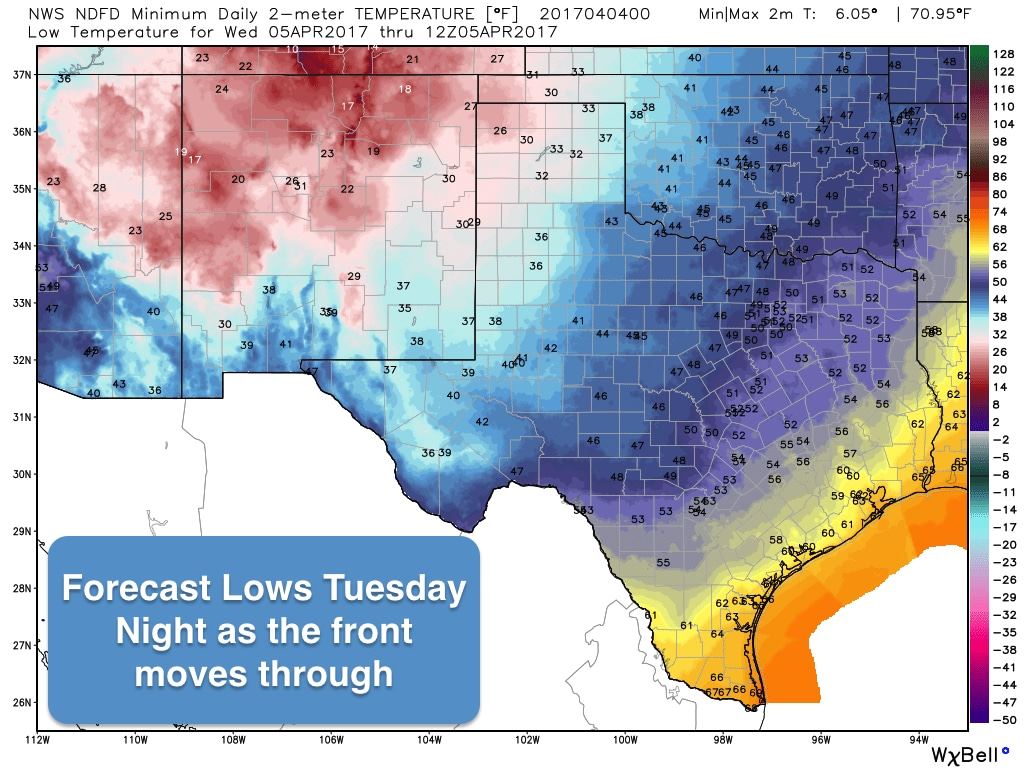
The front will basically remain stalled somewhere between Amarillo and Lubbock most of tomorrow and won’t begin moving south until later in the afternoon once a surface low kicks off to the northeast along with the upper level disturbance. That means we’ll have quite a temperature difference between the panhandle…which will be in the 30s and 40s…and deep south Texas which could see temps approaching 100 in the borderlands. Once the front begins to move south/southeast, it will make quick progress across the state…impacting western north Texas by late evening, north Texas before midnight, central Texas around 3am…and should arrive along the coast by sunrise Wednesday. Behind the front, we’ll have several days of cooler conditions with less humidity and seasonal highs before things warm up again for the weekend.Chances for rain and a few isolated storms will be possible as the front moves into north Texas overnight Tuesday. Most of these will be sub-severe, but a few of the stronger cells could produce isolated episodes of small hail and some gusty winds. Nothing to be too concerned about though. Rain chances look slim for the remainder of the work week ahead and into next weekend as well. Storms may return to the forecast early next week, but it’s too early to talk about that just yet with it being so far out.


0 Comments