
The Storm Prediction Center has issued a new severe thunderstorm watch for portions of Northeast Texas and East Texas. This watch runs along and east of a line from De Kalb to Longview to Henderson to Nacogdoches to Lufkin to Zavalla to Pineland. The tornado watch is no longer in effect. A broken line of showers and thunderstorms, associated with a cold front, will continue to push off to the east this evening. Storms aren’t particularly organized at this point, but we can’t rule out a re-intensification trend. The strongest storms could produce localized damaging wind gusts up to 70 MPH, hail up to the size of ping-pong balls, and perhaps a brief tornado. The tornado threat is considerably lower than earlier. Localized flooding is also a threat. Storms will exit Texas to the east late tonight.
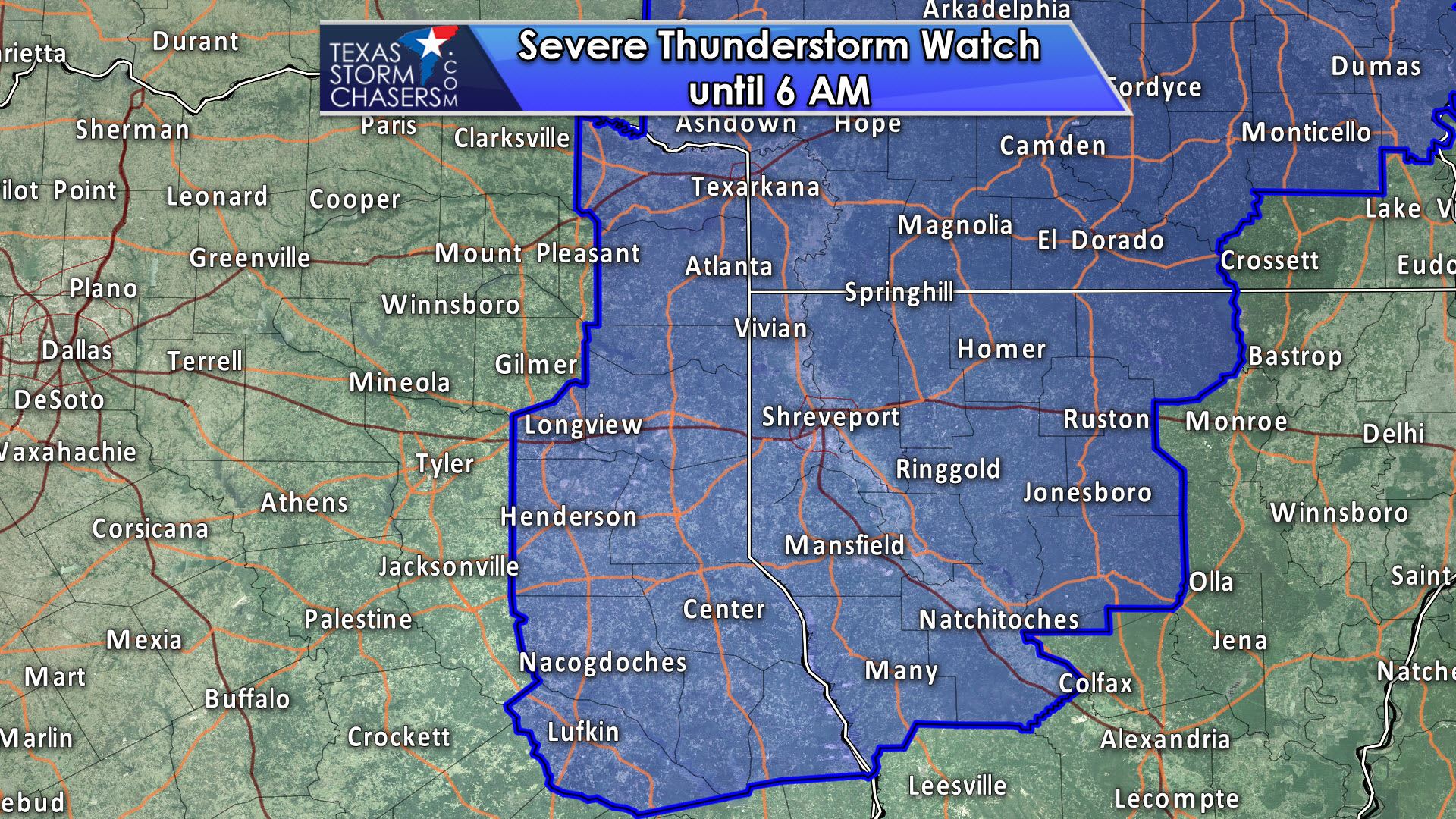
Severe Thunderstorm Watch Number 178
NWS Storm Prediction Center Norman OK
1015 PM CDT Sat Apr 29 2017
The NWS Storm Prediction Center has issued a
* Severe Thunderstorm Watch for portions of
Central and southern Arkansas
Northwestern Louisiana
Northeastern Texas
* Effective this Saturday night and Sunday morning from 1015 PM
until 600 AM CDT.
* Primary threats include…
Isolated damaging wind gusts to 70 mph possible
Isolated large hail events to 1.5 inches in diameter possible
A tornado or two possible
SUMMARY…Bands and clusters of strong to occasionally severe storms
will continue to form and move to the north-northeast through the
overnight hours, along and ahead of a cold front moving eastward
from eastern Oklahoma and northeaster Texas. Damaging winds and
large hail will be the main risks, though an isolated tornado or two
may occur with embedded circulations.


0 Comments