
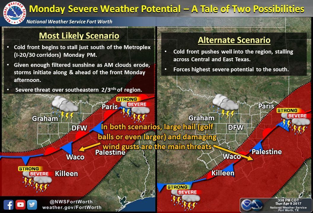
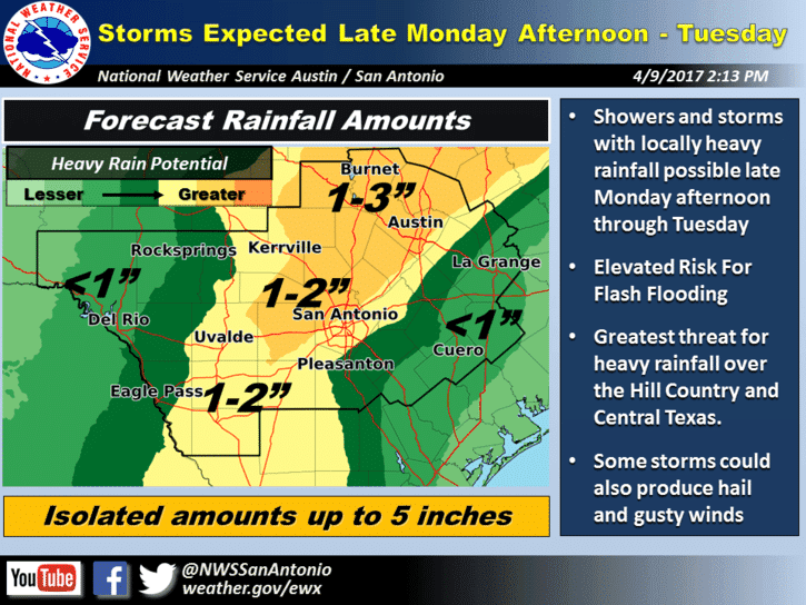
We have a Level 2 risk of severe weather Monday and Monday night stretching from north Texas down into Central Texas. A cold front will move south overnight into the panhandle region after sunset…western north Texas and the rolling plains by dawn tomorrow and eventually stall out somewhere close to the I-20 corridor by tomorrow afternoon. Some showers are possible out ahead of the front early Monday, but as we get into the afternoon and early evening hours, we should see a fairly rapid intensification of storms…some of which could become severe with a large hail and damaging wind threat. Where the greatest threat for severe storms develops near or within the DFW metroplex will depend on how far south the front manages to push by tomorrow afternoon. Some forecast models are developing storms right over Dallas extending south into central Texas…others are pushing the front a bit further south which takes the threat of strong storms south along with it. Where the front ends up tomorrow afternoon will likely be dependent upon how much storm coverage we get out ahead of the front overnight across Oklahoma. If there’s a lot of storms, that could send an outflow boundary south overnight which could push the front a bit further south than current models are forecasting. Right not, none of the short-range models are projecting much in the way of storm coverage overnight in Oklahoma, so the expectation at this point is for storms in or very close to the DFW metro area and down across central Texas and into portions of the Hill Country region tomorrow evening and through the overnight hours. In addition to the aforementioned hail and damaging wind threats, flash flooding will also be a concern, especially for residents across central Texas where isolated 5+ inch rainfall totals will be possible Monday night through Tuesday.
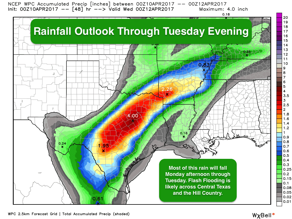
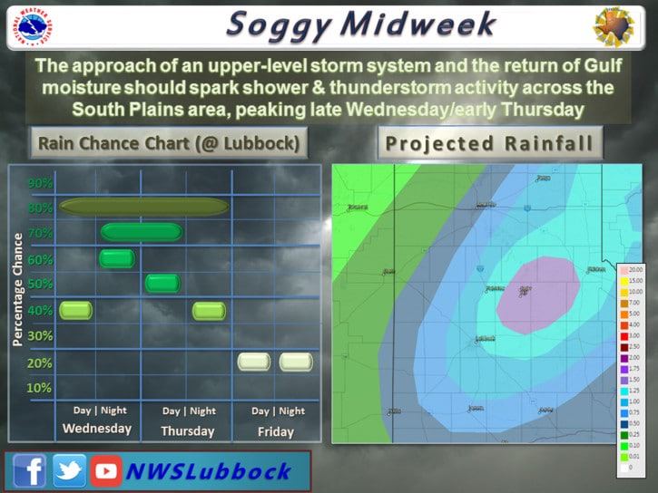
 A majority of the rainfall depicted on the graphic below will occur between Monday afternoon and Tuesday afternoon. Might as well prepare for the possibility of a wet commute home from work or school tomorrow, and a wet commute to work or school early Tuesday. Be sure to check local media for the latest on the storms and road conditions before heading out Tuesday morning. We will have a break from the heavy rain on Wednesday across central and north Texas, but we’ll see them increase for portions of the Texas panhandle, rolling plains and western north Texas late Wednesday and into Thursday. Accumulations across the panhandle and western north Texas will likely not be as much as what we’ll see tomorrow and Tuesday for central Texas, but we’ll still see respectable 1-2+ inch amounts. Severe weather Wednesday through Thursday does not appear too likely, but we’ll be keeping an eye on that and will let you know the latest as we get further into the work week.


0 Comments