
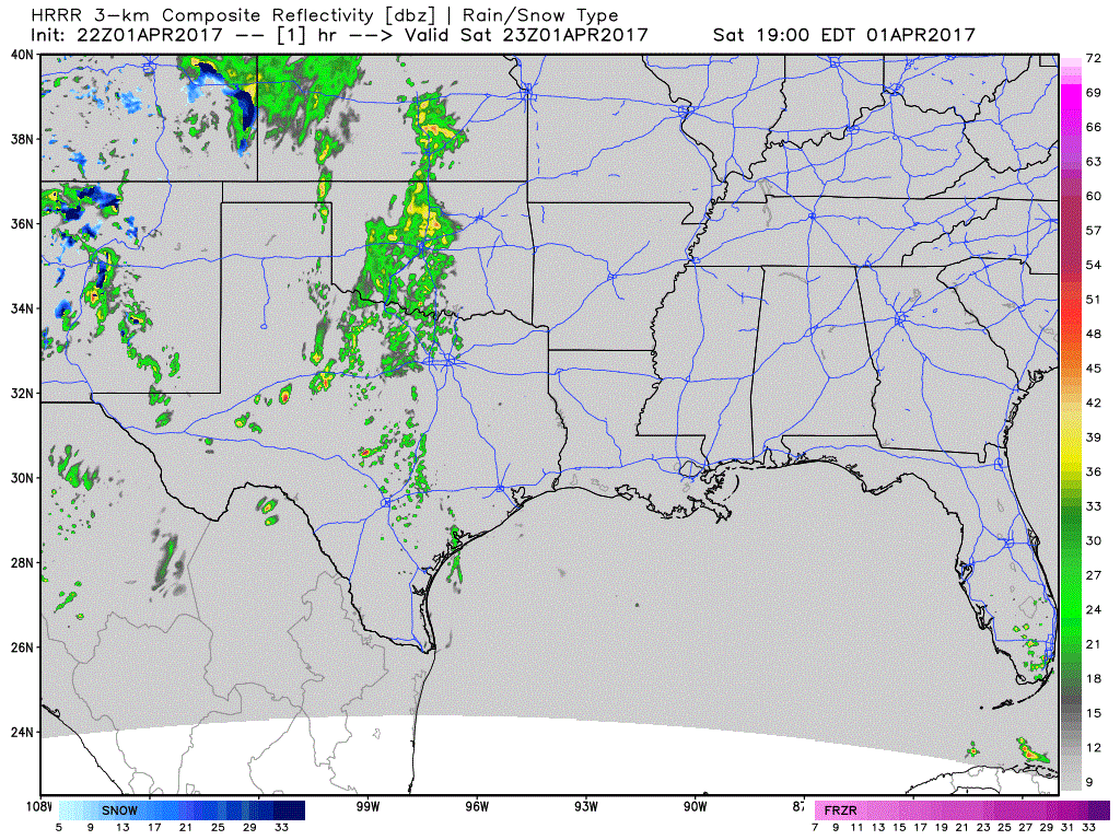
Storms across western north Texas have remained scattered to isolated this afternoon with reports of mainly gusty winds and ping-pong ball sized hail. The strongest cell previously affecting the Sweetwater area has moved north of the frontal boundary and is expected to gradually weaken over the next hour. South of the frontal boundary between San Angelo and the I-20 corridor, additional storms are developing and we will continue to see development for several more hours. Again, the main threats will be isolated damaging wind events and hail up to 2 inches in diameter. The tornado threat this evening is low, but is non-zero, so just keep an eye on any severe storm that develops in your area. As we get into the overnight hours, forcing from the upper level low to our west will arrive across southwest Texas. This will cause widespread strong to severe storm development across southwest Texas/western Edwards Plateau region. Damaging winds and large hail will be the main threats with the storms overnight as they move east towards central Texas near Austin by sunrise tomorrow.
Simulated Radar through 11am Sunday
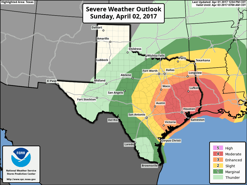
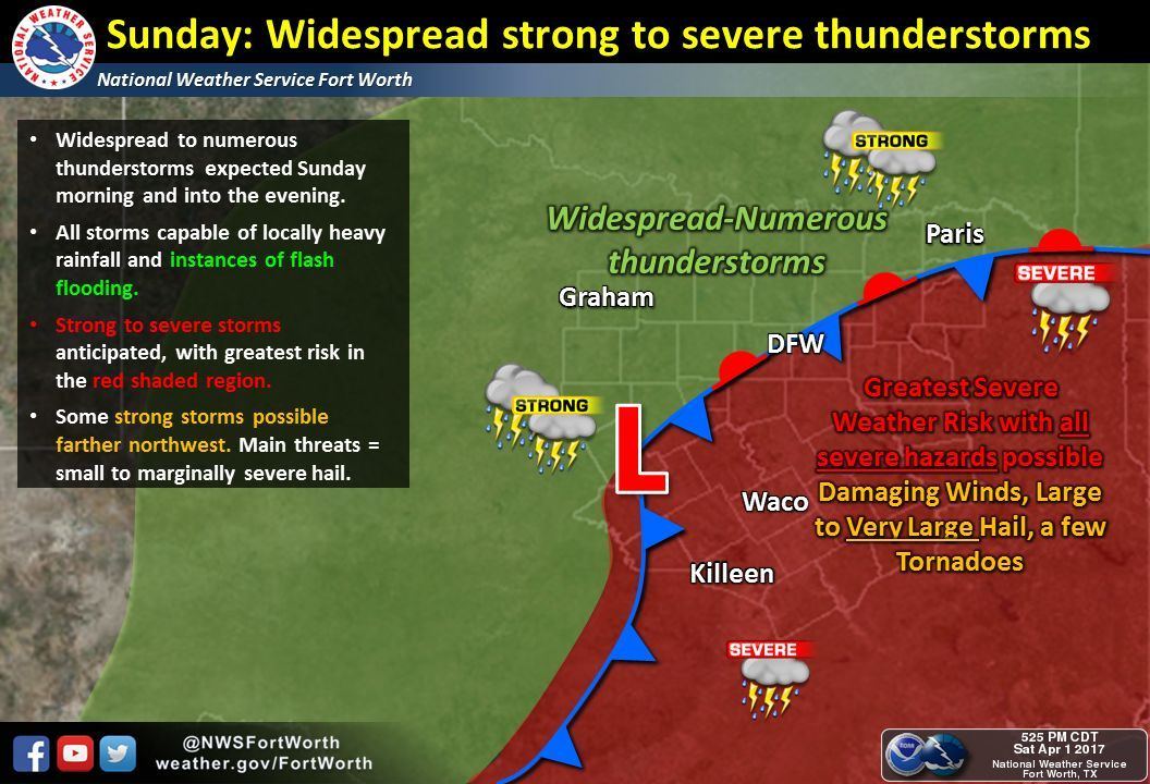
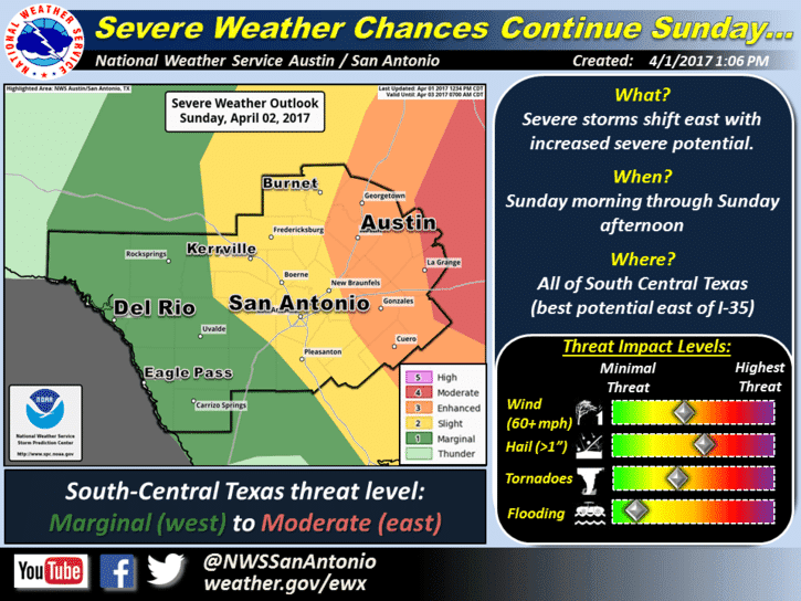
Sunday Morning: As better lift from the low out west arrives, an uptick in severe storm development is expected by around daybreak tomorrow from near Austin to just east of the DFW metroplex. As the morning progresses, widespread showers and storms, some severe, will be possible all along the I-35 corridor from Dallas down into the Hill country and central Texas. The latest high-resolution forecast models are showing the potential for a squall line to develop and impact much of the I-35 corridor between Dallas and Austin by sunrise on Sunday. Those planning to attend church services tomorrow morning between 8am and noon in and around the Dallas, Waco and Austin metro areas will be under a threat of at least marginally to severe thunderstorms with periods of torrential rain. By late morning, the squall line will advance east of the I-35 corridor into central Texas and parts of northeast Texas. As instability continues to build into the early afternoon hours across the warm sector east of I-35 across much of south central and southeast Texas, we’ll see the greatest risk for supercell and tornado development across the Moderate Risk area. The exact evolution of the highest potential and the timing for severe weather…specifically tornado development…tomorrow across southeast remains a bit unclear, but current forecaster thinking is between daybreak and mid-afternoon. Any discrete supercells that form within the warm sector tomorrow morning within the Enhanced and Moderate Risk areas east of I-35 will have the potential to produce tornados…some of which could be strong. Once the latest data rolls in overnight, we’ll likely see some details ironed out and we’ll provide updates at that time. What everyone needs to know now, especially those in the current Enhanced to Moderate Risk Outlook area is this: Severe weather is likely, tornadoes are also likely. Can we tell you right now where and when they will form? No. But everyone within the Enhanced and Moderate risk areas tomorrow needs to be on high alert starting early tomorrow morning and through the afternoon hours and have a way to receive weather alerts.
PLEASE READ: As always, when we are faced with the threat of significant severe weather, we get lots of questions such as “What’s the threat at my house in XYZ city?” Please understand that we can’t get into that level of micro-detail in the forecast. All we can do is give you the forecast, the map detailing the at risk areas and it’s up to you to take it from there with your severe weather preparations. Know where you are on a map and know what county you live in, and if you are within either the Enhanced or Moderate risk area, just understand that you could see severe weather tomorrow. Is that a guarantee? No. But it’s a possibility, so make sure you have a way to receive weather warnings (NOAA Weather Radio or a smartphone App) and seek shelter immediately if Warnings are activated for your location.


0 Comments