
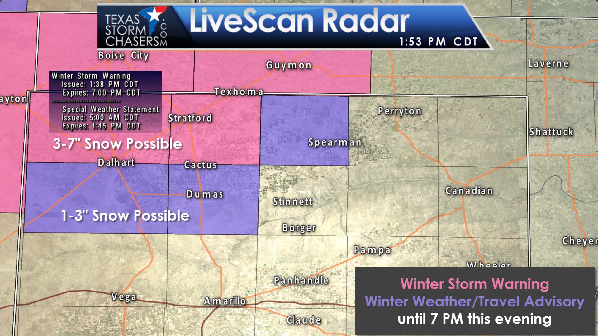
These cold core upper level systems are always a pain in the rear end to forecast. Out of all the systems we deal with, these have a tendency to either be no big deal – or overperform in a big way. Today’s event in the northwestern Panhandle is overperforming in a big way. Four to five inches of snow has fallen in the extreme northwestern Texas Panhandle up into the western Oklahoma Panhandle. Light snows will be possible as far southeast as Dumas to Spearman with maybe a dusting to an inch of wet snow. Further northwest, and generally northwest of a Dalhart to Texhoma line, much more significant snows are possible. Considering we’ve already seen four to five inches in spots, another two to three inches is certainly not out of the question. The good news is most snow is melting fairly quickly thanks to warm soils. However, slick roadways are possible thanks to all the slush. Snowfall intensity should decrease later this afternoon. All precipitation will be outta the picture by 7 to 8 PM.
Move over Texhoma…Boise City snowstorm in the house! #okwx #okmesonet
Posted by Oklahoma Mesonet on Tuesday, April 4, 2017
Here’s a photo from the Oklahoma Mesonet showing the wet snow causing big-time accumulations up in Boise City, Oklahoma.


0 Comments