
Little change has been made to the forecast with the latest Storm Prediction Center Outlook. Two rounds of severe weather are expected today across parts of central and southeast Texas…the first occurring now with scattered strong to severe storm development north of the Houston metro area, and another round once the squall line of storms currently west of Austin/San Antonio moves through this afternoon ahead of a strong cold front. East Texas will see the greatest threat of severe weather as we get into the afternoon hours…mainly from noon until about 10pm. It’s important to note that even thought the Moderate Risk (Level 4) category has been trimmed and lifted further north from the greater Houston Metro area, the Enhanced (Level 3) remains in place and there is still a chance for significant severe weather across the southeast Texas region. All it takes is one or two very strong cells, such as the tornado warned cell currently impacting the Huntsville and New Waverley areas, to cause issues, so keep a weather eye out today.
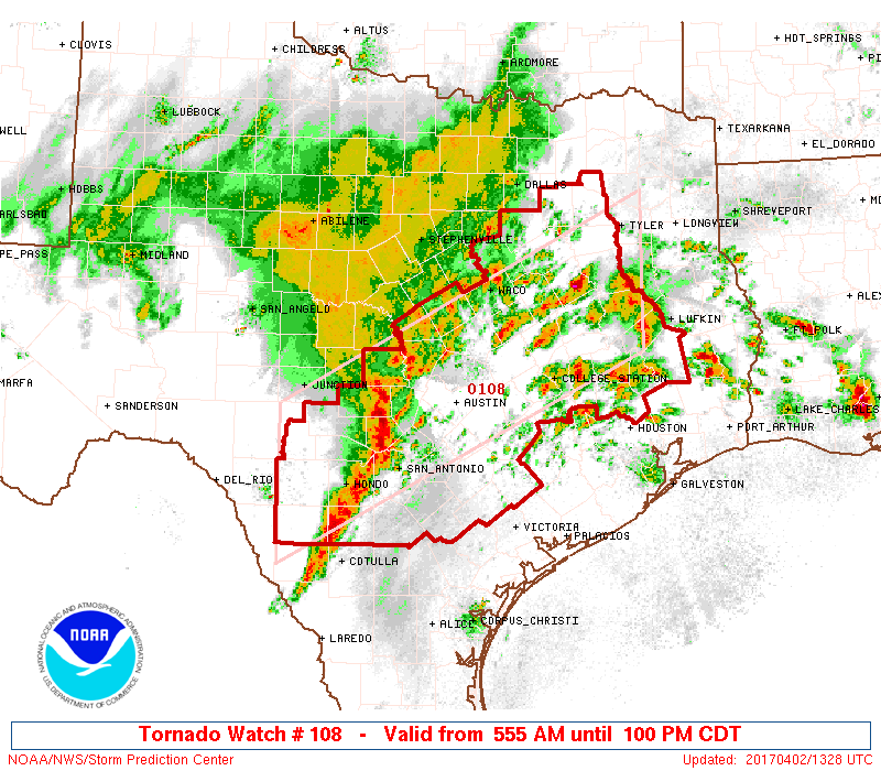
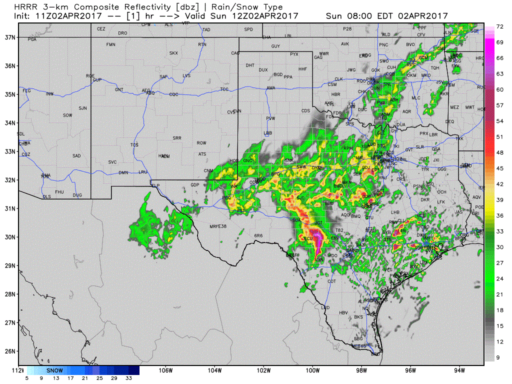
For the Hill Country Region – A squall line of strong to severe storms continues to move east towards the I-35 corridor this morning. This line of storms should reach the San Antonio area within the next 30 minutes to an hour, and will reach the Austin area within the next hour or two. Damaging winds and a few spin-up tornadoes along the leading edge of the squall line are the main threats. The line is expected to increase in intensity once it’s past the I-35 corridor and we get into better daytime heating. While still expected to be mainly a hail and wind threat as it tracks across central Texas, all modes of severe weather including tornadoes cannot be ruled out. Flash flooding from torrential downpours will also be an issued. Flash Flood Watches are in place for most of central, east and the northern sections of southeast Texas through the evening hours. The simulated radar image below will provide a look at how things may shape up through 8pm this evening.
On busy days like today, we cannot post and update on every single warning that goes out…we will try to hit the highlights…but have a way to receive weather warnings by monitoring local media, a NOAA Weather Radio, or a smartphone alert app.


0 Comments