
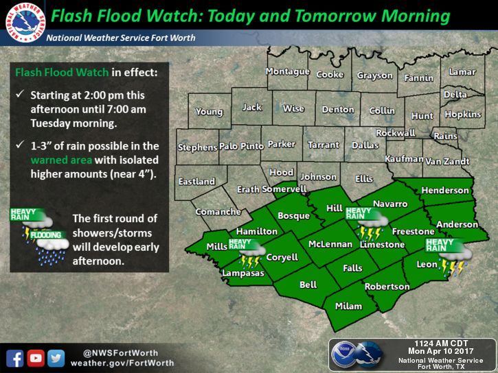
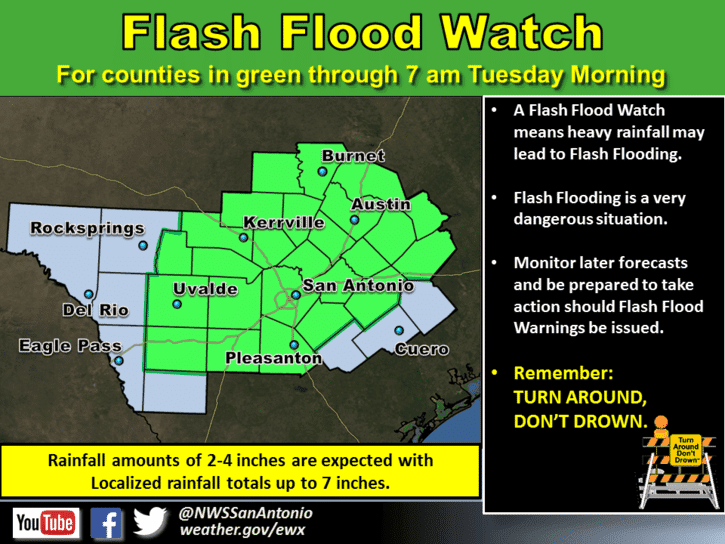
Coverage of heavy rain and storms is still anticipated overnight and into early Tuesday across parts of central Texas and the Hill Country region. Things look pretty calm on radar across central Texas right now with a weak cap still in place, but this cap is expected to weaken and eventually erode within the next couple of hours as the cold front pushes further into central Texas. This will lead to a fairly rapid uptick in rain and storm development across the region later this evening and during the overnight hours. A Flash Flood WATCH will remain in effect for the southern half of north central Texas and most all of central Texas until 7am Tuesday morning. Torrential rainfall is expected to be the greatest issue overnight with accumulations of 2 to 4 inches likely, although some folks may see up to 7 inches collect between now and tomorrow morning. Next greatest issue will be the possibility of embedded strong thunderstorms and development of a squall line that will push south across central Texas and approach the central coast and possibly parts of southeast Texas by early tomorrow morning. With the squall line, damaging winds and hail will be the greatest issue on top of the aforementioned risk of flash flooding. 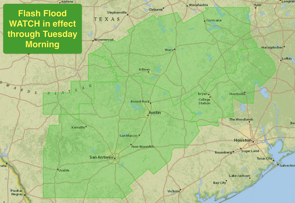
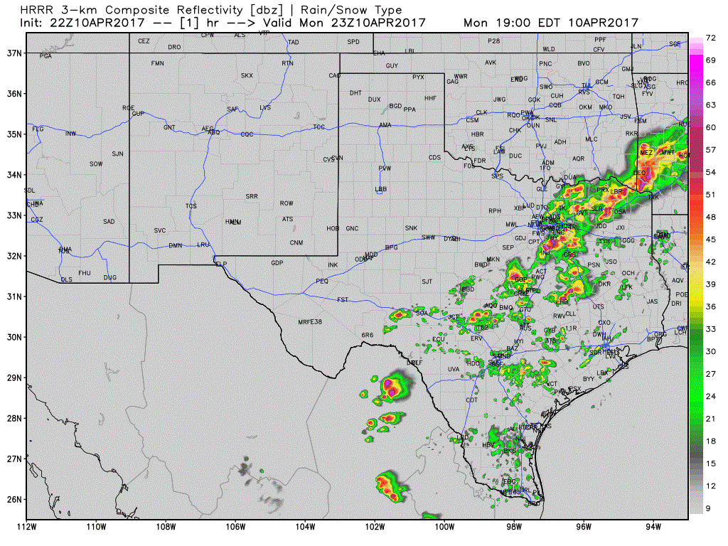
Here’s the latest simulated radar loop from one of the 18 hour high-resolution forecast models. While things may not evolve exactly as pictured here, it will give you a good idea of how the radar will likely shape up later this evening and overnight. Folks in areas in or near Austin, San Antonio, Victoria, College Station, Huntsville and even into the Houston area will need to be prepared for very heavy rainfall tonight into early tomorrow morning. Most of the heavier rain should be clearing out after midnight for folks along the I-35 corridor in central Texas, but for folks further east and closer to the I-45 corridor across southeast Texas, you could see your early morning commute turn into a mess with heavy rainfall still in the area. Be sure to check your local media for roadway conditions before heading out tomorrow morning. Also, if you live in an area that typically floods, take precautions now to protect your property, livestock and pets.


0 Comments