
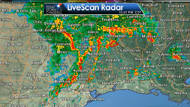
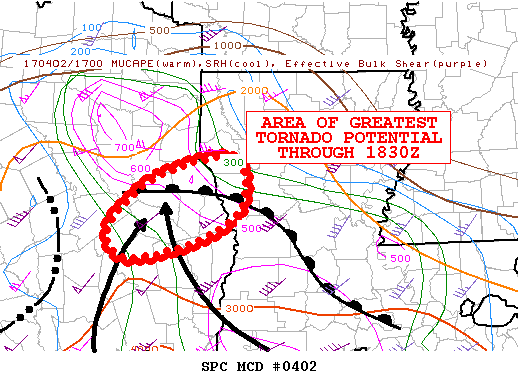
A complex yet potentially dangerous severe weather situation continues to evolve in East Texas. A tornado-warned supercell near Center, TX about 45 minutes ago has now moved into Louisiana. Our focus now shifts to new developing thunderstorms from Nacogdoches to Lufkin to Livingston to near Cleveland. These storms have shown signs of organization over the last half hour. These storms are forming in the open-warm sector, also known as the warm and unstable airmass ahead of a cold front further west. We’ll be watching for any of these isolated storms to become supercellular. The enviornment over East Texas is quite supportive of severe weather, including tornadoes. There is a significant concern that any storm that becomes surface-based and supercellular will have a significant risk of tornadoes. Any tornado that develops has the potential of being strong to violent, and potentially long-track. That’s why we have a level 4 and 5 risk of severe weather in place. In addition, the storms from Crockett to Huntsville also need to be watched for signs of becoming supercellular as they slowly move east/northeast. I hope we’re able to simply get through the afternoon with some hail, wind, and only brief tornadoes. However, we must remain extremely vigilant and so we shall.
The highest tornado threat through 1:30 PM looks to be in the vicinity of a warm front from Lufkin to San Augustine. This front is slowly moving north. We’ll keep a close eye on storms as they interact with this warm front, or residual outflow boundaries from previous storms. The highest severe weather threat will be through 5 to 6 PM in East Texas. After that point most of the storms should be in Louisiana. Some strong to severe storms may remain possible into the evening further south in Southeast Texas.


0 Comments