
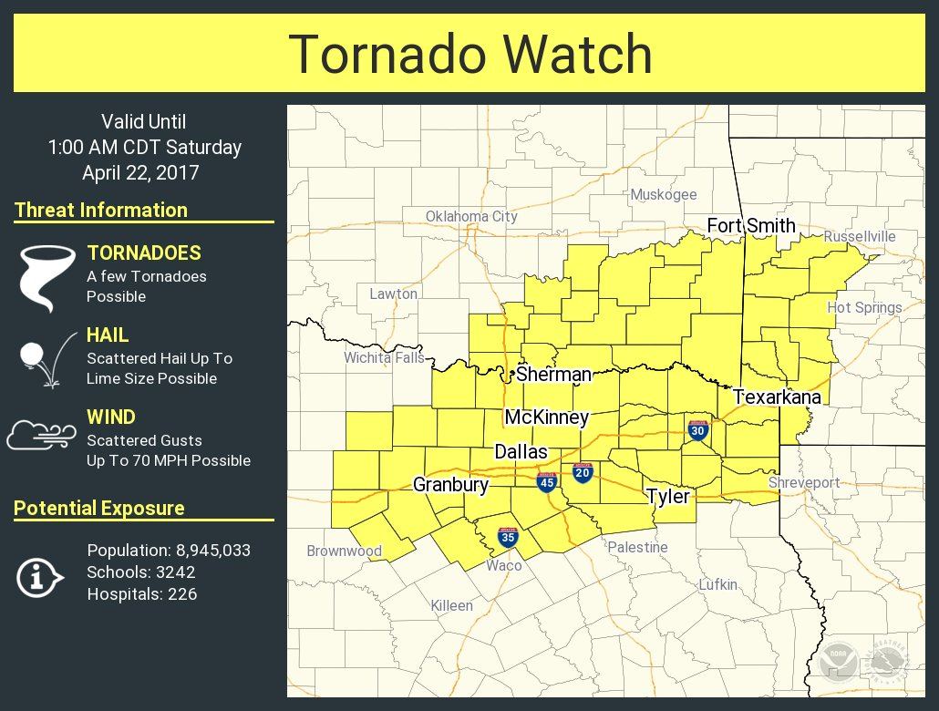
Numerous severe storms continue to impact north Texas this evening. The storms currently across Denton and Collin counties north of the immediate DFW metroplex carry a threat for very large hail up to the size of baseballs. The cells moving east of the immediate metroplex around Wylie and Greenville will also carry a threat for large hail in addition to a low, but non-zero, threat for a tornado spin up. This area of storms will continue to move east as the front continues to accelerate across the region tonight and should all be east of the DFW metroplex within the next one to two hours. As the current grouping of storms continues to move east/southeast away from the DFW metroplex, we should begin to see them congeal into a linear complex which will then approach the Corsicana to Tyler to Mt. Pleasant region with a threat of damaging winds and hail. Current high-resolution forecast models have the line diminishing in intensity after midnight as it heads further into east Texas. The current Tornado WATCH remains in effect until 1am.


0 Comments