
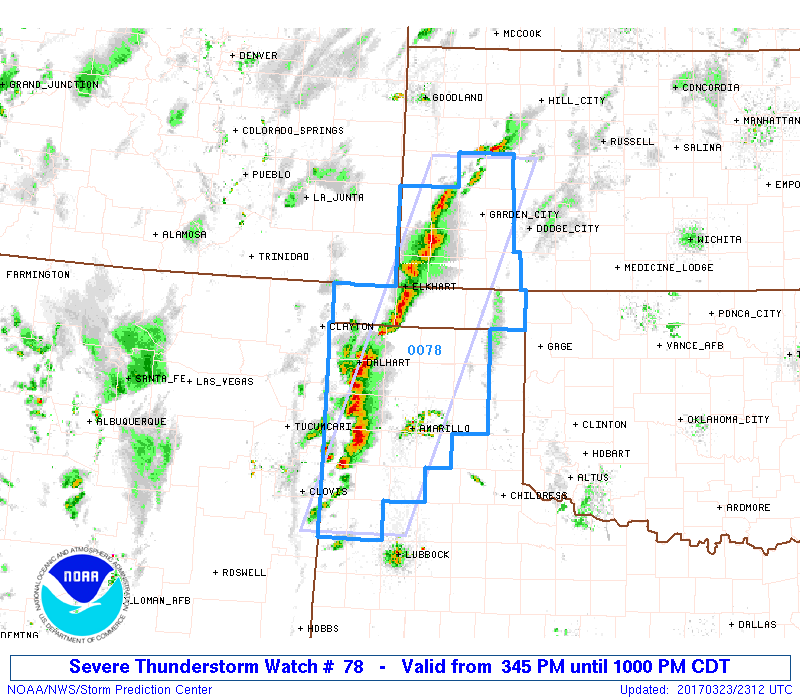
A Severe Thunderstorm Watch is in effect for a large portion of the Texas panhandle until 10pm this evening. A line of strong to severe storms has developed west of the I-27 corridor with several reports already received of wind in excess of 60mph with blowing dust. Large hail between 1 and 2 inches and downburst winds will be the primary threats through the evening hours as this line continues east towards the Amarillo metro area. Blowing dust may significantly reduce visibility at times…and may push well ahead of the main line of storms…so be aware of this as you’re out and about this evening. Once we get past sunset and into the early nighttime hours, the severity of the storms is expected to decrease due to loss of daytime heating and instability.


0 Comments