
Our active weather pattern continues but we’ll take it one day at a time. The severe weather risk today will be for portions of Northeast Texas, East Texas, and Southeast Texas. Just because you’re in a risk zone does not mean you’re guaranteed a thunderstorm – or severe weather. A category three risk includes extreme Northeast Texas and extreme East Texas – east of a Avery to Longview to Zavalla to Buna line. A category two risk runs east of a line from Paris to Mineola to Crockett to Huntsville to Katy to Freeport. Finally, a category one risk runs along and east of a line from Sherman to Terrell to Fairfield to Bryan/College Station to Victoria to Rockport. The difference in risks is simply a higher probability of having severe weather occur within a 25 mile point. Here are more specific definitions:

Category 1/Marginal Risk: Up to a 5 percent chance of severe weather occuring within 25 miles of your location.
Category 2/Elevated Risk: Up to a 15 percent chance of severe weather occuring within 25 miles of your location.
Category 3/Enhanced Risk: Up to a 30 percent chance of severe weather occuring within 25 miles of your location.
The primary severe weather threats with new development later today could be large hail up to the size of golfballs, localized damaging wind gusts up to 70 MPH, and the risk of isolated tornadoes. The higher threat for tornadoes is expected to be tonight once storms have moved into Arkansas.
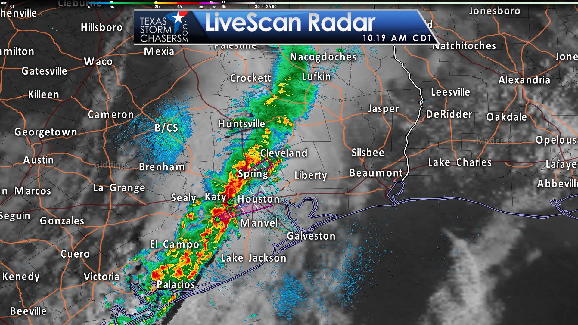
At the time of this writing (at 10 AM) we had a line of showers and storms moving into Houston extending southwest to near Bay City. Showers were occuring further northeast toward Nacogdoches. Some of these storms moving into Houston have had the potential of producing small hail and gusty winds. This first round of storms should continue to slowly weaken through midday, and eventually move close to or off the coast entirely.
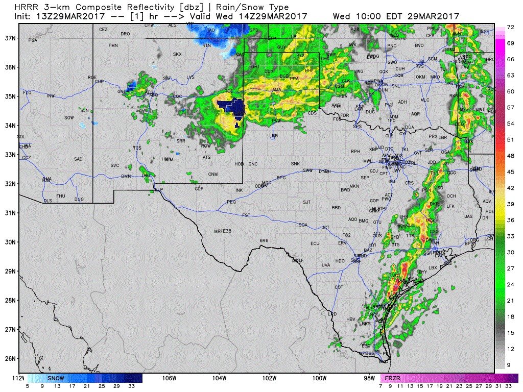
Simulated Radar through Tonight | MODEL PROJECTION ONLY
The potential for a second round of storms later today remains more unclear. We’ll have to have a few things happen in order to get the severe risk to develop. The on-going first round of storms will need to clear out. Second, we’ll need time for the atmosphere to destabilize across portions of East and Southeast Texas. The High Resolution Rapid Refresh (HRRR) seems to think that will happen. This model is showing isolated thunderstorm development occuring by the late afternoon across far Northeast Texas, East Texas, and Southeast Texas. Assuming the atmosphere is able to destabilize this afternoon, the strongest of this afternoon’s storms could be severe. The highest potential for severe weather will be in Arkansas, but we’ll have to keep tabs on East Texas and Southeast Texas. Boundaries left over from this morning’s storms may help spark off new development this afternoon – and that would not be indicated on this model graphic. Large hail and localized damaging winds would be the primary threats, but isolated tornadoes and localized flooding are also concerns. We’ll be done with thunderstorms by midnight as this entire system moves off to the east – bringing a severe weather outbreak late tonight and on Thursday to the Mid-South.
Thursday, Friday, and most of Saturday look to feature relatively benign weather as we wait on our next storm system in the upper level wave train. We won’t have to wait long as it’ll arrive late Saturday. Severe thunderstorms and heavy rainfall potential will increase late Saturday and continue into Sunday. Specifics will have to be ironed out as we get closer, but another period of active weather is expected. We could also see a higher threat for flooding since we’ve now had a couple rounds of rain over the past week in some locations.


0 Comments