
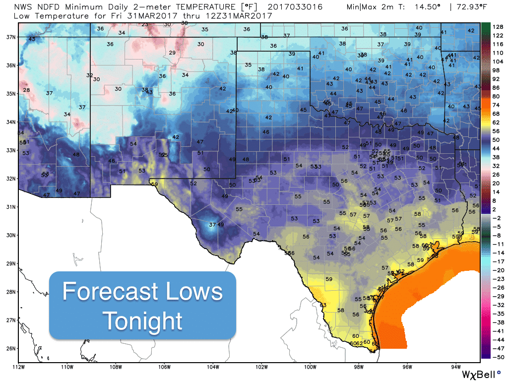
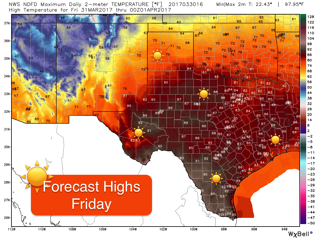
Friday will be another day of relatively quiet weather across the state before our next weather maker arrives over the weekend. No rain is expected until late Friday night with slight chances for rain and thunderstorms across the northern Texas panhandle and Oklahoma panhandle region. Lows tonight will drop down into the 30s and 40s again across the panhandle, but elsewhere, we’ll be mild and spring like with lows only dipping into the 50s and low 60s. Temps will heat up to a good 10-15 degrees above average tomorrow for all but the central and northern panhandle region which will benefit from surface winds bringing cooler air in from the east. The warmest spots in the state tomorrow will be found across the Rio Grande plains where highs in the low 90 to mid 90s will be possible.
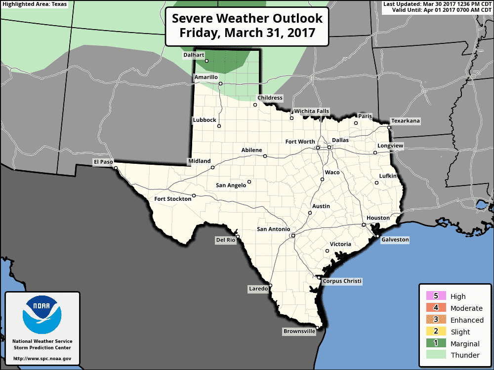
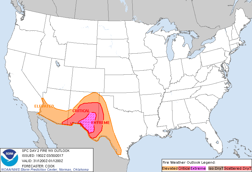
Extremely critical fire weather conditions will be present tomorrow across far western Texas/Trans Pecos region. Red Flag Warnings remain in effect through this evening, and again tomorrow afternoon and evening as relative humidity values are expected to drop down to around 5% with sustained winds around 20-25mph with higher gusts possible, especially in and around the Guadalupe and Van Horn mountain ranges.
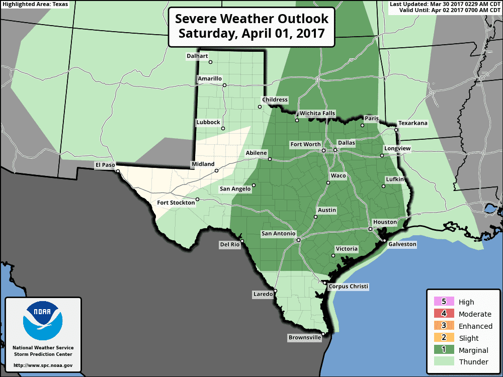
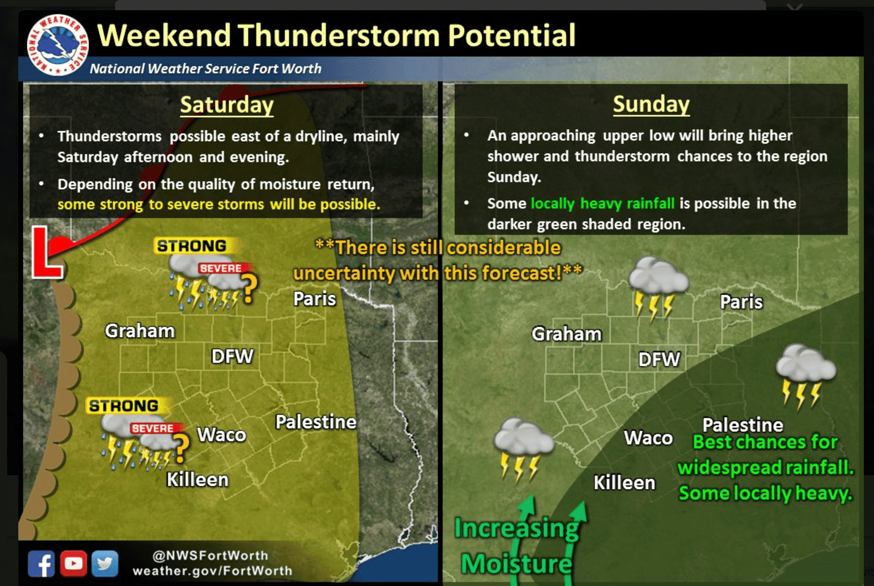
Our attention then turns to the possibility of severe weather and widespread rain chances this weekend. This next system is different than the one we faced last weekend in that this one will be moving much slower and will be weakening as it approaches. However, there continues to be the chance for some scattered strong to severe storm development along the dryline Saturday afternoon which is likely to impact parts of west central, central and north central Texas by Saturday afternoon and evening. By Saturday evening/overnight, most of the medium-range model guidance is showing the development of a linear complex of storms, but its areas of impact have not been consistent. The main threats expected at this time are damaging winds and hail…although hail size is not expected to be as large as what we saw last weekend, so we at least have that bit of good news. Also, because this next upper level system will be moving more slowly, we’ll see better chances of rain sticking around, heavy at times, which could cause isolated flooding issues overnight Saturday and into Sunday. By Sunday afternoon, the threat for rain and severe weather looks to shift down across south central and southeast Texas. We’ll have more out on Sunday’s threats tomorrow once that part of the forecast becomes more clear.


0 Comments