
We now have two severe thunderstorm watches through the evening hours. These two watches run from Dalhart and Perryton all the way south to Abilene, San Angelo, Sanderson, and Del Rio. In regional format: Texas Panhandle, South Plains, Rolling Plains, West Texas, West-Central Texas, the Big Country, Concho Valley, and Southwest Texas are all in severe thunderstorm watches. What that means is the primary severe weather hazards through this evening should be large hail up to the size of softballs and wind gusts over 70 MPH possible. The tornado threat is low, but definitely not zero. The hail threat will be highest while storms are in their discrete/semi-discrete phase this afternoon. Once they congeal into a squall line, the threat for damaging winds will increase along with continued hail potential.
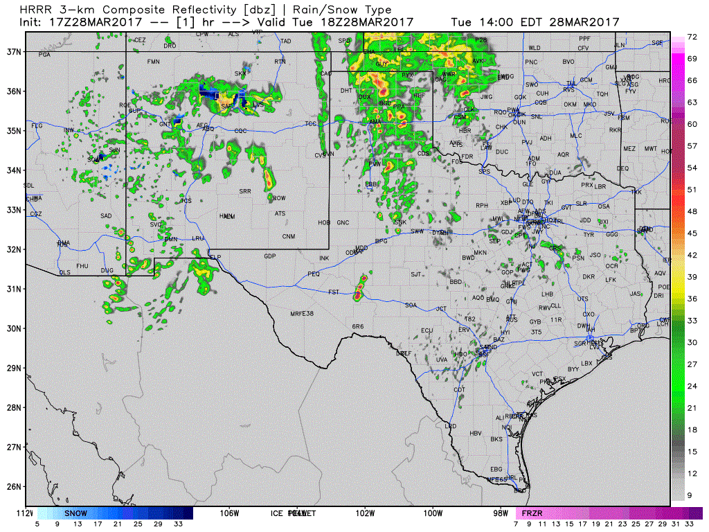
17Z HRRR – Simulated Model Radar through tonight. THIS IS MODEL PROJECTION ONLY.
The primary area of concern for tornado potential will be in Northwest Texas, where skies are mostly cloudy as a warm front approaches from the south. We’re actually sitting near Vernon right now awaiting the warm front and late-afternoon thunderstorm initiation. I expect we’ll see a tornado watch issued for portions of Northwest Texas and the northern Big Country by the mid-afternoon hours. If storms are able to remain more discrete late this afternoon and early evening, a tornado threat will exsist. Very large hail up to the size of softballs and damaging wind gusts over 70 MPH are probable. Even after storms congeal into a cluster the threat for tornadoes will remain, albit lower than if storms were out by themselves. Large hail and damaging winds will continue with these storms into the evening hours.
A nearly solid line of thunderstorms will likely fire up quickly by the early evening hours across West Texas, the Big Country, Concho Valley, and Northwest Texas. This will be round #2 for some folks that are getting storms now. This line will race off to the east tonight with a threat of damaging straight-line winds over 70 MPH in stronger segments. Large hail up to the size of golfballs and isolated tornadoes are secondary concerns. The line of storms should arrive in Abilene around 9-11PM, and make it to Interstate 35 from the Red River to San Antonio by 2-4AM. Some severe weather threat will continue with the squall line throughout the night, albit slowly diminishing with eastward extent.


0 Comments