
Severe Thunderstorm Warning
National Weather Service Fort Worth TX
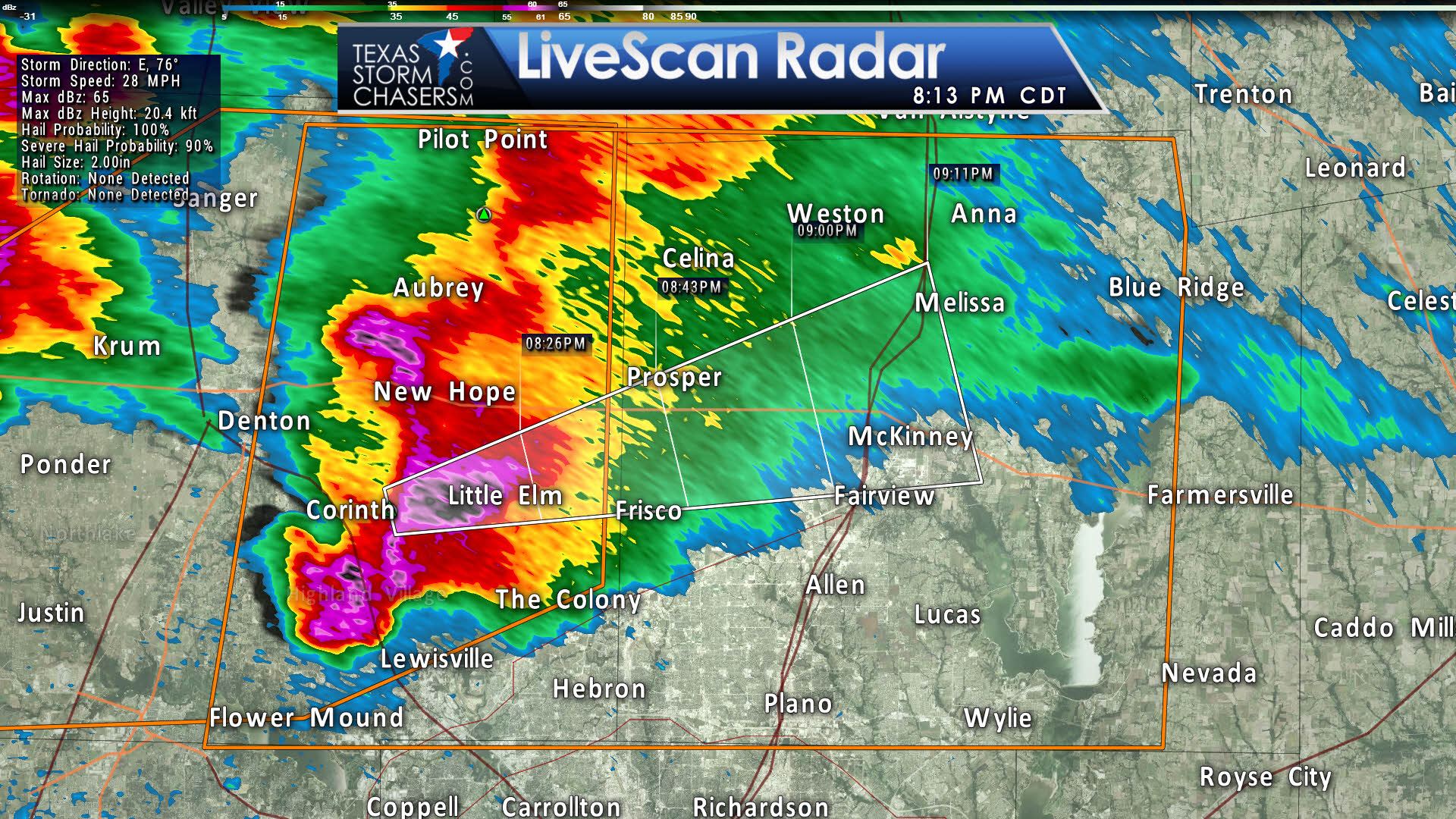
811 PM CDT SUN MAR 26 2017
The National Weather Service in Fort Worth has issued a
* Severe Thunderstorm Warning for…
Eastern Denton County in north central Texas…
Collin County in north central Texas…
* Until 930 PM CDT.
* At 810 PM CDT, a large severe thunderstorm was located from
Flower Mound to Highland Village to Corinth, moving east at 30 mph.
This is a very dangerous storm! Seek immediate shelter!
HAZARD…Baseball size hail and 65 mph wind gusts.
SOURCE…Radar indicated.
IMPACT…People and animals outdoors will be severely injured.
Expect shattered windows, extensive damage to roofs,
siding, and vehicles.
* This severe thunderstorm will be near,
Lake Lewisville around 815 PM CDT.
The Colony and Hackberry around 820 PM CDT.
Frisco, Little Elm and Hebron around 825 PM CDT.
Plano, McKinney and Prosper around 840 PM CDT.
PRECAUTIONARY/PREPAREDNESS ACTIONS…
This is a dangerous storm. Prepare immediately for large destructive
hail capable of producing significant damage. Move to shelter inside
a sturdy building and stay away from windows!


0 Comments