
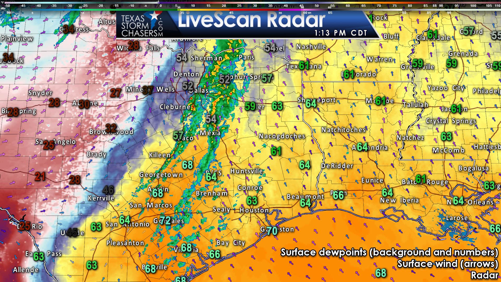
A line of showers and a few thunderstorms extend from Bonham to Terrell to Corsicana to Temple to Round Rock. This activity has remained relatively disorganized this morning through the lunch-hour. However, we expect that to change as we head into the middle to late afternoon. Gusty southeasterly winds across East Texas have allowed upper 50 to middle 60 degree dewpoints to advect northward. The atmosphere is becoming primed to support intensification of the squall line as it moves east of Interstate 45 later this afternoon. High-resolution short-range weather models support this idea, as we’ll show below.
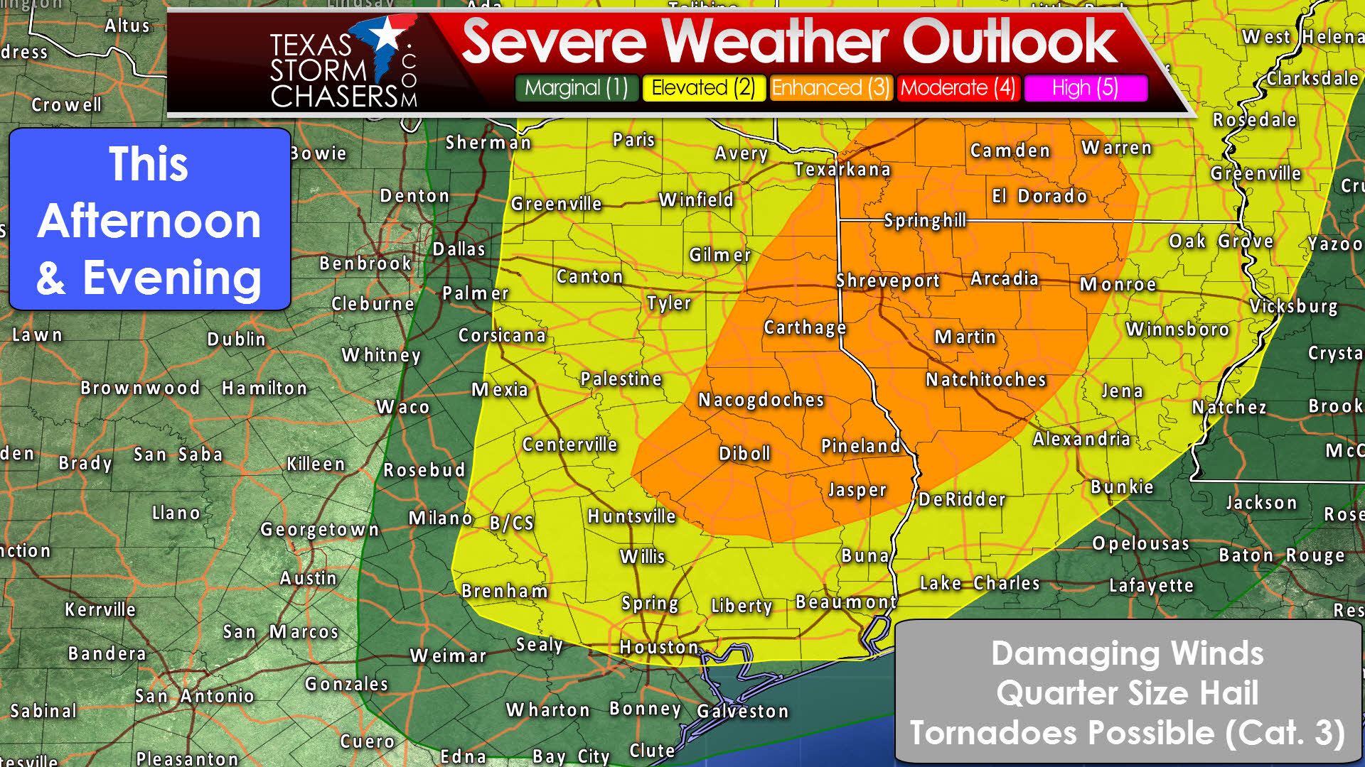
The Storm Prediction Center has a category two risk of severe weather along and east of a Bonham to Terrell to Mexia to Caldwell line, extending southeast to Interstate 10 from Katy east through Houston to Louisiana. I expect most of our severe weather threat to remain north of Interstate 10, but it’ll be a close call so we’ll keep an eye on it. Damaging straight-line winds will be possible with the strongest parts of the squall line, especially once storms move east of Interstate 45 and into a more unstable airmass. A category three risk of severe weather is in place across East Texas, east of line from Texarkana to Longview to Crocket to Livingston to Kirbyville. There is an increased concern about a potential tornado threat in the enhanced risk zone by early evening. Low-level wind shear will be quite strong and there are some indications the squall line may have a few embedded supercells. Should we be dealing with embedded supercell structures, or supercells ahead of the line itself, they will be capable of producing tornadoes along with damaging wind gusts. Either way, strong wind gusts can bring down trees – and if they fall on a house or car, they can cause serious injuries or worse. Not everyone will see severe weather, but there is the potential for issues.

16Z HRRR: Simulated radar projection through tonight
The High Resolution Rapid Refresh (HRRR) model shows an increase in thunderstorm intensity by late afternoon in Northeast Texas and East Texas. Some of these storms will likely be severe in an enviornment of strong wind shear and modest amounts of instability. As mentioned above we may have to deal with a tornado threat, in addition to damaging winds, by the early evening hours in East Texas. This first line will exit the state by midnight or shortly thereafter. Not mentioned previously, but now an increased possibility, is that a second line will form on the leading edge of a cold front by late tonight. These storms could impact East Texas and Southeast Texas. The threat for severe weather would be lower with this second line, but some storms may be strong with some hail, gusty winds, and heavy rain.


0 Comments