
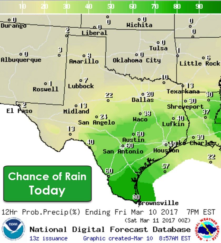
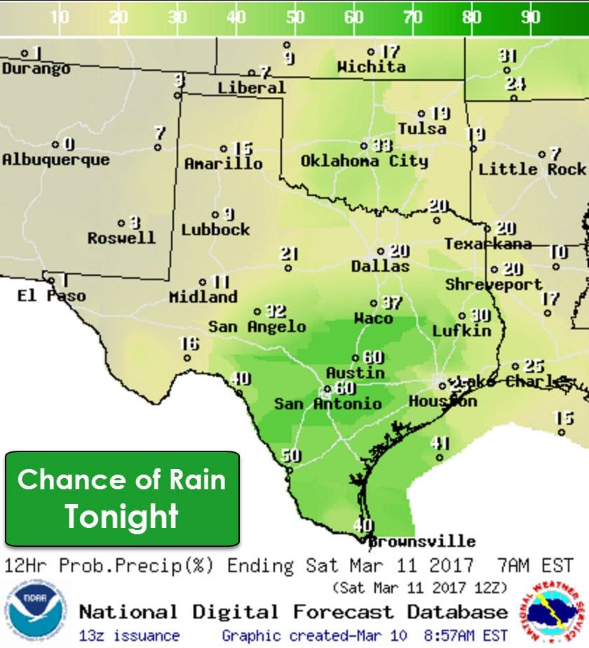
Numerous showers and thunderstorms are forecast today in the Rio Grande Valley, Deep South Texas, South-Central Texas, into Central Texas. Scattered coverage of showers/storms is expected in the Hill Country into the Brazos Valley, East Texas, and Southeast Texas. Severe thunderstorms are not expected today but we may see some locally heavy rain. Minor flooding could occur, especially in the typical trouble spots and urban areas. Overall, rainfall rates shouldn’t be heavy enough to support more than nuisance flooding. We will keep an eye on the Rio Grande Valley since some folks did receive heavier rains yesterday. We’ll see those rain chances continue tonight across the southern half of Texas. No severe storms are expected to develop tonight. It will not be a pleasant day to be on spring break on the coast.
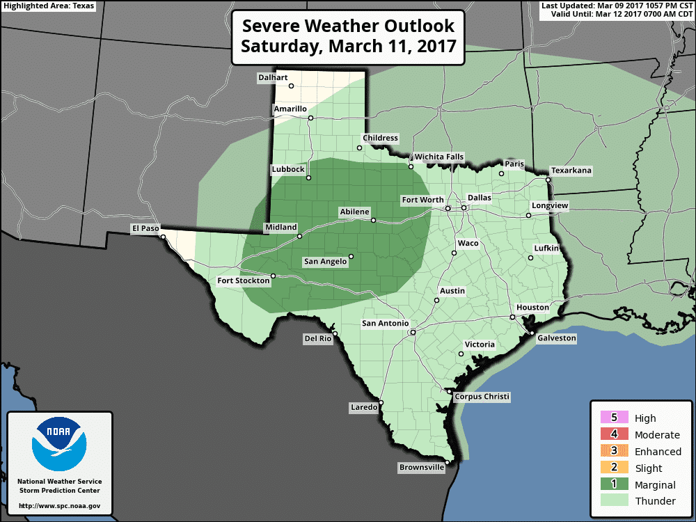
The Storm Prediction Center has issued a category one risk of severe weather for Saturday into Saturday Night. This risk encompasas the Permian Basin, Concho Valley, West Texas, the Big Country, and western sections of North and Central Texas. An advancing cold front could spark off a few stronger thunderstorms. The strongest storms tomorrow may produce hail up to the size of quarters and localized wind gusts of 50 to 60 MPH. One or more small clusters of strong thunderstorms may propagate southeast into the Concho Valley and Southwest Texas late Saturday night.
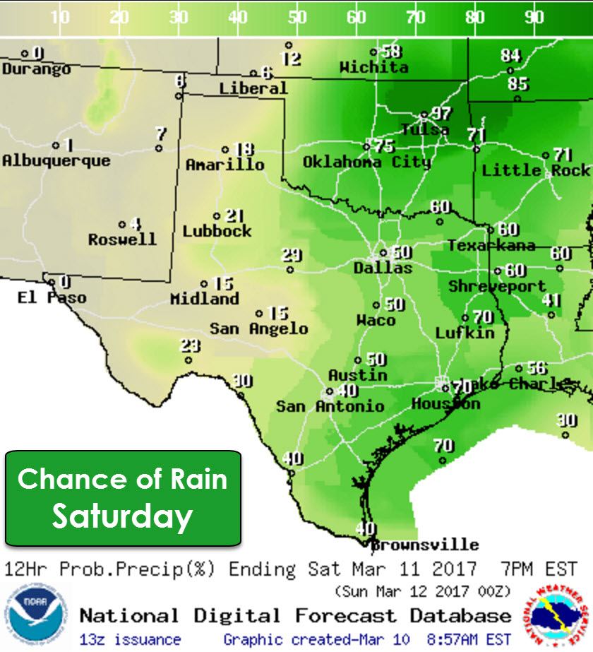
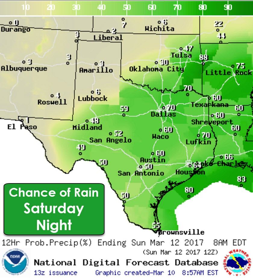
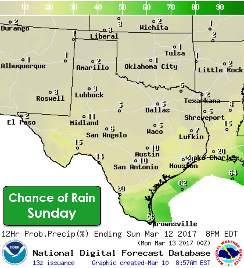

While strong thunderstorm chances will be localized/marginal tomorrow, the chance for rain will increase as that cold front moves south. Showers and thunderstorms are likely tomorrow and tomorrow night across the southeastern two-thirds of Texas. Unfortunately, rain chances in the Texas Panhandle are fairly low. There might be a shower or two, but nothing even close to what’s needed to relieve drought conditions or bring long-term relief to fire concerns. Rain chances will end from north to south tomorrow night as the cold front progresses south. By Sunday rain chances will be confined to Deep South Texas, the Rio Grande Valley, and immediate coastline. We should all be drying out by Sunday evening as the cold front moves out into the Gulf of Mexico.
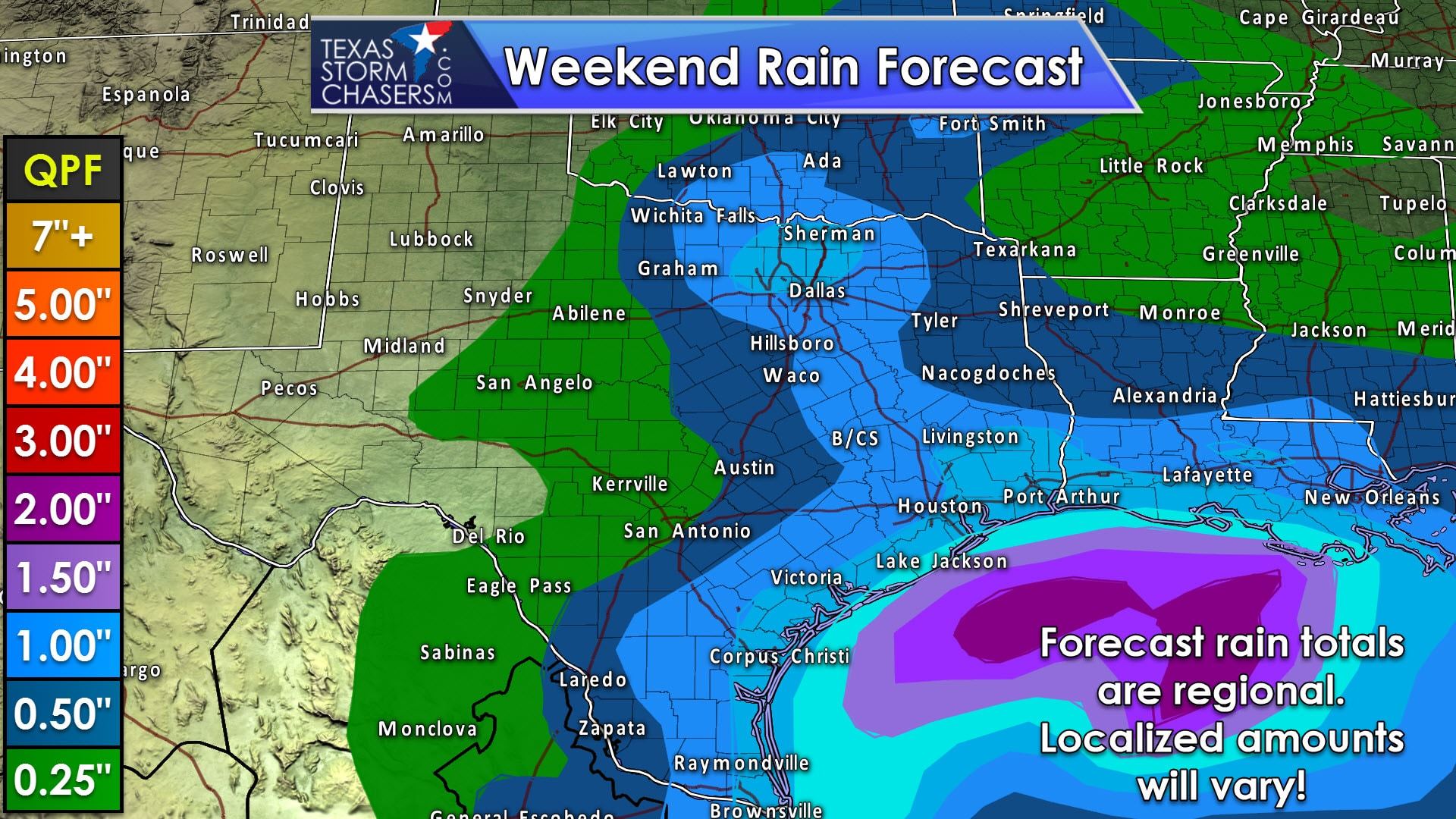
Overall rain totals this weekend should be heaviest along the coastline with up to two inches of rain possible in localized spots. One-half inch to one inch of rain may fall along and east of the I-35 corridor from Laredo north through San Antonio, Austin, to D/FW. Those heavier totals could also extend northwest up Highway 287 into Northwest Texas. Localized, minor flooding may occur where we see multiple rounds of heavy rain. Widespread flooding is not expected, nor is river flooding.


0 Comments